Area Overview for UB10 9BY
Photos of UB10 9BY
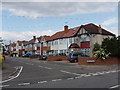
34 photos from this area
Area Information
Key information about the UB10 9BY including its size, population, and administrative classification.
- Area Type
- Postcode
- Area Size
- 1.4 hectares
- Population
- 1538
- Population Density
- 4501 people/km²
House Prices in UB10 9BY
42
Properties
£292,065
Average Sold Price
£79,800
Lowest Price
£570,000
Highest Price
Showing 42 properties
| Address | Type | Beds | Baths | Last Sale Price | Last Sale Date | |
|---|---|---|---|---|---|---|
| 56 Ryefield Avenue, Uxbridge, UB10 9BY | Semi-detached | 3 | 1 | £570,000 | Feb 2023 | |
| 54 Ryefield Avenue, Uxbridge, UB10 9BY | Semi-detached | 4 | 1 | £535,000 | May 2022 | |
| 38 Ryefield Avenue, Uxbridge, UB10 9BY | Semi-detached | 3 | - | £485,000 | Jun 2018 | |
| 34 Ryefield Avenue, Uxbridge, UB10 9BY | Semi-detached | 3 | 1 | £460,000 | Aug 2017 | |
| 50 Ryefield Avenue, Uxbridge, UB10 9BY | Detached | 5 | 3 | £420,000 | May 2017 | |
| 66 Ryefield Avenue, Uxbridge, UB10 9BY | Semi-detached | 3 | - | £425,000 | Feb 2017 | |
| 97 Ryefield Avenue, Uxbridge, UB10 9BY | Semi-detached | 3 | 3 | £427,000 | Aug 2016 | |
| 70 Ryefield Avenue, Uxbridge, UB10 9BY | Semi-detached | 4 | 2 | £452,000 | Aug 2015 | |
| 93 Ryefield Avenue, Uxbridge, UB10 9BY | Semi-detached | 3 | - | £294,950 | Nov 2013 | |
| 46 Ryefield Avenue, Uxbridge, UB10 9BY | Semi-detached | 4 | 2 | £345,000 | Feb 2013 |
Page 1 of 5
Energy Efficiency in UB10 9BY
Amenities
Schools
| Rank | School | Type | Entry gender | Ages |
|---|
Explore more schools in this area
Go to Schools tabDemographics
Household Size
Family (3-5 people)
most common
Accommodation Type
Houses
most common
Tenure
76
majority
Ethnic Group
White
most common
Religion
N/A
most common
Household Composition
N/A
most common
Age
47
median
Adults (30-64 years)
most common
Household Deprivation
N/A
with no deprivation
NS-SEC
35
in Lower managerial occupations
Explore more demographic insights in this area
Go to Demographics tabPlanning
Planning Constraints
- Flood RiskPremium
- Ramsar Wetland SitesPremium
- Area of Outstanding Natural BeautyPremium
- Protected Nature ReservePremium
- Protected WoodlandPremium