Area Overview for UB10 9AX
Photos of UB10 9AX
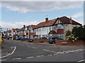
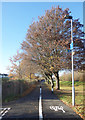
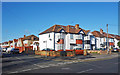
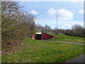
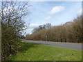
34 photos from this area
Area Information
Key information about the UB10 9AX including its size, population, and administrative classification.
- Area Type
- Postcode
- Area Size
- 1.2 hectares
- Population
- 1538
- Population Density
- 4501 people/km²
House Prices in UB10 9AX
28
Properties
£402,528
Average Sold Price
£118,500
Lowest Price
£690,000
Highest Price
Showing 28 properties
| Address | Type | Beds | Baths | Last Sale Price | Last Sale Date | |
|---|---|---|---|---|---|---|
| 97 Windsor Avenue, Uxbridge, UB10 9AX | Detached | 3 | 1 | £607,000 | Oct 2025 | |
| 60 Windsor Avenue, Uxbridge, UB10 9AX | Detached | 5 | 3 | £375,000 | Aug 2024 | |
| 103 Windsor Avenue, Uxbridge, UB10 9AX | Semi-detached | 3 | 1 | £600,000 | Feb 2023 | |
| 68 Windsor Avenue, Uxbridge, UB10 9AX | house | - | - | £445,000 | Mar 2021 | |
| 105 Windsor Avenue, Uxbridge, UB10 9AX | Semi-detached | 5 | 2 | £690,000 | Dec 2020 | |
| 50 Windsor Avenue, Uxbridge, UB10 9AX | Semi-detached | 3 | 1 | £555,000 | Nov 2018 | |
| 52 Windsor Avenue, Uxbridge, UB10 9AX | Semi-detached | 4 | 2 | £550,000 | Aug 2018 | |
| 56 Windsor Avenue, Uxbridge, UB10 9AX | Detached | 3 | 2 | £465,000 | Mar 2016 | |
| 101 Windsor Avenue, Uxbridge, UB10 9AX | house | 3 | 1 | £410,000 | Dec 2014 | |
| 91 Windsor Avenue, Uxbridge, UB10 9AX | Semi-detached | 3 | 1 | £285,000 | Sep 2014 |
Page 1 of 3
Energy Efficiency in UB10 9AX
Amenities
Schools
| Rank | School | Type | Entry gender | Ages |
|---|
Explore more schools in this area
Go to Schools tabDemographics
Household Size
Family (3-5 people)
most common
Accommodation Type
Houses
most common
Tenure
76
majority
Ethnic Group
White
most common
Religion
N/A
most common
Household Composition
N/A
most common
Age
47
median
Adults (30-64 years)
most common
Household Deprivation
N/A
with no deprivation
NS-SEC
35
in Lower managerial occupations
Explore more demographic insights in this area
Go to Demographics tabPlanning
Planning Constraints
- Flood RiskPremium
- Ramsar Wetland SitesPremium
- Area of Outstanding Natural BeautyPremium
- Protected Nature ReservePremium
- Protected WoodlandPremium