Area Overview for TW5 0JJ
Photos of TW5 0JJ

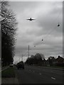
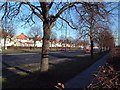
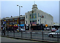
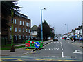
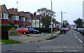
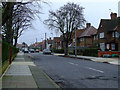
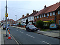
68 photos from this area
Area Information
Key information about the TW5 0JJ including its size, population, and administrative classification.
- Area Type
- Postcode
- Area Size
- 3.0 hectares
- Population
- 2060
- Population Density
- 8937 people/km²
House Prices in TW5 0JJ
50
Properties
£363,669
Average Sold Price
£67,500
Lowest Price
£610,000
Highest Price
Showing 50 properties
| Address | Type | Beds | Baths | Last Sale Price | Last Sale Date | |
|---|---|---|---|---|---|---|
| 77 The Crossways, Hounslow, TW5 0JJ | Detached | 3 | 2 | £610,000 | Oct 2025 | |
| 131 The Crossways, Hounslow, TW5 0JJ | Semi-detached | 3 | 2 | £600,000 | Mar 2023 | |
| 101 The Crossways, Hounslow, TW5 0JJ | Semi-detached | 3 | 1 | £570,000 | Mar 2022 | |
| 75 The Crossways, Hounslow, TW5 0JJ | Semi-detached | 3 | - | £600,000 | Sep 2021 | |
| 113 The Crossways, Hounslow, TW5 0JJ | house | - | - | £500,000 | Dec 2020 | |
| 103 The Crossways, Hounslow, TW5 0JJ | house | - | - | £505,000 | Nov 2019 | |
| 55 The Crossways, Hounslow, TW5 0JJ | house | - | - | £466,000 | Nov 2018 | |
| 65 The Crossways, Hounslow, TW5 0JJ | Semi-detached | 3 | - | £462,500 | Apr 2018 | |
| 111 The Crossways, Hounslow, TW5 0JJ | house | - | - | £520,000 | Dec 2016 | |
| 129 The Crossways, Hounslow, TW5 0JJ | Semi-detached | 6 | 5 | £395,000 | Dec 2015 |
Page 1 of 5
Energy Efficiency in TW5 0JJ
Amenities
Schools
| Rank | School | Type | Entry gender | Ages |
|---|
Explore more schools in this area
Go to Schools tabDemographics
Household Size
Family (3-5 people)
most common
Accommodation Type
Houses
most common
Tenure
72
majority
Ethnic Group
asian_total
most common
Religion
N/A
most common
Household Composition
N/A
most common
Age
47
median
Adults (30-64 years)
most common
Household Deprivation
N/A
with no deprivation
NS-SEC
27
in Lower managerial occupations
Explore more demographic insights in this area
Go to Demographics tabPlanning
Planning Constraints
- Flood RiskPremium
- Ramsar Wetland SitesPremium
- Area of Outstanding Natural BeautyPremium
- Protected Nature ReservePremium
- Protected WoodlandPremium