Area Overview for SW17 7UF
Photos of SW17 7UF


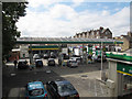
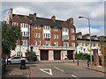
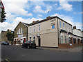

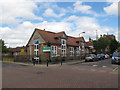
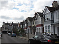
100 photos from this area
Area Information
Key information about the SW17 7UF including its size, population, and administrative classification.
- Area Type
- Postcode
- Area Size
- 6800 m²
- Population
- 1847
- Population Density
- 3193 people/km²
House Prices in SW17 7UF
37
Properties
£303,042
Average Sold Price
£67,500
Lowest Price
£625,000
Highest Price
Showing 37 properties
| Address | Type | Beds | Baths | Last Sale Price | Last Sale Date | |
|---|---|---|---|---|---|---|
| 59 College Gardens, London, SW17 7UF | house | 2 | 2 | £625,000 | Jul 2025 | |
| 73 College Gardens, London, SW17 7UF | Terraced | 1 | 1 | £400,000 | Sep 2024 | |
| 65 College Gardens, London, SW17 7UF | Terraced | 2 | 2 | £477,000 | Jan 2024 | |
| 29 College Gardens, London, SW17 7UF | Maisonette | 2 | 2 | £422,000 | Nov 2022 | |
| 31 College Gardens, London, SW17 7UF | Maisonette | 2 | 1 | £525,000 | Aug 2022 | |
| 53 College Gardens, London, SW17 7UF | Terraced | 1 | 1 | £577,700 | Jun 2021 | |
| 5 College Gardens, London, SW17 7UF | house | - | - | £530,000 | Oct 2020 | |
| 13 College Gardens, London, SW17 7UF | Terraced | 1 | 1 | £425,000 | Oct 2019 | |
| 17 College Gardens, London, SW17 7UF | Maisonette | 1 | 1 | £325,000 | Aug 2019 | |
| 23 College Gardens, London, SW17 7UF | Flat | 1 | 1 | £332,000 | Feb 2019 |
Page 1 of 4
Energy Efficiency in SW17 7UF
Amenities
Schools
| Rank | School | Type | Entry gender | Ages |
|---|
Explore more schools in this area
Go to Schools tabDemographics
Household Size
Family (3-5 people)
most common
Accommodation Type
Houses
most common
Tenure
67
majority
Ethnic Group
White
most common
Religion
N/A
most common
Household Composition
N/A
most common
Age
47
median
Adults (30-64 years)
most common
Household Deprivation
N/A
with no deprivation
NS-SEC
66
in Lower managerial occupations
Explore more demographic insights in this area
Go to Demographics tabPlanning
Planning Constraints
- Flood RiskPremium
- Ramsar Wetland SitesPremium
- Area of Outstanding Natural BeautyPremium
- Protected Nature ReservePremium
- Protected WoodlandPremium