Area Overview for SW17 7UA
Photos of SW17 7UA

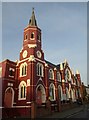
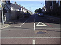
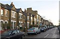
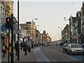
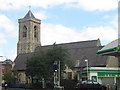
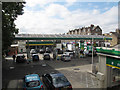
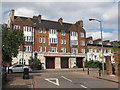
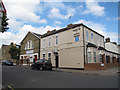

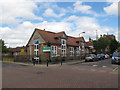
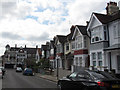
100 photos from this area
Area Information
Key information about the SW17 7UA including its size, population, and administrative classification.
- Area Type
- Postcode
- Area Size
- 4262 m²
- Population
- 1847
- Population Density
- 3193 people/km²
House Prices in SW17 7UA
26
Properties
£377,862
Average Sold Price
£102,500
Lowest Price
£615,000
Highest Price
Showing 26 properties
| Address | Type | Beds | Baths | Last Sale Price | Last Sale Date | |
|---|---|---|---|---|---|---|
| 15 St Catherines Close, London, SW17 7UA | Detached | 2 | 1 | £615,000 | Aug 2023 | |
| 5 St Catherines Close, London, SW17 7UA | Semi-detached | 1 | 1 | £427,000 | Jun 2022 | |
| 4 St Catherines Close, London, SW17 7UA | house | 1 | 1 | £375,000 | Oct 2021 | |
| 20 St Catherines Close, London, SW17 7UA | Terraced | 2 | 1 | £540,000 | Jul 2020 | |
| 6 St Catherines Close, London, SW17 7UA | Terraced | 2 | 1 | £535,000 | Sep 2019 | |
| 21 St Catherines Close, London, SW17 7UA | Terraced | 2 | 1 | £558,000 | Aug 2019 | |
| 26 St Catherines Close, London, SW17 7UA | Terraced | 3 | 1 | £530,000 | May 2018 | |
| 17 St Catherines Close, London, SW17 7UA | Terraced | 2 | - | £535,000 | Jun 2016 | |
| 12 St Catherines Close, London, SW17 7UA | house | 2 | 1 | £530,000 | Mar 2015 | |
| 2 St Catherines Close, London, SW17 7UA | Detached | 2 | 1 | £432,500 | Oct 2013 |
Page 1 of 3
Energy Efficiency in SW17 7UA
Amenities
Schools
| Rank | School | Type | Entry gender | Ages |
|---|
Explore more schools in this area
Go to Schools tabDemographics
Household Size
Family (3-5 people)
most common
Accommodation Type
Houses
most common
Tenure
67
majority
Ethnic Group
White
most common
Religion
N/A
most common
Household Composition
N/A
most common
Age
47
median
Adults (30-64 years)
most common
Household Deprivation
N/A
with no deprivation
NS-SEC
66
in Lower managerial occupations
Explore more demographic insights in this area
Go to Demographics tabPlanning
Planning Constraints
- Flood RiskPremium
- Ramsar Wetland SitesPremium
- Area of Outstanding Natural BeautyPremium
- Protected Nature ReservePremium
- Protected WoodlandPremium