Area Overview for SM1 4AS
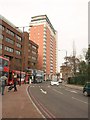
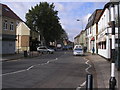
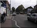
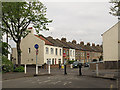
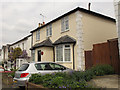
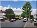
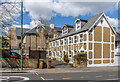
Photos of SM1 4AS


Area Information
Living in SM1 4AS offers a distinct experience defined by extremely high density and a compact footprint. This specific postcode covers just 3,763 square metres yet houses 2,556 residents, resulting in a remarkable population density of 679,206 people per square kilometre. Such intensity suggests immediate surroundings are characterised by closely packed buildings rather than expansive gardens or private grounds. The character here is shaped by a residential cluster where neighbours are likely just a short walk away. You will find yourself in a setting where urban living is the primary mode of existence. Daily life revolves around efficiency and proximity to essential services rather than distance from town centres. The sheer number of people living within this small footprint creates a dynamic environment but leaves little room for large-scale open spaces within the boundaries of the post code itself. Residents must be prepared for a highly urban experience where the rhythm of the local area is dictated by foot traffic and public transport schedules. This location is ideal for those who prioritise convenience over space and enjoy a bustling, well-Integrated community.
- Area Type
- Postcode
- Area Size
- 3763 m²
- Population
- 2556
- Population Density
- 11032 people/km²
Homes in SM1 4AS are overwhelmingly flats, a direct result of the area's small landmass and high population concentration. With a population of 2,556 living within just 3,763 square metres, traditional detached houses are improbable within these specific boundaries. The market is defined by a mix of private rentals and second-hand residential units rather than new-build developments. Home ownership rates of 43% suggest that while significant numbers of people own their homes, there is also a substantial proportion of renters within this postcode. This dual nature creates a versatile market where buyers can find flats tailored for different purposes or investors looking for rental yield. The limited physical size of the area implies that property values are driven by location and proximity to transport links rather than land scarcity within the post code itself. Você will likely encounter a stock of established properties that form part of the existing urban fabric of the local area.
House Prices in SM1 4AS
Showing 2 properties
| Address | Type | Beds | Baths | Last Sale Price | Last Sale Date | |
|---|---|---|---|---|---|---|
| Swimming Pool, Sutton Grammar School For Boys, Manor Lane, Sutton, SM1 4AS | Leisure | - | - | - | - | |
| Indoor Sports Hall, Sutton Grammar School For Boys, Manor Lane, Sutton, SM1 4AS | assembly_leisure | - | - | - | - |
Energy Efficiency in SM1 4AS
Residents of SM1 4AS benefit from a dense network of amenities just a short distance away. Retail options include established high streets featuring major names such as M&S Sutton, Tesco Sutton, and Asda Sutton, ensuring all daily shopping needs are met conveniently. Transport links are equally extensive, with five railway stations within easy reach, including West Sutton and Sutton Common Station, providing swift access to broader travel networks. Complementing the rail network are five subway and tram stops, such as Mitcham Tram Stop and Belgrave Walk Tram Stop, alongside Morden station for deeper tube connections. For those preferring water travel, two ferry terminals exist nearby, including Kingston Town End Pier and Kingston Turks Pier. This abundance of facilities means you can access work, leisure, retail, and transport hubs without needing a private vehicle, making life in this area highly practical for daily commutes and errands.
Amenities
Schools
Families residing near SM1 4AS have access to several educational institutions within practical reach. Manor Park Primary School serves the local area as a primary establishment. Sutton Grammar School for Boys is also listed in the vicinity, offering primary education for the community. Further up the academic ladder, Sutton Grammar School operates as an academy and holds a Good Ofsted rating, a quality mark that reassures parents regarding educational standards. Manor Park Primary Academy represents another option for younger students in the immediate neighbourhood. This mix of schools provides a localised choice for families, though the specific distance from each school to the postcode is not detailed in the available records. The presence of multiple primary options alongside a highly rated academy indicates a functioning educational catchment area designed to serve the resident population of this zone.
| Rank | School | Type | Entry gender | Ages |
|---|
Explore more schools in this area
Go to Schools tabDemographics
The community surrounding SM1 4AS comprises a mature resident base with a median age of 47 years. The most common age range consists of adults between 30 and 64 years, indicating a household structure dominated by working families and established professionals rather than students or young singles. Home ownership stands at 43%, meaning slightly under half of the residents own their properties outright or with a mortgage. The remaining households likely reside in the rental sector. Accommodation types in this area are dominated by flats, reflecting the high-density nature of the built environment. Demographically, the predominant ethnic group is White, which informs the cultural landscape of the neighbourhood. There is an absence of data regarding specific deprivation indices, so the financial status of residents cannot be quantified here. However, the age profile suggests a stable demographic with relatively few young children living with their parents, though the presence of primary schools nearby indicates some families with school-aged children do reside in the wider catchment area.
Household Size
Accommodation Type
Tenure
Ethnic Group
Religion
Household Composition
Age
Household Deprivation
NS-SEC
Explore more demographic insights in this area
Go to Demographics tabPlanning
Planning Constraints
- Flood RiskPremium
- Ramsar Wetland SitesPremium
- Area of Outstanding Natural BeautyPremium
- Protected Nature ReservePremium
- Protected WoodlandPremium