Area Overview for SM1 4AG
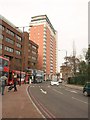
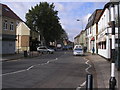
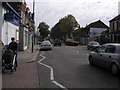
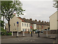
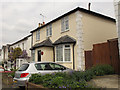
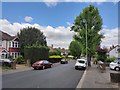
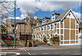
Photos of SM1 4AG


Area Information
The postcode SM1 4AG designates a specific residential cluster covering an area of 1.6 hectares with a population of 2,556. You are looking at a compact neighbourhood where density is high, reflecting a population density of 163,608 people per square kilometre. Living in SM1 4AG means residing in a tightly knit environment where the community is close at hand. The area functions as a practical base for daily commuting and local living, situated within the broader Sutton context. This postcode represents a defined slice of the larger community, offering residents immediate access to surrounding transport links and amenities without requiring long journeys. The small physical footprint contrasts with the substantial number of households, creating an urban feel despite being largely residential. Daily life here involves navigating a busy street network while surrounded by established services. For those considering homes in SM1 4AG, the location offers a mix of convenience and character typical of growing suburban fringes. The area does not sprawl; instead, it concentrates population and activity within its boundaries. You find a neighbourhood defined by its proximity to major thoroughfares and its integration into the wider London suburban network. This specific cluster of 1.6 hectares serves as a fundamental building block of the local housing market, catering to families and individuals seeking a settled address. The high population density suggests active streets and a shared reliance on public utilities and transit infrastructure. When you explore values and properties here, you are engaging with a mature, compact settlement rather than a developing greenfield site.
- Area Type
- Postcode
- Area Size
- 1.6 hectares
- Population
- 2556
- Population Density
- 11032 people/km²
The housing stock in SM1 4AG is characterised primarily by flats, reflecting the area's high population density of 163,608 people per kilometre squared. This accommodation type is the standard offering for the 1.6 hectares that make up the postcode. The market is split, with only 43% of households being owner-occupied. This figure implies a majority of residents are tenants, suggesting a strong presence of rental properties alongside the owned stock. For buyers looking at homes in SM1 4AG, the focus remains on apartments and flats rather than semi-detached or detached houses. You should expect a market where leasehold purchases are common due to the flat-based design. The lower home ownership rate means you might compete with investors and employers offering rental arrangements. This dynamic can affect price stability and redevelopment potential, as lease extensions or regeneration projects become feasible points of interest. Living in this area means dealing with service charges and communal maintenance, which are typical for flat living. The proximity to transport hubs like West Sutton and Sutton Common stations adds value to these units, making them attractive to commuters. Your options are concentrated in existing buildings rather than new builds, given the residential cluster's established nature. Potential buyers must weigh the convenience of living close to amenities against the constraints of block living. The 43% ownership figure provides a clear signal: this is a hybrid market where buying exclusivity through freehold is rare compared to acquiring a leasehold unit. Consulting with local agents will clarify specific building types and lease terms available in this specific postcode.
House Prices in SM1 4AG
Showing 21 properties
| Address | Type | Beds | Baths | Last Sale Price | Last Sale Date | |
|---|---|---|---|---|---|---|
| 22 Lenham Road, Sutton, SM1 4AG | Semi-detached | 4 | 2 | £670,000 | Mar 2025 | |
| 12 Lenham Road, Sutton, SM1 4AG | Semi-detached | 2 | 1 | £635,000 | Oct 2023 | |
| 6 Lenham Road, Sutton, SM1 4AG | house | - | - | £630,000 | May 2021 | |
| 4 Lenham Road, Sutton, SM1 4AG | Semi-detached | 4 | 2 | £637,500 | May 2019 | |
| 2 Lenham Road, Sutton, SM1 4AG | Semi-detached | 4 | 2 | £615,000 | Mar 2019 | |
| 8A Lenham Road, Sutton, SM1 4AG | Flat | - | - | £315,000 | Jan 2016 | |
| 30 Lenham Road, Sutton, SM1 4AG | Semi-detached | 4 | 2 | £385,000 | Jul 2013 | |
| 38 Lenham Road, Sutton, SM1 4AG | house | 3 | - | £350,000 | Feb 2012 | |
| 36 Lenham Road, Sutton, SM1 4AG | Semi-detached | - | - | £305,000 | May 2007 | |
| 8 Lenham Road, Sutton, SM1 4AG | Flat | - | - | £120,000 | May 2004 |
Energy Efficiency in SM1 4AG
Daily life in SM1 4AG is supported by a wide array of amenities within practical reach. Retail options include M&S Sutton, Tesco Sutton, and Asda Sutton, ensuring you have access to major supermarket chains and boutique stores. Shopping for groceries, fashion, and household goods is therefore convenient without needing a long journey. For travel, five rail stations and multiple tram stops integrate seamlessly into your daily routine. West Sutton and Sutton Common Station provide rail links, while Mitcham and Belgrave Walk Tram Stop offer local connectivity. Morden serves as a further transport hub nearby. Water travel is also possible via Kingston Town End Pier and Kingston Turks Pier, adding variety to your commute when the motorway is busy. Beyond transport and retail, the area benefits from its integration into the wider suburban network. You can stroll to local shops or hop on a tram for a scenic ride. The presence of these specific venues like Asda and M&S means your weekly shopping targets are directly accessible. Living in SM1 4AG offers a balance of urban convenience and suburban calm. The five retail establishments nearby mean you rarely run out of essentials. Transport options span rail, metro, train, and ferry, giving you flexibility based on the weather or time of day. Your lifestyle is enriched by having these diverse services immediately adjacent to your home.
Amenities
Schools
Families living in SM1 4AG have access to a selection of educational institutions within practical reach. Manor Park Primary School offers primary education and is a key local option for younger children. Sutton Grammar School for Boys also operates as a primary facility, providing an alternative choice within the catchment vicinity. For secondary and further education, Sutton Grammar School stands as an academy with a good Ofsted rating. This rating provides a verified benchmark for quality, allowing parents to make informed decisions about their children's future education. Manor Park Primary Academy rounds out the primary options available near the postcode. The mix of schools includes both standard primary academies and a highly rated grammar academy. Sutton Grammar School for Boys serves the primary stage, whereas the academy bearing the same name likely caters to older students. You will find a straightforward progression route where younger children start at local schools and eventually move to the well-regarded grammar institution. No specific secondary schools other than the grammar are listed in the immediate data, but the presence of Manor Park Primary Academy indicates a continued focus on primary care. Schools near SM1 4AG thus include a blend of academies and traditional primary setups. This variety allows parents to choose based on curriculum style, transport convenience, or specific rating criteria. The good rating specifically attached to Sutton Grammar School for Boys highlights an area of strength in the local educational landscape.
| Rank | School | Type | Entry gender | Ages |
|---|
Explore more schools in this area
Go to Schools tabDemographics
The community within SM1 4AG is defined by a mature age profile, with a median age of 47 years. The vast majority of residents fall into the adult bracket, specifically those aged between 30 and 64 years. You are entering an area where householders are typically further along in their working lives, rather than young families or retirees making up the bulk of the demographic. This age structure influences local spending habits and lifestyle choices, prioritising stability and convenience. Diversity notes that White remains the predominant ethnic group, shaping the cultural character of the neighbourhood. While specific data on other groups is not listed, the primary demographic leans towards traditional family structures associated with this age range. Home ownership stands at 43%, indicating that less than half of the households own their properties outright. The remaining 57% likely live in the rental sector, creating a dynamic mix of owners and tenants. This split means you will encounter both long-term residents and those who may plan shorter stays. The accommodation type is predominantly flats, which aligns with the high density figure of 163,608 people per square kilometre. You will find brick-and-mortar blocks and multi-unit buildings rather than detached houses. This vertical living option supports the neighbouring transport links and reduces the need for private car ownership. The demographic profile suggests a stable environment where long-term planning is common, yet the relatively low ownership rate shows significant rental activity. Residents here balance the benefits of high-density living with the practicalities of shared spaces and community facilities.
Household Size
Accommodation Type
Tenure
Ethnic Group
Religion
Household Composition
Age
Household Deprivation
NS-SEC
Explore more demographic insights in this area
Go to Demographics tabPlanning
Planning Constraints
- Flood RiskPremium
- Ramsar Wetland SitesPremium
- Area of Outstanding Natural BeautyPremium
- Protected Nature ReservePremium
- Protected WoodlandPremium