Area Overview for SM1 4AP
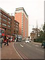
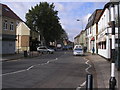
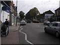
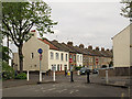
Photos of SM1 4AP


Area Information
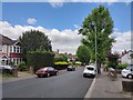
SM1 4AP represents a specific residential postcode serving approximately 2,556 people across just 1.4 hectares. You are looking at a compact cluster where density defines the daily experience. The population density here reaches 179,206 people per square kilometre, which is exceptionally high for Southern England. This means your nearest neighbours will be very close by, creating a tightly knit but crowded living environment. The area functions as a small residential hub rather than a sprawling suburb. You will find that space is at a premium, with every square metre serving a purpose. Despite the small footprint, the location connects you to wider networks of transport and services found in Greater London. Living in SM1 4AP means accepting a high-density lifestyle in exchange for proximity to key infrastructure. You do not have vast grounds to maintain, but you benefit from short walks to local stations and shops. The sheer concentration of residents creates a dynamic environment where community life moves quickly. It is a distinct neighbourhood type that prioritises access over extensive land, suiting those who prefer an urban rhythm over a suburban pace.
- Area Type
- Postcode
- Area Size
- 1.4 hectares
- Population
- 2556
- Population Density
- 11032 people/km²
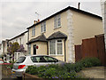
The property market in SM1 4AP is defined by a specific housing stock type and ownership pattern. Flats dominate the accommodation landscape, which is a logical outcome of building on only 1.4 hectares of land. This physical constraint prevents the construction of detached single-family homes, pushing the market toward multi-unit buildings. You will find that searching for homes in SM1 4AP means looking largely for apartments or maisonettes rather than traditional houses. The home ownership rate of 43% reveals a balanced market where neither renting nor buying completely overwhelms the other. This suggests a diverse tenant and buyer base, including downsizers, investors, and young professionals. The high density of 179,206 people per square kilometre drives competition for these specific units. Buyers must expect that properties in this cluster will command different values compared to low-density neighbouring areas. The concentration of flats means you will encounter communal areas, shared entry systems, and proximity to other households within short distances. Understanding this market means accepting that space internal to the home may be tighter than in suburban developments. The mix of ownership types indicates resilience in the local economy, supporting both those seeking to invest and those looking for secure tenure.
House Prices in SM1 4AP
Showing 65 properties
| Address | Type | Beds | Baths | Last Sale Price | Last Sale Date | |
|---|---|---|---|---|---|---|
| 7 Warwick Road, Sutton, SM1 4AP | Terraced | 2 | 1 | £427,500 | Sep 2025 | |
| 37 Warwick Road, Sutton, SM1 4AP | Terraced | 2 | 1 | £436,000 | Sep 2025 | |
| Rose Cottage, 18 Warwick Road, Sutton, SM1 4AP | Semi-detached | 2 | 1 | £445,350 | Jul 2025 | |
| 46 Warwick Road, Sutton, SM1 4AP | Cottage | 3 | 1 | £505,000 | Feb 2025 | |
| 51 Warwick Road, Sutton, SM1 4AP | Terraced | 2 | 1 | £460,000 | Jan 2025 | |
| 41 Warwick Road, Sutton, SM1 4AP | Terraced | 2 | 1 | £455,000 | Aug 2024 | |
| 16 Warwick Road, Sutton, SM1 4AP | Semi-detached | 2 | 1 | £475,000 | Jul 2024 | |
| 52 Warwick Road, Sutton, SM1 4AP | Terraced | 3 | 1 | £455,000 | May 2024 | |
| 50 Warwick Road, Sutton, SM1 4AP | Terraced | 2 | 1 | £410,000 | Nov 2023 | |
| 1 Warwick Road, Sutton, SM1 4AP | Maisonette | 1 | 1 | £295,000 | Sep 2023 |
Energy Efficiency in SM1 4AP
Your daily lifestyle in SM1 4AP revolves around convenient access to major retail chains and transport nodes. Retail options include Tesco Sutton, Mamp Sutton, and Asda Sutton, all located within practical reach. These supermarkets provide the essentials you need without requiring a long shopping trip. You also have access to five railway stations including West Sutton, Sutton Common Station, and Carshalton Beeches. The local tram network connects you to Mitcham Tram Stop and Belgrave Walk Tram Stop, with Morden serving as a key interchange. Additionally, two ferry terminals are nearby: Kingston Town End Pier and Kingston Turks Pier. This range of transport links gives you flexibility in how you commute across London. Dining and leisure options cluster around these transport hubs. The density of amenities means you rarely need to drive for basic conveniences. You can step outside your door and access fresh groceries within minutes. The variety of retail and transport choices supports a self-sufficient daily routine. You do not rely solely on one route to get to work or visit friends in other boroughs. The presence of multiple supermarkets ensures competitive pricing and variety in your weekly shop.
Amenities
Schools
Families moving to SM1 4AP have several educational institutions immediately accessible to residents. Manor Park Primary School operates as a primary school nearby and serves the local catchment. Sutton Grammar School for Boys also functions as a primary establishment within the vicinity. Sutton Grammar School serves as a full academy with a good Ofsted rating, providing a secondary education option for older children. Manor Park Primary Academy rounds out the list of primary education providers in the area. The presence of both standard primary schools and academies gives you choices regarding your child's curriculum and teaching philosophy. Having a school rated good by Ofsted is a significant advantage for parents prioritising academic standards. The mix of primary and secondary institutions means you can stay local from early years through to the transition to high school. While specific data on school catchment boundaries is not included in the provided reports, the physical proximity of these schools suggests they are practical choices for residents. You do not need to travel far to secure education for your children. The availability of multiple primary options means if one school reaches capacity, alternatives exist within walking distance. The academy status of Sutton Grammar School may attract children seeking a more autonomous educational environment.
| Rank | School | Type | Entry gender | Ages |
|---|
Explore more schools in this area
Go to Schools tabDemographics
The community in SM1 4AP has a mature demographic profile with a median age of 47 years. Most residents fall into the adult category ranging between 30 and 64 years old. This age group typically represents active professionals, families, or established households. Home ownership stands at 43%, indicating that slightly fewer than half of the houses in this postcode are owned by their occupants. The remaining properties are likely part of the rental market or purchased with mortgages. Accommodation in this area primarily consists of flats, which aligns with the high population density and limited land available. The predominant ethnic group is White, reflecting the historical development of the Sutton and Carshalton corridor. There is no data provided on deprivation statistics, so you cannot judge financial hardship levels beyond the housing tenure mix. The age structure suggests a stable community with fewer young children than you might find in outer suburbs. You are dealing with an area where life has progressed beyond the teenage years, offering a quieter atmosphere than student-heavy zones. The prevalence of flats alongside a significant ownership rate suggests a mix of investment properties and long-term residents.
Household Size
Accommodation Type
Tenure
Ethnic Group
Religion
Household Composition
Age
Household Deprivation
NS-SEC
Explore more demographic insights in this area
Go to Demographics tabPlanning
Planning Constraints
- Flood RiskPremium
- Ramsar Wetland SitesPremium
- Area of Outstanding Natural BeautyPremium
- Protected Nature ReservePremium
- Protected WoodlandPremium