Area Overview for SM1 3LA
Photos of SM1 3LA
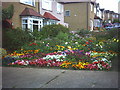
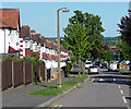
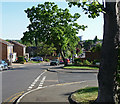
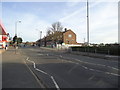
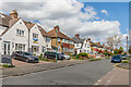
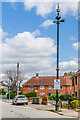
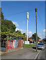
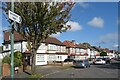
40 photos from this area
Area Information
Key information about the SM1 3LA including its size, population, and administrative classification.
- Area Type
- Postcode
- Area Size
- 2.1 hectares
- Population
- 1770
- Population Density
- 4349 people/km²
House Prices in SM1 3LA
47
Properties
£470,989
Average Sold Price
£171,500
Lowest Price
£950,000
Highest Price
Showing 47 properties
| Address | Type | Beds | Baths | Last Sale Price | Last Sale Date | |
|---|---|---|---|---|---|---|
| 63 Rose Hill Park West, Sutton, SM1 3LA | Semi-detached | 3 | 1 | £585,200 | Jul 2024 | |
| 9 Rose Hill Park West, Sutton, SM1 3LA | Terraced | 4 | 1 | £684,000 | Jul 2023 | |
| Rosewood, 11 Rose Hill Park West, Sutton, SM1 3LA | Semi-detached | 5 | 2 | £790,000 | Jun 2023 | |
| 31A Rose Hill Park West, Sutton, SM1 3LA | Bungalow | 4 | 2 | £850,000 | Feb 2023 | |
| 61 Rose Hill Park West, Sutton, SM1 3LA | Semi-detached | 3 | 1 | £565,000 | Feb 2023 | |
| 13 Rose Hill Park West, Sutton, SM1 3LA | house | 3 | 1 | £591,000 | Nov 2022 | |
| 79 Rose Hill Park West, Sutton, SM1 3LA | Detached | 4 | 2 | £950,000 | Jun 2022 | |
| 37 Rose Hill Park West, Sutton, SM1 3LA | Flat | 3 | 1 | £580,005 | Sep 2021 | |
| 7 Rose Hill Park West, Sutton, SM1 3LA | house | - | - | £565,000 | Aug 2021 | |
| 71 Rose Hill Park West, Sutton, SM1 3LA | Semi-detached | 4 | 1 | £564,000 | Mar 2021 |
Page 1 of 5
Energy Efficiency in SM1 3LA
Amenities
Schools
| Rank | School | Type | Entry gender | Ages |
|---|
Explore more schools in this area
Go to Schools tabDemographics
Household Size
Family (3-5 people)
most common
Accommodation Type
Houses
most common
Tenure
83
majority
Ethnic Group
White
most common
Religion
N/A
most common
Household Composition
N/A
most common
Age
47
median
Adults (30-64 years)
most common
Household Deprivation
N/A
with no deprivation
NS-SEC
40
in Lower managerial occupations
Explore more demographic insights in this area
Go to Demographics tabPlanning
Planning Constraints
- Flood RiskPremium
- Ramsar Wetland SitesPremium
- Area of Outstanding Natural BeautyPremium
- Protected Nature ReservePremium
- Protected WoodlandPremium