Area Overview for SM1 3AN
Photos of SM1 3AN
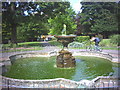
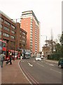
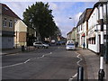
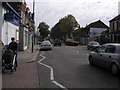


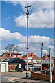
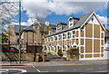
54 photos from this area
Area Information
Key information about the SM1 3AN including its size, population, and administrative classification.
- Area Type
- Postcode
- Area Size
- 1.3 hectares
- Population
- 1862
- Population Density
- 6795 people/km²
House Prices in SM1 3AN
27
Properties
£320,667
Average Sold Price
£75,000
Lowest Price
£692,000
Highest Price
Showing 27 properties
| Address | Type | Beds | Baths | Last Sale Price | Last Sale Date | |
|---|---|---|---|---|---|---|
| 155 Oakhill Road, Sutton, SM1 3AN | Bungalow | 3 | 1 | £555,000 | Nov 2025 | |
| 147 Oakhill Road, Sutton, SM1 3AN | Semi-detached | 4 | 2 | £692,000 | Jun 2022 | |
| 163 Oakhill Road, Sutton, SM1 3AN | Bungalow | - | - | £540,000 | Feb 2022 | |
| 125 Oakhill Road, Sutton, SM1 3AN | Bungalow | - | - | £420,000 | May 2021 | |
| 131 Oakhill Road, Sutton, SM1 3AN | Semi-detached | 2 | 1 | £385,000 | May 2019 | |
| 143 Oakhill Road, Sutton, SM1 3AN | Semi-detached | 2 | 1 | £345,000 | Dec 2018 | |
| 121 Oakhill Road, Sutton, SM1 3AN | Semi-detached | 3 | 1 | £505,000 | Nov 2015 | |
| 123 Oakhill Road, Sutton, SM1 3AN | Semi-detached | 3 | 1 | £487,000 | Jul 2015 | |
| 161 Oakhill Road, Sutton, SM1 3AN | Semi-detached | 2 | - | £375,000 | Oct 2014 | |
| 137 Oakhill Road, Sutton, SM1 3AN | Semi-detached | 4 | - | £365,000 | Jun 2013 |
Page 1 of 3
Energy Efficiency in SM1 3AN
Amenities
Schools
| Rank | School | Type | Entry gender | Ages |
|---|
Explore more schools in this area
Go to Schools tabDemographics
Household Size
Family (3-5 people)
most common
Accommodation Type
Flats
most common
Tenure
69
majority
Ethnic Group
White
most common
Religion
N/A
most common
Household Composition
N/A
most common
Age
47
median
Adults (30-64 years)
most common
Household Deprivation
N/A
with no deprivation
NS-SEC
34
in Lower managerial occupations
Explore more demographic insights in this area
Go to Demographics tabPlanning
Planning Constraints
- Flood RiskPremium
- Ramsar Wetland SitesPremium
- Area of Outstanding Natural BeautyPremium
- Protected Nature ReservePremium
- Protected WoodlandPremium