Area Overview for SM1 3SD
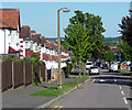
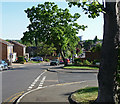
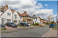
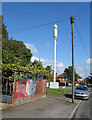
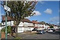
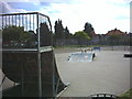
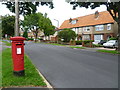
Photos of SM1 3SD


Area Information
The postcode SM1 3SD covers a small residential cluster occupying only 2.5 hectares. This compact area houses 1,862 people, creating an extremely dense living environment with approximately 73,066 people per square kilometre. Despite its small footprint, the distinction lies in its function as a concentrated residential zone rather than a sprawling suburb. The location offers a direct connection to wider London infrastructure while maintaining a tight-knit local footprint. You will find that daily life here is defined by proximity, with essential services and transport links lying within practical reach. The area does not offer vast green spaces or extensive street networks; instead, it provides a focused living experience where neighbours are often within shouting distance. This density means that the character of your day-to-door journey is determined by how you navigate between your smaller home and the larger amenities of Sutton or Morden. The environment is practical and utilitarian, lacking the extensive parks or broad avenues found in wider postcodes. For those seeking a specific entry point into this locality, SM1 3SD delivers a high-intensity residential setting every inch of its way. The compact nature ensures that everything you need is accessible without long commutes by car, though the sheer number of residents per hectare creates a vibrant, if crowded, atmosphere.
- Area Type
- Postcode
- Area Size
- 2.5 hectares
- Population
- 1862
- Population Density
- 6795 people/km²
SM1 3SD functions primarily as a residential zone where ownership is the dominant model. The data confirms that 69% of residents are homeowners, which defines the local property market as stable and established. This high ownership rate contrasts with areas where private landlords dominate the housing stock. The predominant accommodation type is flats, meaning you will find a significant concentration of apartment living within this 2.5-hectare cluster. This housing stock is suited to adults between 30 and 64, the group that forms the backbone of the community. For buyers, this means the local market consists mainly of second-hand flats intended for owner-occupiers rather than new-build developments or massive rental schemes. The area accommodates 1,862 people within its compact boundaries, suggesting a limited supply of new units entering the market compared to larger urban zones. The flats serve a population that includes a large cohort of established adults, indicating that the design of these homes caters to practical living needs rather than luxury market demands. When purchasing homes in SM1 3SD, you are entering the secondary market of a mature neighbourhood. The density of 73,066 people per square kilometre implies that properties are close together, which can affect privacy and noise levels. However, the high home ownership percentage suggests that value retention in this area is driven by local demand and established community ties rather than speculative investment potential.
House Prices in SM1 3SD
Showing 58 properties
| Address | Type | Beds | Baths | Last Sale Price | Last Sale Date | |
|---|---|---|---|---|---|---|
| 65 Benfleet Close, Sutton, SM1 3SD | Semi-detached | 4 | 2 | £625,000 | Mar 2025 | |
| 3 Benfleet Close, Sutton, SM1 3SD | Semi-detached | 5 | 3 | £745,000 | Oct 2023 | |
| 99 Benfleet Close, Sutton, SM1 3SD | Semi-detached | 3 | 2 | £650,000 | Sep 2023 | |
| 43 Benfleet Close, Sutton, SM1 3SD | Semi-detached | 3 | 1 | £530,000 | May 2023 | |
| 109 Benfleet Close, Sutton, SM1 3SD | Semi-detached | 3 | 1 | £600,000 | Nov 2022 | |
| 17 Benfleet Close, Sutton, SM1 3SD | Bungalow | 2 | 1 | £555,000 | Oct 2022 | |
| 9 Benfleet Close, Sutton, SM1 3SD | Bungalow | 4 | 3 | £680,000 | Mar 2022 | |
| 71 Benfleet Close, Sutton, SM1 3SD | Bungalow | - | - | £665,000 | Sep 2021 | |
| 47 Benfleet Close, Sutton, SM1 3SD | Semi-detached | 3 | 1 | £432,500 | Jun 2021 | |
| 23 Benfleet Close, Sutton, SM1 3SD | Semi-detached | 3 | - | £530,000 | Jun 2021 |
Energy Efficiency in SM1 3SD
Daily life in SM1 3SD benefits from immediate access to a wide range of retail and transport amenities. Retail options include notable venues such as Tesco Sutton, Lidl London, and Tesco Angel, all within practical reach for your weekly shopping. You can choose between a variety of supermarket formats to suit your household size and budget. Public transport options are extensive nearby, with Sutton Common Station, Carshalton Station, and West Sutton providing frequent rail connections. For those preferring escalators and local travel, Mitcham Tram Stop, Belgrave Walk Tram Stop, and Morden are all accessible. Ferry enthusiasts can utilise Kingston Town End Pier and Kingston Turks Pier for river views and leisure trips. This density of amenities means you do not need to travel far for your daily groceries, work commute, or leisure activities. The small size of the postcode area ensures that these services are concentrated within a short distance of your flat or home. Living in SM1 3SD offers the convenience of city-sized shopping and transport without the need for extensive car journeys. The proximity to Sutton and Morden effectively expands your living circle, giving you access to larger entertainment venues and broader retail parks while retaining the convenience of a compact local address. Your lifestyle hinges on this efficient network of shops and transit stops that support a busy, urban-centred existence.
Amenities
Schools
Families living in SM1 3SD have direct access to quality education within their immediate vicinity. The primary option is All Saints Benhilton CofE Primary School, which holds a Good rating from Ofsted. This school serves the younger demographic within the area, providing a secure and rated learning environment for children. As a Church of England institution, it offers a specific ethos which some parents may prefer. The area does not have secondary schools listed in its immediate proximity, meaning older children may need to travel further for secondary education. The concentration of a single primary school reflects the residential nature of SM1 3SD, where families seek reputable entry-level education before moving to other catchment zones. The Good rating signifies that the school meets high standards and is a reliable choice for local parents. For those with school-aged children, the proximity of this rated institution is a practical advantage that shortens commuting times for drop-offs and pick-ups. The educational landscape is therefore straightforward, anchored by one strong primary provider rather than a complex mix of academies or specialist colleges. This simplicity appeals to households prioritising a stable local school environment before children transition to high schools further away.
| Rank | School | Type | Entry gender | Ages |
|---|
Explore more schools in this area
Go to Schools tabDemographics
The community in SM1 3SD reflects a mature and settled population. The median age stands at 47 years, with adults aged between 30 and 64 constituting the most common age range. This demographic profile suggests a neighbourhood dominated by working families, empty nesters, or established professionals rather than young students or retirees. Housing stability is evident, with a home ownership rate of 69%. This figure indicates that the majority of residents buy their properties rather than renting, contributing to long-term community cohesion. The predominant accommodation type consists of flats, aligning with the high-density nature of the 2.5-hectare site. While specific ethnicity data points to a White majority, the area supports a significant portion of the adult workforce. The absence of a high youth population correlates with the median age and the prevalence of flats, which are often popular with professionals working in nearby business districts. The environment is characterised by established households who value stability and proximity to transport hubs. With nearly seven in ten residents owning their homes, the area lacks the transient feel of a standard young lets market. The population density of over 73,000 people per square kilometre further shapes social interactions, fostering a close neighbourhood where residents share similar life stages and economic pressures.
Household Size
Accommodation Type
Tenure
Ethnic Group
Religion
Household Composition
Age
Household Deprivation
NS-SEC
Explore more demographic insights in this area
Go to Demographics tabPlanning
Planning Constraints
- Flood RiskPremium
- Ramsar Wetland SitesPremium
- Area of Outstanding Natural BeautyPremium
- Protected Nature ReservePremium
- Protected WoodlandPremium