Area Overview for SE9 5LR
Photos of SE9 5LR
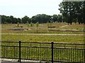
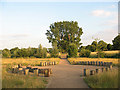
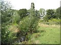
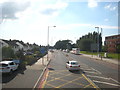
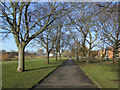
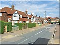
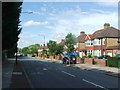
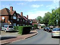
100 photos from this area
Area Information
Key information about the SE9 5LR including its size, population, and administrative classification.
- Area Type
- Postcode
- Area Size
- 2.7 hectares
- Population
- 1618
- Population Density
- 4286 people/km²
House Prices in SE9 5LR
38
Properties
£301,748
Average Sold Price
£93,000
Lowest Price
£670,000
Highest Price
Showing 38 properties
| Address | Type | Beds | Baths | Last Sale Price | Last Sale Date | |
|---|---|---|---|---|---|---|
| 449 Westhorne Avenue, Eltham, SE9 5LR | Retail | 3 | 1 | £670,000 | Aug 2022 | |
| 455 Westhorne Avenue, Eltham, SE9 5LR | Semi-detached | 5 | 3 | £430,000 | Oct 2019 | |
| 459 Westhorne Avenue, Eltham, SE9 5LR | Semi-detached | 3 | - | £510,000 | Dec 2017 | |
| 437 Westhorne Avenue, Eltham, SE9 5LR | Semi-detached | 3 | - | £475,000 | Apr 2017 | |
| 447 Westhorne Avenue, Eltham, SE9 5LR | Semi-detached | 1 | 1 | £520,000 | Jul 2016 | |
| 467 Westhorne Avenue, Eltham, SE9 5LR | Semi-detached | 3 | - | £490,000 | Sep 2015 | |
| 451 Westhorne Avenue, Eltham, SE9 5LR | Semi-detached | 3 | 1 | £375,000 | May 2014 | |
| 453 Westhorne Avenue, Eltham, SE9 5LR | house | - | - | £365,000 | Aug 2013 | |
| 469 Westhorne Avenue, Eltham, SE9 5LR | house | - | - | £250,000 | Feb 2013 | |
| 465 Westhorne Avenue, Eltham, SE9 5LR | house | 3 | - | £317,000 | Jan 2013 |
Page 1 of 4
Energy Efficiency in SE9 5LR
Amenities
Schools
| Rank | School | Type | Entry gender | Ages |
|---|
Explore more schools in this area
Go to Schools tabDemographics
Household Size
Family (3-5 people)
most common
Accommodation Type
Houses
most common
Tenure
72
majority
Ethnic Group
White
most common
Religion
N/A
most common
Household Composition
N/A
most common
Age
47
median
Adults (30-64 years)
most common
Household Deprivation
N/A
with no deprivation
NS-SEC
41
in Lower managerial occupations
Explore more demographic insights in this area
Go to Demographics tabPlanning
Planning Constraints
- Flood RiskPremium
- Ramsar Wetland SitesPremium
- Area of Outstanding Natural BeautyPremium
- Protected Nature ReservePremium
- Protected WoodlandPremium