Area Overview for SE9 5EL
Photos of SE9 5EL

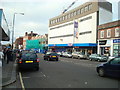
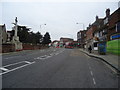
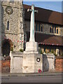
100 photos from this area
Area Information
Key information about the SE9 5EL including its size, population, and administrative classification.
- Area Type
- Postcode
- Area Size
- 9490 m²
- Population
- 1664
- Population Density
- 3657 people/km²
House Prices in SE9 5EL
37
Properties
£204,544
Average Sold Price
£63,500
Lowest Price
£365,000
Highest Price
Showing 37 properties
| Address | Type | Beds | Baths | Last Sale Price | Last Sale Date | |
|---|---|---|---|---|---|---|
| 148 Queenscroft Road, Eltham, SE9 5EL | Maisonette | 2 | 1 | £298,500 | Mar 2022 | |
| 132 Queenscroft Road, Eltham, SE9 5EL | Flat | - | - | £287,000 | Aug 2021 | |
| 126 Queenscroft Road, Eltham, SE9 5EL | Maisonette | 2 | 1 | £270,000 | Sep 2017 | |
| 166 Queenscroft Road, Eltham, SE9 5EL | Maisonette | 2 | 1 | £250,000 | Aug 2017 | |
| 120 Queenscroft Road, Eltham, SE9 5EL | Terraced | 2 | - | £365,000 | Sep 2016 | |
| 172 Queenscroft Road, Eltham, SE9 5EL | Maisonette | 2 | 1 | £250,000 | May 2016 | |
| 124 Queenscroft Road, Eltham, SE9 5EL | Maisonette | 2 | 1 | £267,500 | Jan 2016 | |
| 146 Queenscroft Road, Eltham, SE9 5EL | Maisonette | 2 | 1 | £260,000 | Dec 2015 | |
| 118 Queenscroft Road, Eltham, SE9 5EL | Terraced | 3 | - | £257,000 | Apr 2015 | |
| 142 Queenscroft Road, Eltham, SE9 5EL | Flat | - | - | £145,000 | Jun 2012 |
Page 1 of 4
Energy Efficiency in SE9 5EL
Amenities
Schools
| Rank | School | Type | Entry gender | Ages |
|---|
Explore more schools in this area
Go to Schools tabDemographics
Household Size
Family (3-5 people)
most common
Accommodation Type
Houses
most common
Tenure
54
majority
Ethnic Group
White
most common
Religion
N/A
most common
Household Composition
N/A
most common
Age
47
median
Adults (30-64 years)
most common
Household Deprivation
N/A
with no deprivation
NS-SEC
27
in Lower managerial occupations
Explore more demographic insights in this area
Go to Demographics tabPlanning
Planning Constraints
- Flood RiskPremium
- Ramsar Wetland SitesPremium
- Area of Outstanding Natural BeautyPremium
- Protected Nature ReservePremium
- Protected WoodlandPremium