Area Overview for SE9 2RW
Photos of SE9 2RW

Area Information
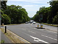
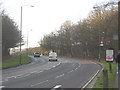
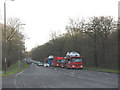
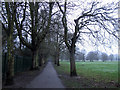
SE9 2RW occupies a small residential cluster covering just 2,925 square metres. This postcode sits within the Falconwood and Welling electoral ward in the London Borough of Bexley. The area is named after neighbouring regions and first appeared in the 2002 elections. It is located near coordinates 51.462257, 0.113882, running along the historic Watling Street, now known as the A207. This road runs from London to Dover. The postcode lies west of Bexleyheath and incorporates parts of the ancient manor of East Wickham. Residents here benefit from a community of 1,766 people. Living in SE9 2RW means you are settled in a historic location that evolved from farming to a residential estate. The area retains links to the Roman road network and the 19th-century railway expansion. You are situated in South East London with proximity to established local hubs. The small footprint of the postcode indicates a compact, focused community rather than a sprawling neighbourhood. Daily life revolves around the specific amenities and transport links immediately surrounding this cluster. The location offers direct access to the North Kent line and key road arteries.
- Area Type
- Postcode
- Area Size
- 2925 m²
- Population
- 1766
- Population Density
- 7056 people/km²
The housing stock in SE9 2RW is predominantly made up of houses. This real estate landscape contrasts with flat-heavy districts commonly found in inner London. Eighty-four per cent of households in this postcode own their homes. This high level of ownership suggests a market driven by established residents rather than short-term landlords or corporate lettings. Buyers looking at SE9 2RW will find an area where the property market reflects stability and continuity. The accommodation type data confirms that houses are the standard dwelling here. You are likely purchasing a home intended for families or multi-generational living rather than a starter flat or pied-à-terre. The historical record shows growth from 1362 and council housing schemes in the 1920s alongside the Falconwood Estate developed in the 1930s. These developments laid the foundation for the current homes in SE9 2RW. The mix of housing dates back to the 20th century, including the Welling Council Housing Scheme which provided 426 houses. Understanding the home ownership percentage helps clarify the local market dynamics. You are entering a property sector where buyers compete for established, owner-occupied stock rather than rental voids. This area offers a settled market environment for serious homebuyers seeking security.
House Prices in SE9 2RW
Showing 62 properties
Energy Efficiency in SE9 2RW
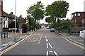
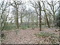
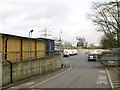
Residents of SE9 2RW enjoy access to five retail outlets, five rail stations, and five ferry terminals. M&S Crownwood Connect BP, Co-op Falconwood, and Budgens Welling are key retail anchors nearby. Falconwood Station and Welling Station serve daily commute needs. Libraries, schools, and post offices fall within this broader circle of convenience. St Michael's Church in East Wickham offers a historic focal point. Danson Park features the restored Palladian Danson House dating from the 1760s. Historic coaching inns such as the Guy, Earl of Warwick, and Nag's Head line the route. These venues contribute to the area's deep historical character. Living in SE9 2RW places you within walking distance of these landmarks. The Belle Grove residential district adds to the high-class nature of the surroundings. East Wickham House and Farm provide open space. A 1996 War Memorial and a carronade on loan from the Royal Artillery Museum further enrich the local environment. You are close to the ancient manor of East Wickham and the Domesday Book site. The area balances modern retail needs with historic preservation sites.
Amenities
Schools
| Rank | School | Type | Entry gender | Ages |
|---|
Explore more schools in this area
Go to Schools tabDemographics
The community in SE9 2RW has an established character defined by its age profile and household structures. The median age for residents is 47 years old. Most of the population falls into the adult age range between 30 and 64 years. This demographic skews towards older working-age adults and families rather than young professionals or teenagers. Home ownership stands at 84 per cent within this zone. The majority of households own their properties outright or with a mortgage. There is minimal long-term renting or transient housing in this cluster. The predominant ethnic group is White, reflecting a specific local community make-up. The main type of accommodation consists of houses, distinguishing this area from blocks of flats or high-density blocks found elsewhere in London. With a population density of 603,664 people per square kilometre, the census data highlights the total population figures rather than per-square-kilometre concentration metrics for the entire ward context. This high urban density figure for the broader context contrasts with the specific residential nature of the SE9 2RW cluster. Living in SE9 2RW means you join a stable community where long-term residents form the backbone of the local economy and social fabric.
Household Size
Accommodation Type
Tenure
Ethnic Group
Religion
Household Composition
Age
Household Deprivation
NS-SEC
Explore more demographic insights in this area
Go to Demographics tabPlanning
Planning Constraints
- Flood RiskPremium
- Ramsar Wetland SitesPremium
- Area of Outstanding Natural BeautyPremium
- Protected Nature ReservePremium
- Protected WoodlandPremium