Area Overview for SE9 2AR
Photos of SE9 2AR
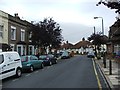

37 photos from this area
Area Information
Key information about the SE9 2AR including its size, population, and administrative classification.
- Area Type
- Postcode
- Area Size
- 1.2 hectares
- Population
- 1628
- Population Density
- 2346 people/km²
House Prices in SE9 2AR
10
Properties
£462,883
Average Sold Price
£244,000
Lowest Price
£600,000
Highest Price
Showing 10 properties
| Address | Type | Beds | Baths | Last Sale Price | Last Sale Date | |
|---|---|---|---|---|---|---|
| 168 Green Lane, Eltham, SE9 2AR | Semi-detached | - | - | £325,000 | Aug 2025 | |
| 152 Green Lane, Eltham, SE9 2AR | Semi-detached | 3 | 2 | £595,000 | Sep 2023 | |
| 156 Green Lane, Eltham, SE9 2AR | house | - | - | £600,000 | Nov 2021 | |
| 166 Green Lane, Eltham, SE9 2AR | house | 4 | 1 | £490,000 | Aug 2018 | |
| 150 Green Lane, Eltham, SE9 2AR | Semi-detached | 4 | 2 | £522,000 | Jun 2018 | |
| 160 Green Lane, Eltham, SE9 2AR | house | - | - | £575,000 | Sep 2015 | |
| 158 Green Lane, Eltham, SE9 2AR | Detached | 5 | - | £550,000 | May 2015 | |
| 154 Green Lane, Eltham, SE9 2AR | Semi-detached | 3 | 1 | £244,000 | Oct 2006 | |
| 164 Green Lane, Eltham, SE9 2AR | Terraced | - | - | £264,950 | Jul 2006 | |
| 162 Green Lane, Eltham, SE9 2AR | house | - | - | - | - |
Energy Efficiency in SE9 2AR
Amenities
Schools
| Rank | School | Type | Entry gender | Ages |
|---|
Explore more schools in this area
Go to Schools tabDemographics
Household Size
One person
most common
Accommodation Type
Houses
most common
Tenure
76
majority
Ethnic Group
White
most common
Religion
N/A
most common
Household Composition
N/A
most common
Age
47
median
Adults (30-64 years)
most common
Household Deprivation
N/A
with no deprivation
NS-SEC
40
in Lower managerial occupations
Explore more demographic insights in this area
Go to Demographics tabPlanning
Planning Constraints
- Flood RiskPremium
- Ramsar Wetland SitesPremium
- Area of Outstanding Natural BeautyPremium
- Protected Nature ReservePremium
- Protected WoodlandPremium