Area Overview for SE6 1HJ
Photos of SE6 1HJ
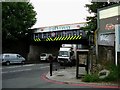
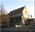
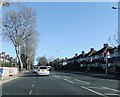
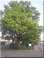
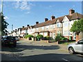
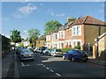
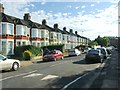
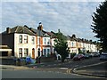
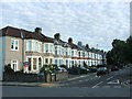
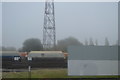
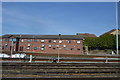
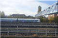
84 photos from this area
Area Information
Key information about the SE6 1HJ including its size, population, and administrative classification.
- Area Type
- Postcode
- Area Size
- 4576 m²
- Population
- 1668
- Population Density
- 9287 people/km²
House Prices in SE6 1HJ
17
Properties
£516,249
Average Sold Price
£305,000
Lowest Price
£715,000
Highest Price
Showing 17 properties
| Address | Type | Beds | Baths | Last Sale Price | Last Sale Date | |
|---|---|---|---|---|---|---|
| 16 Dowanhill Road, London, SE6 1HJ | house | 4 | 1 | £715,000 | Feb 2016 | |
| 13 Dowanhill Road, London, SE6 1HJ | Terraced | 4 | - | £661,991 | Sep 2015 | |
| 11 Dowanhill Road, London, SE6 1HJ | house | 4 | 1 | £642,500 | May 2014 | |
| 12 Dowanhill Road, London, SE6 1HJ | Terraced | 3 | - | £420,000 | May 2007 | |
| Waterfield Supported Homes Limited, 10 Dowanhill Road, London, SE6 1HJ | hospital_care_home | - | - | £305,000 | Jul 2005 | |
| 9 Dowanhill Road, London, SE6 1HJ | Terraced | - | - | £353,000 | Aug 2002 | |
| Flat A, 14 Dowanhill Road, London, SE6 1HJ | Retail | 3 | 2 | - | - | |
| Flat 2, Ashmore Court, 16A Dowanhill Road, London, SE6 1HJ | Flat | - | - | - | - | |
| Flat 4, Ashmore Court, 16A Dowanhill Road, London, SE6 1HJ | Flat | - | - | - | - | |
| Flat 3, Ashmore Court, 16A Dowanhill Road, London, SE6 1HJ | Flat | - | - | - | - |
Page 1 of 2
Energy Efficiency in SE6 1HJ
Amenities
Schools
| Rank | School | Type | Entry gender | Ages |
|---|
Explore more schools in this area
Go to Schools tabDemographics
Household Size
Family (3-5 people)
most common
Accommodation Type
Houses
most common
Tenure
54
majority
Ethnic Group
White
most common
Religion
N/A
most common
Household Composition
N/A
most common
Age
47
median
Adults (30-64 years)
most common
Household Deprivation
N/A
with no deprivation
NS-SEC
39
in Lower managerial occupations
Explore more demographic insights in this area
Go to Demographics tabPlanning
Planning Constraints
- Flood RiskPremium
- Ramsar Wetland SitesPremium
- Area of Outstanding Natural BeautyPremium
- Protected Nature ReservePremium
- Protected WoodlandPremium