Area Overview for SE6 1HR
Photos of SE6 1HR
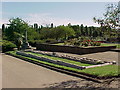
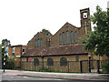
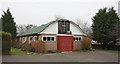
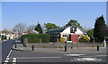
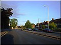
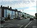
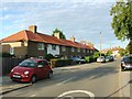
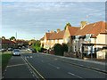
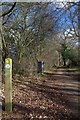
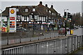
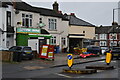
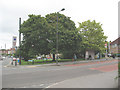
68 photos from this area
Area Information
Key information about the SE6 1HR including its size, population, and administrative classification.
- Area Type
- Postcode
- Area Size
- 1.3 hectares
- Population
- 1573
- Population Density
- 8600 people/km²
House Prices in SE6 1HR
33
Properties
£477,952
Average Sold Price
£142,000
Lowest Price
£792,500
Highest Price
Showing 33 properties
| Address | Type | Beds | Baths | Last Sale Price | Last Sale Date | |
|---|---|---|---|---|---|---|
| 209 Wellmeadow Road, London, SE6 1HR | Terraced | 4 | 2 | £765,000 | Aug 2025 | |
| 205 Wellmeadow Road, London, SE6 1HR | Terraced | 6 | 2 | £792,500 | Jun 2024 | |
| 177 Wellmeadow Road, London, SE6 1HR | Semi-detached | 3 | 1 | £644,600 | Jun 2022 | |
| 193 Wellmeadow Road, London, SE6 1HR | Terraced | 4 | 1 | £675,000 | Mar 2021 | |
| 167 Wellmeadow Road, London, SE6 1HR | Semi-detached | 4 | 1 | £775,000 | May 2020 | |
| 179 Wellmeadow Road, London, SE6 1HR | Semi-detached | 4 | 1 | £480,000 | Nov 2015 | |
| 207 Wellmeadow Road, London, SE6 1HR | Terraced | 6 | - | £600,000 | May 2014 | |
| 181 Wellmeadow Road, London, SE6 1HR | Semi-detached | 3 | 1 | £295,000 | Aug 2013 | |
| 203 Wellmeadow Road, London, SE6 1HR | house | - | - | £275,000 | Apr 2010 | |
| 169 Wellmeadow Road, London, SE6 1HR | Detached | 1 | 1 | £325,000 | Oct 2007 |
Page 1 of 4
Energy Efficiency in SE6 1HR
Amenities
Schools
| Rank | School | Type | Entry gender | Ages |
|---|
Explore more schools in this area
Go to Schools tabDemographics
Household Size
Family (3-5 people)
most common
Accommodation Type
Houses
most common
Tenure
63
majority
Ethnic Group
White
most common
Religion
N/A
most common
Household Composition
N/A
most common
Age
47
median
Adults (30-64 years)
most common
Household Deprivation
N/A
with no deprivation
NS-SEC
41
in Lower managerial occupations
Explore more demographic insights in this area
Go to Demographics tabPlanning
Planning Constraints
- Flood RiskPremium
- Ramsar Wetland SitesPremium
- Area of Outstanding Natural BeautyPremium
- Protected Nature ReservePremium
- Protected WoodlandPremium