Area Overview for SE5 8ST
Photos of SE5 8ST

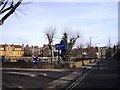

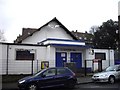
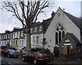
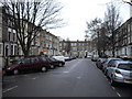
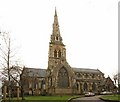
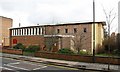
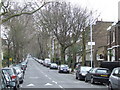
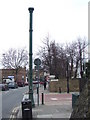
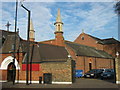
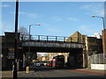
100 photos from this area
Area Information
Key information about the SE5 8ST including its size, population, and administrative classification.
- Area Type
- Postcode
- Area Size
- 7470 m²
- Population
- 2043
- Population Density
- 8679 people/km²
House Prices in SE5 8ST
36
Properties
£1,121,344
Average Sold Price
£50,000
Lowest Price
£2,200,000
Highest Price
Showing 36 properties
| Address | Type | Beds | Baths | Last Sale Price | Last Sale Date | |
|---|---|---|---|---|---|---|
| 42 Grove Lane, London, SE5 8ST | house | - | - | £1,900,000 | Feb 2025 | |
| 26 Grove Lane, London, SE5 8ST | house | - | - | £1,900,000 | Aug 2021 | |
| 46 Grove Lane, London, SE5 8ST | house | - | - | £1,865,000 | Jan 2021 | |
| 50 Grove Lane, London, SE5 8ST | Terraced | 4 | 3 | £2,150,000 | Oct 2019 | |
| 44 Grove Lane, London, SE5 8ST | Terraced | 4 | 3 | £2,200,000 | Feb 2018 | |
| 64 Grove Lane, London, SE5 8ST | Flat | - | - | £50,000 | Sep 2016 | |
| 68 Grove Lane, London, SE5 8ST | Flat | - | - | £649,950 | Oct 2015 | |
| 66 Grove Lane, London, SE5 8ST | Flat | - | - | £775,000 | Oct 2015 | |
| 40 Grove Lane, London, SE5 8ST | Terraced | 5 | 3 | £1,765,000 | Dec 2013 | |
| 22 Grove Lane, London, SE5 8ST | Terraced | 6 | 4 | £1,150,000 | Dec 2007 |
Page 1 of 4
Energy Efficiency in SE5 8ST
Amenities
Schools
| Rank | School | Type | Entry gender | Ages |
|---|
Explore more schools in this area
Go to Schools tabDemographics
Household Size
Family (3-5 people)
most common
Accommodation Type
Flats
most common
Tenure
41
majority
Ethnic Group
White
most common
Religion
N/A
most common
Household Composition
N/A
most common
Age
47
median
Adults (30-64 years)
most common
Household Deprivation
N/A
with no deprivation
NS-SEC
51
in Lower managerial occupations
Explore more demographic insights in this area
Go to Demographics tabPlanning
Planning Constraints
- Flood RiskPremium
- Ramsar Wetland SitesPremium
- Area of Outstanding Natural BeautyPremium
- Protected Nature ReservePremium
- Protected WoodlandPremium