Area Overview for SE5 8SH
Photos of SE5 8SH


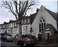
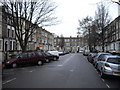


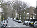
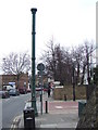

100 photos from this area
Area Information
Key information about the SE5 8SH including its size, population, and administrative classification.
- Area Type
- Postcode
- Area Size
- 2904 m²
- Population
- 2043
- Population Density
- 8679 people/km²
House Prices in SE5 8SH
14
Properties
£368,813
Average Sold Price
£91,000
Lowest Price
£640,000
Highest Price
Showing 14 properties
| Address | Type | Beds | Baths | Last Sale Price | Last Sale Date | |
|---|---|---|---|---|---|---|
| 6 Cuthill Walk, London, SE5 8SH | house | - | - | £616,000 | Feb 2025 | |
| 3 Cuthill Walk, London, SE5 8SH | Retail | 2 | 1 | £550,000 | Jun 2022 | |
| 11 Cuthill Walk, London, SE5 8SH | house | - | - | £480,000 | Nov 2021 | |
| 12 Cuthill Walk, London, SE5 8SH | Terraced | 3 | 1 | £640,000 | Oct 2018 | |
| 7 Cuthill Walk, London, SE5 8SH | house | 3 | - | £362,000 | Dec 2011 | |
| 2 Cuthill Walk, London, SE5 8SH | Terraced | 2 | 1 | £110,000 | Jul 1998 | |
| 10 Cuthill Walk, London, SE5 8SH | Terraced | - | - | £101,500 | Aug 1997 | |
| 8 Cuthill Walk, London, SE5 8SH | Detached | 3 | 1 | £91,000 | Jul 1995 | |
| 1 Cuthill Walk, London, SE5 8SH | Terraced | 3 | - | - | - | |
| 14 Cuthill Walk, London, SE5 8SH | Terraced | - | - | - | - |
Page 1 of 2
Energy Efficiency in SE5 8SH
Amenities
Schools
| Rank | School | Type | Entry gender | Ages |
|---|
Explore more schools in this area
Go to Schools tabDemographics
Household Size
Family (3-5 people)
most common
Accommodation Type
Flats
most common
Tenure
41
majority
Ethnic Group
White
most common
Religion
N/A
most common
Household Composition
N/A
most common
Age
47
median
Adults (30-64 years)
most common
Household Deprivation
N/A
with no deprivation
NS-SEC
51
in Lower managerial occupations
Explore more demographic insights in this area
Go to Demographics tabPlanning
Planning Constraints
- Flood RiskPremium
- Ramsar Wetland SitesPremium
- Area of Outstanding Natural BeautyPremium
- Protected Nature ReservePremium
- Protected WoodlandPremium