Area Overview for SE5 8RE
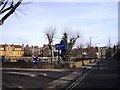
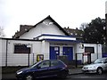
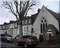
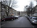
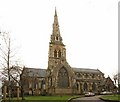
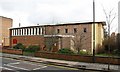
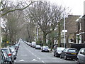
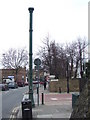
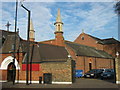
Photos of SE5 8RE


Area Information
Living in SE5 8RE means residing within a compact residential cluster that covers just 1.2 hectares. This small postcode area contains a population of 2,043, resulting in a very high population density of 175,127 people per square kilometre. You are situated in a heavily built-up environment where private space is limited by the sheer number of neighbours around you. The area functions as a small pocket within the wider South London landscape, specifically characterised by its concentration of flats rather than semi-detached houses or terraced rows. Despite its diminutive size, the location benefits from immediate access to major transport hubs, making it a practical choice for commuters who value connection over green space. Daily life here is defined by proximity to services and people, with the majority of your routine needs likely reachable within a short walk. The area blends into the bustling fabric of SE5, offering a slice of London living that prioritises convenience. You will find yourself surrounded by a dense community where residents rely on the extensive public transport network for their daily journeys rather than private vehicles.
- Area Type
- Postcode
- Area Size
- 1.2 hectares
- Population
- 2043
- Population Density
- 8679 people/km²
The housing stock in SE5 8RE is defined almost exclusively by flats, catering to buyers seeking urban living without the footprint of a detached house. With 41% of residents owning their homes, the area maintains a significant proportion of owner-occupiers alongside a large rental sector. This balance indicates a healthy market where properties serve both as family bases and investment assets. You are unlikely to find bungalows or large detached properties available for purchase in this specific 1.2 hectare spot. The high population density of 175,127 people per square kilometre reinforces the expectation of apartments rather than spacious single-family dwellings. If you are looking for homes in SE5 8RE, your search will focus on blocks of residential towers or smaller conversion buildings. The area appeals to those who accept a city-centre lifestyle with sensible distances to transport links. While the lack of detached homes may deter some, it ensures that travel to work and amenities is efficient for everyone living in these flats.
House Prices in SE5 8RE
Showing 45 properties
| Address | Type | Beds | Baths | Last Sale Price | Last Sale Date | |
|---|---|---|---|---|---|---|
| 16 Camberwell Grove, London, SE5 8RE | Terraced | 5 | 3 | £2,150,000 | Dec 2024 | |
| 42 Camberwell Grove, London, SE5 8RE | Semi-detached | 4 | 2 | £2,000,000 | Sep 2024 | |
| 6 Camberwell Grove, London, SE5 8RE | house | 2 | 1 | £1,775,000 | May 2022 | |
| 52 Camberwell Grove, London, SE5 8RE | house | 4 | - | £1,750,000 | Mar 2021 | |
| 14 Camberwell Grove, London, SE5 8RE | house | - | - | £1,970,000 | Dec 2020 | |
| 36 Camberwell Grove, London, SE5 8RE | Detached | 4 | 2 | £1,620,000 | Jul 2020 | |
| Bryce House, 2A Camberwell Grove, London, SE5 8RE | Terraced | 3 | 2 | £1,435,000 | Nov 2019 | |
| 54 Camberwell Grove, London, SE5 8RE | house | - | - | £1,825,000 | Dec 2018 | |
| 38 Camberwell Grove, London, SE5 8RE | Semi-detached | 4 | 2 | £1,800,000 | Oct 2018 | |
| 4 Camberwell Grove, London, SE5 8RE | Terraced | 1 | 1 | £1,699,999 | Apr 2018 |
Energy Efficiency in SE5 8RE
Residents of SE5 8RE enjoy a dense network of amenities within practical reach of their flats. Five retail outlets serve the local shopping needs, including Morrisons Camberwell, Lidl Denmark, and Co-op Camberwell. These supermarkets provide fresh groceries and daily essentials without requiring a long journey. Transport links are extensive, with five railway stations including Denmark Hill and Loughborough Junction Station, alongside five metro stations like Oval and Kennington. Five ferry piers such as Vauxhall St George Wharf Pier and Lambeth Pier are accessible, offering a leisure option for trips across the Thames. Bus services include the Green Line Coach Station and arrivals at London Victoria Coach Station, ensuring you can travel nationwide with ease. This wealth of facilities means you can grocery shop, commute, and pursue leisure activities without leaving the immediate vicinity of your home. The area functioned as a well-serviced residential pocket where daily conveniences are just a short walk or tube ride away.
Amenities
Schools
Families in SE5 8RE have access to specific educational institutions within practical reach of their homes. Lyndhurst Primary School stands as a primary option for younger children in the vicinity. For specialist educational needs, you can reach Maudsley and Bethlem Hospital School, which operates as a special school serving children with complex requirements. The presence of these two institutions offers a limited but targeted choice for parents living in this small cluster. You do not find a broad spectrum of secondary or academy options listed directly adjacent to this postcode, meaning commuting may be necessary for older children depending on individual needs. The mix of a standard primary school and a specialist hospital school reflects the diverse requirements of the wider community that includes the 41% of owner-occupiers and younger adults in the 30-64 age bracket. When considering schools near SE5 8RE, you must map out travel times carefully to accommodate the layout of the local estate.
| Rank | School | Type | Entry gender | Ages |
|---|
Explore more schools in this area
Go to Schools tabDemographics
The community in SE5 8RE reflects a mature population profile. You will find that adults aged between 30 and 64 years represent the most common age range, suggesting a neighbourhood dominated by established residents and young families rather than students or the elderly. The median age of 47 years aligns with this finding, indicating a settled demographic that has likely grown roots in the local flats. Of the 2,043 residents, 41% own their homes, meaning the remaining majority are likely renting their accommodations. This tenure mix points to a dynamic market where both buy-to-let landlords and private tenants operate. The predominant ethnic group in the area is White, contributing to the specific character of the local populace in this small postcode. Most of the accommodation consists of flats, which suits the high-density living style preferred by many in this age group. You do not find low-rise suburbs or rural settings here, but rather a vertical living environment where multiple households occupy individual floors within larger buildings.
Household Size
Accommodation Type
Tenure
Ethnic Group
Religion
Household Composition
Age
Household Deprivation
NS-SEC
Explore more demographic insights in this area
Go to Demographics tabPlanning
Planning Constraints
- Flood RiskPremium
- Ramsar Wetland SitesPremium
- Area of Outstanding Natural BeautyPremium
- Protected Nature ReservePremium
- Protected WoodlandPremium