Area Overview for SE4 2EA
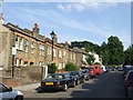
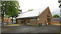
Photos of SE4 2EA

Area Information
Living in SE4 2EA offers a distinct experience defined by its compact footprint and high population density. This specific postcode covers just 8079 square metres, packing 1696 residents into a tight residential cluster. The density reaches approximately 209,933 people per square kilometre, creating an urban environment where space is a premium. For those seeking homes in SE4 2EA, the area presents a concentrated living situation typical of inner London, where proximity to daily necessities often outweighs the desire for expansive gardens. The population profile skews towards adults aged between 30 and 64 years, with a median age of 47, suggesting a neighbourhood of established residents rather than young professionals just starting out. Daily life here involves navigating a bustling environment where every street feels central to the community. You will find that the area is essentially a small village within a larger city, where the distinction between home and neighbourhood blurs due to the sheer number of dwellings per square metre. This configuration means that local interactions are frequent, and the area functions as a self-contained hub within the wider SE4 borough.
- Area Type
- Postcode
- Area Size
- 8079 m²
- Population
- 1696
- Population Density
- 10367 people/km²
The property market in SE4 2EA is shaped by the dominance of flats and a moderate level of home ownership. With accommodation types primarily consisting of flats, buyers looking for houses with substantial grounds may find limited options within this specific small area. However, the 48% home ownership rate indicates a healthy market where many residents have stayed put and invested in their properties over time. This statistic suggests that when properties come up for sale in SE4 2EA, they often attract serious buyers rather than transient renters. For those viewing homes in this postcode, the inventory will largely reflect the local housing strategy of vertical living solutions. The high population density of roughly 209,933 people per square kilometre ensures that demand often outstrips supply, maintaining value for existing homeowners. Potential purchasers should anticipate a competitive market given that nearly one-third of the London-wide average choice is constrained by the lack of detached houses. The mix of ownership means that you will see both properties occupied by owners who have grown with their homes and units available to first-time buyers seeking flats. This balance creates a dynamic selling environment where price stability is often supported by owner-occupiers who view their flats as long-term assets.
House Prices in SE4 2EA
Showing 3 properties
| Address | Type | Beds | Baths | Last Sale Price | Last Sale Date | |
|---|---|---|---|---|---|---|
| Flat B, 47 St Asaph Road, London, SE4 2EA | Flat | - | - | - | - | |
| 45 St Asaph Road, London, SE4 2EA | house | - | - | - | - | |
| Flat A, 47 St Asaph Road, London, SE4 2EA | Maisonette | - | - | - | - |
Energy Efficiency in SE4 2EA
Daily life in SE4 2EA is supported by a diverse range of amenities within practical reach, ensuring you never need to travel far for essentials. Residents can commute via numerous transport links including five railway stations such as Nunhead, Brockley, and Queens Road Peckham, or utilise five metro stations like Deptford Bridge and Cutty Sark DLR. For visitors arriving by water, choices include fleets pinning at Masthouse Terrace Pier, Greenwich Pier, or Greenland Surrey Quays Pier. Shopping needs are met by five major retail outlets including Sainsburys Brockley, Co-op Nunhead, and Sainsburys Lewisham. For longer journeys, three bus stations serve the area, connecting to major terminals like London Victoria Coach Station. Additionally, London City Airport is just one station away, offering rapid travel to the financial district. This connectivity ensures that your morning commute, evening outing, or weekend trip requires minimal planning. The variety of transport modes means there is likely a solution that fits your schedule and budget, whether you prefer the train, the DLR, or a quick bus ride. Living here places you at the intersection of commerce and leisure, with everything needed for daily living steps away or on the next leg of your journey.
Amenities
Schools
Families considering education near SE4 2EA have access to a robust selection of institutions catering to different needs and academic standards. One of the notable options is Haberdashers' Aske's Hatcham College, which serves as an academy with a Good Ofsted rating. Your children might also attend Haberdashers' Hatcham Free School, which holds an Outstanding Ofsted rating and operates as an academy. For younger children, Haberdashers Askes School serves as a primary institution, providing a seamless continuum of education under the same federation structure. Families with specific needs can look to Meadowgate School, a special school that forms part of the educational landscape. The presence of multiple schools in immediate proximity ensures that residents do not need to travel far for quality education. The mix of primary, secondary, and special provision schools highlights the comprehensive nature of the local education network. Access to these schools supports the reputation of SE4 2EA as an area where community and education intersect. Whether you are a local returning resident or a newcomer drawn by the academic reputation, the school choices remain consistent and accessible.
| Rank | School | Type | Entry gender | Ages |
|---|
Explore more schools in this area
Go to Schools tabDemographics
The community within SE4 2EA is characterised by mature living arrangements, with the median age recorded at 47 years. The most common age range consists of adults between 30 and 64 years old, reinforcing the impression of an area dominated by families and long-term residents rather than students or empty nesters. Home ownership stands at 48%, indicating a balanced mix of owner-occupiers and renters. While nearly half of the residents own their homes, the other half navigate the rental market, which is common in high-density London postcodes. The predominant ethnic group is White, though the area benefits from a diverse population inherent to London. Accommodation types are primarily flats, aligning with the high-density nature of the 2EA postcode. This housing stock suits residents who prioritise convenience over space, matching the needs of those with commuting requirements or smaller households. The demographic profile suggests a stable, settled community where families with older children or empty-nesters have settled. With a median age of 47, the purchasing power within the area likely reflects established careers and long-term investments in the local property market.
Household Size
Accommodation Type
Tenure
Ethnic Group
Religion
Household Composition
Age
Household Deprivation
NS-SEC
Explore more demographic insights in this area
Go to Demographics tabPlanning
Planning Constraints
- Flood RiskPremium
- Ramsar Wetland SitesPremium
- Area of Outstanding Natural BeautyPremium
- Protected Nature ReservePremium
- Protected WoodlandPremium