Area Overview for SE14 5UB
Photos of SE14 5UB
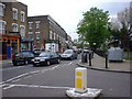
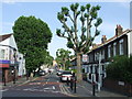
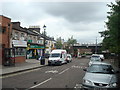
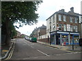
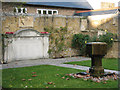
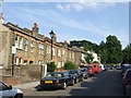
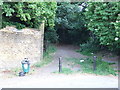
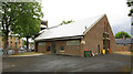
100 photos from this area
Area Information
Key information about the SE14 5UB including its size, population, and administrative classification.
- Area Type
- Postcode
- Area Size
- 8926 m²
- Population
- 1451
- Population Density
- 11452 people/km²
House Prices in SE14 5UB
100
Properties
£200,925
Average Sold Price
£44,995
Lowest Price
£535,000
Highest Price
Showing 100 properties
| Address | Type | Beds | Baths | Last Sale Price | Last Sale Date | |
|---|---|---|---|---|---|---|
| 26 Beacon Gate, London, SE14 5UB | Flat | 2 | 1 | £420,000 | May 2025 | |
| 14 Beacon Gate, London, SE14 5UB | Flat | 2 | 1 | £400,000 | Dec 2024 | |
| 52 Beacon Gate, London, SE14 5UB | house | 2 | - | £535,000 | Feb 2024 | |
| 49 Beacon Gate, London, SE14 5UB | Semi-detached | 2 | 1 | £490,000 | Nov 2021 | |
| 24 Beacon Gate, London, SE14 5UB | Flat | - | - | £280,000 | Sep 2021 | |
| 29, Beacon Gate, Kitto Road, London, SE14 5UB | Flat | 2 | 1 | £335,000 | Mar 2021 | |
| 53 Beacon Gate, London, SE14 5UB | Terraced | 2 | 1 | £515,000 | Nov 2020 | |
| 16 Beacon Gate, London, SE14 5UB | Flat | 1 | 1 | £270,000 | Aug 2019 | |
| 31 Beacon Gate, London, SE14 5UB | Flat | - | - | £287,500 | Dec 2018 | |
| 21 Beacon Gate, London, SE14 5UB | Flat | 1 | 1 | £270,000 | Sep 2018 |
Page 1 of 10
Energy Efficiency in SE14 5UB
Amenities
Schools
| Rank | School | Type | Entry gender | Ages |
|---|
Explore more schools in this area
Go to Schools tabDemographics
Household Size
Two person
most common
Accommodation Type
Flats
most common
Tenure
48
majority
Ethnic Group
White
most common
Religion
N/A
most common
Household Composition
N/A
most common
Age
47
median
Adults (30-64 years)
most common
Household Deprivation
N/A
with no deprivation
NS-SEC
47
in Lower managerial occupations
Explore more demographic insights in this area
Go to Demographics tabPlanning
Planning Constraints
- Flood RiskPremium
- Ramsar Wetland SitesPremium
- Area of Outstanding Natural BeautyPremium
- Protected Nature ReservePremium
- Protected WoodlandPremium