Area Overview for SE14 5SJ
Photos of SE14 5SJ
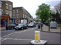
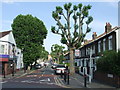
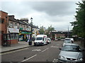
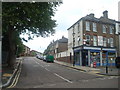
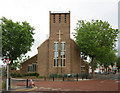

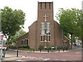
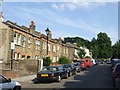
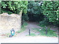
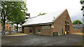
100 photos from this area
Area Information
Key information about the SE14 5SJ including its size, population, and administrative classification.
- Area Type
- Postcode
- Area Size
- 1.6 hectares
- Population
- 1451
- Population Density
- 11452 people/km²
House Prices in SE14 5SJ
41
Properties
£626,610
Average Sold Price
£97,000
Lowest Price
£1,661,000
Highest Price
Showing 41 properties
| Address | Type | Beds | Baths | Last Sale Price | Last Sale Date | |
|---|---|---|---|---|---|---|
| 88 Drakefell Road, London, SE14 5SJ | Semi-detached | 4 | 2 | £1,661,000 | Sep 2023 | |
| 60 Drakefell Road, London, SE14 5SJ | Semi-detached | 4 | 2 | £1,085,000 | Aug 2023 | |
| 42 Drakefell Road, London, SE14 5SJ | house | - | - | £890,000 | Oct 2021 | |
| 52 Drakefell Road, London, SE14 5SJ | house | - | - | £835,818 | Sep 2021 | |
| 48 Drakefell Road, London, SE14 5SJ | Semi-detached | 3 | 1 | £890,000 | Aug 2018 | |
| 44 Drakefell Road, London, SE14 5SJ | Semi-detached | 3 | 2 | £795,000 | Aug 2014 | |
| 62B Drakefell Road, London, SE14 5SJ | Flat | - | - | £265,000 | Oct 2013 | |
| 64 Drakefell Road, London, SE14 5SJ | Semi-detached | 3 | - | £505,000 | Jul 2012 | |
| 84 Drakefell Road, London, SE14 5SJ | house | 4 | - | £499,999 | Jul 2011 | |
| 72 Drakefell Road, London, SE14 5SJ | house | - | - | £429,950 | Apr 2011 |
Page 1 of 5
Energy Efficiency in SE14 5SJ
Amenities
Schools
| Rank | School | Type | Entry gender | Ages |
|---|
Explore more schools in this area
Go to Schools tabDemographics
Household Size
Two person
most common
Accommodation Type
Flats
most common
Tenure
48
majority
Ethnic Group
White
most common
Religion
N/A
most common
Household Composition
N/A
most common
Age
47
median
Adults (30-64 years)
most common
Household Deprivation
N/A
with no deprivation
NS-SEC
47
in Lower managerial occupations
Explore more demographic insights in this area
Go to Demographics tabPlanning
Planning Constraints
- Flood RiskPremium
- Ramsar Wetland SitesPremium
- Area of Outstanding Natural BeautyPremium
- Protected Nature ReservePremium
- Protected WoodlandPremium