Area Overview for SE26 6HH
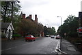
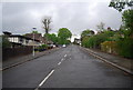
Photos of SE26 6HH


Area Information
Living in SE26 6HH means residing within a specific residential cluster in the London Borough of Bromley. This postcode covers an area of 9,954 square metres and is home to a population of 1,883 people. You are situated in a zone where density reaches 189,177 people per square kilometre, reflecting a compact urban environment. The location sits approximately 5.6 kilometres west of Bromley town centre and roughly 6.0 kilometres north east of Bromley. Historically, Penge was once a small hamlet attached to the manor of Battersea before becoming an independent urban district in 1900. The area merged into the London Borough of Bromley during local government reorganisation in 1965. Your daily life is shaped by proximity to historic landmarks and established transport routes. You live near the famous Crooked Billet, the oldest public house in Penge dating back at least to 1601. Victorian expansion in the 19th century transformed the region into a fashionable suburb near the Crystal Palace. The London and Croydon Railway opened here in 1839, following the former canal route. Several Victorian almshouses still stand on Beckenham Road and St John's Road, marking the estate's historical roots. You are part of a community that retains links to the Cator family, who held lands in the area from the 1750s. Thomas Crapper, the inventor of the U-bend toilet, notably retired to 12 Thornsett Road within this ward. The area currently functions as a settled residential suburb with deep historical ties to the Cator estates.
- Area Type
- Postcode
- Area Size
- 9954 m²
- Population
- 1883
- Population Density
- 4020 people/km²
The property market in SE26 6HH is characterised by a mix of ownership patterns and housing stock types. Half of the homeowners in the area, or 48 per cent, hold title to their properties. This figure places the postcode slightly below the national average for home ownership in some London boroughs, suggesting a healthy presence of long-term tenants as well. Flats constitute the primary form of accommodation, which is typical for this high-density cluster of 9,954 square metres. You are unlikely to find large detached houses within the immediate boundaries of SE26 6HH, as the land area supports a concentrated residential environment. When searching for homes in SE26 6HH, you will mostly encounter flats within Puglett Estate blocks or similar Victorian conversions. The compact nature of the area means property values are influenced heavily by the specific building's quality and condition rather than large garden plots. Buyers looking at this small area should expect a market driven by demand for convenient urban living. The high population density means space is at a premium. Those considering purchasing should anticipate competition for well-maintained flats with good access to local services. The mix of owner-occupied and rental stock often indicates a diverse pool of potential buyers. Values here reflect the balance between limited space and excellent transport links to Bromley and central London.
House Prices in SE26 6HH
Showing 15 properties
| Address | Type | Beds | Baths | Last Sale Price | Last Sale Date | |
|---|---|---|---|---|---|---|
| 21 Lawrie Park Crescent, Sydenham, London, SE26 6HH | Retail | 45 | 2 | £1,428,000 | Sep 2022 | |
| 9 Lawrie Park Crescent, Sydenham, London, SE26 6HH | house | 4 | 2 | £950,000 | Nov 2020 | |
| 7 Lawrie Park Crescent, Sydenham, London, SE26 6HH | house | 4 | 2 | £970,000 | Oct 2020 | |
| 3 Lawrie Park Crescent, Sydenham, London, SE26 6HH | house | - | - | £942,500 | Sep 2020 | |
| 7A Lawrie Park Crescent, Sydenham, London, SE26 6HH | house | - | - | £1,025,000 | Sep 2020 | |
| 11 Lawrie Park Crescent, Sydenham, London, SE26 6HH | house | - | - | £950,000 | Apr 2020 | |
| 11A Lawrie Park Crescent, Sydenham, London, SE26 6HH | house | - | - | £1,040,000 | Nov 2019 | |
| 9A Lawrie Park Crescent, Sydenham, London, SE26 6HH | house | - | - | £925,000 | Sep 2019 | |
| 13 Lawrie Park Crescent, Sydenham, London, SE26 6HH | house | 4 | 2 | £1,250,000 | Jan 2019 | |
| 5 Lawrie Park Crescent, Sydenham, London, SE26 6HH | Semi-detached | 4 | 3 | £1,095,000 | Oct 2018 |
Energy Efficiency in SE26 6HH
Your lifestyle in SE26 6HH benefits from immediate access to major shopping and leisure amenities. Five retail outlets are within easy reach, featuring major supermarkets such as Sainsburys Lewisham and Tesco Sydenham. You can stock up on groceries at either of these Tesco branches or the Sainsburys location nearby. Transport connections allow you to reach London Victoria Coach Station quickly for national travel or regional shopping trips. Near the post area, you find significant leisure opportunities at Greenwich Pier and Masthouse Terrace Pier. Cultural and historical sites are also close by. You can visit the historic Crooked Billet pub, a landmark dating back to at least 1601. The area retains Victorian charm through alleghories such as the Free Watermen and Lightermen's Almshouses and Queen Adelaide Almshouses. Penge High Street, formerly Penge New Road, offers a backdrop of Victorian-era development. If you enjoy outdoor activities, Penge Common provides space for walking, near the site of the original London and Croydon Railway. The area balances modern convenience with historical significance. You will find everything from daily essentials to day trips is a short journey away. The blend of retail giants and historic landmarks creates a practical yet character-rich environment for living.
Amenities
Schools
| Rank | School | Type | Entry gender | Ages |
|---|
Explore more schools in this area
Go to Schools tabDemographics
The community in SE26 6HH is defined by a mature demographic profile. The median age for residents is 47 years, with the most common age range being adults between 30 and 64 years. This concentration of middle-aged and senior householders suggests a neighbourhood where families have settled for the long term. Forty-eight per cent of residents own their homes outright or with a mortgage, indicating a balanced mix of owner-occupiers and renters. The remaining residents likely hold private tenancies or shared ownership agreements. The area is predominantly white in terms of ethnic composition, reflecting the traditional character of inner London suburbs. You will find that flats are the predominant accommodation type in this postcode. This high proportion of flats aligns with the high population density of 189,177 people per square kilometre. Many residents live in purpose-built blocks or converted Victorian terraces that now serve as flat units. The age distribution means you should expect to encounter neighbours who have lived in the borough for decades. Older couples and downsizing families form a significant portion of the household make-up. Single-person households may also be well represented among the adult population. The stable ownership figure of 48 per cent implies a quiet, established environment where permanent residents value stability over rapid turnover.
Household Size
Accommodation Type
Tenure
Ethnic Group
Religion
Household Composition
Age
Household Deprivation
NS-SEC
Explore more demographic insights in this area
Go to Demographics tabPlanning
Planning Constraints
- Flood RiskPremium
- Ramsar Wetland SitesPremium
- Area of Outstanding Natural BeautyPremium
- Protected Nature ReservePremium
- Protected WoodlandPremium