Area Overview for SE26 6HA
Photos of SE26 6HA


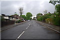
100 photos from this area
Area Information
Key information about the SE26 6HA including its size, population, and administrative classification.
- Area Type
- Postcode
- Area Size
- 1.8 hectares
- Population
- 1773
- Population Density
- 9278 people/km²
House Prices in SE26 6HA
34
Properties
£397,854
Average Sold Price
£91,000
Lowest Price
£1,100,000
Highest Price
Showing 34 properties
| Address | Type | Beds | Baths | Last Sale Price | Last Sale Date | |
|---|---|---|---|---|---|---|
| 5C Lawrie Park Avenue, London, SE26 6HA | Maisonette | 3 | 1 | £435,000 | Oct 2025 | |
| 1A Lawrie Park Avenue, London, SE26 6HA | Detached | 3 | 1 | £410,000 | Jan 2023 | |
| 53G Lawrie Park Avenue, London, SE26 6HA | Flat | 2 | 1 | £390,000 | Nov 2022 | |
| 1B Lawrie Park Avenue, London, SE26 6HA | Maisonette | 3 | 1 | £438,000 | Oct 2022 | |
| 53B Lawrie Park Avenue, London, SE26 6HA | Flat | - | - | £370,000 | Feb 2021 | |
| 13 Lawrie Park Avenue, London, SE26 6HA | house | - | - | £1,100,000 | Oct 2017 | |
| 47 Lawrie Park Avenue, London, SE26 6HA | house | - | - | £655,000 | Aug 2017 | |
| 53C Lawrie Park Avenue, London, SE26 6HA | Flat | - | - | £244,000 | Jan 2015 | |
| 25 Lawrie Park Avenue, London, SE26 6HA | house | 3 | - | £557,500 | Jan 2014 | |
| 15 Lawrie Park Avenue, London, SE26 6HA | house | 6 | 2 | £850,000 | Jul 2013 |
Page 1 of 4
Energy Efficiency in SE26 6HA
Amenities
Schools
| Rank | School | Type | Entry gender | Ages |
|---|
Explore more schools in this area
Go to Schools tabDemographics
Household Size
One person
most common
Accommodation Type
Flats
most common
Tenure
46
majority
Ethnic Group
White
most common
Religion
N/A
most common
Household Composition
N/A
most common
Age
47
median
Adults (30-64 years)
most common
Household Deprivation
N/A
with no deprivation
NS-SEC
45
in Lower managerial occupations
Explore more demographic insights in this area
Go to Demographics tabPlanning
Planning Constraints
- Flood RiskPremium
- Ramsar Wetland SitesPremium
- Area of Outstanding Natural BeautyPremium
- Protected Nature ReservePremium
- Protected WoodlandPremium