Area Overview for SE26 6UJ
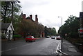
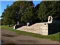
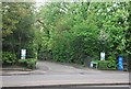
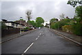
Photos of SE26 6UJ


Area Information
Living in SE26 6UJ means residing within a specific residential cluster in the London Borough of Bromley. This postcode covers just 2316 square metres and is home to a population of 1883 people. The area sits approximately 5.6 kilometres west of Bromley and 6.0 kilometres north east of Bromley town centre. Its distinct character stems from its history as part of Penge, which once served as a small hamlet attached to Battersea before becoming independent in 1888. The local landscape reflects this heritage, featuring the Crooked Billet, the oldest public house in Penge dating back to at least 1601. Electronic history is equally significant, as Thomas Crapper, the inventor of the U-bend toilet, retired to 12 Thornsett Road in the suburb he served. Former Victorian tram services connected the locality to the Crystal Palace, leaving a legacy of connectivity. Understanding this mix of historic estates and modern utilities provides essential context for any prospective homebuyer evaluating daily life in this compact yet well-established corner of South East London.
- Area Type
- Postcode
- Area Size
- 2316 m²
- Population
- 1883
- Population Density
- 4020 people/km²
The property market in SE26 6UJ is defined by a high concentration of flats, which constitute the primary accommodation type for the 1883 residents. Just under half of the local population owns their homes, with a specific home ownership rate of 48 per cent. This means you will find roughly equal numbers of owner-occupied properties and rental units within this 2316 square metre cluster. Potential buyers should note that freehold houses are scarce compared to the flat stock, as the local landlord base or investment trusts likely manage much of the housing supply. This market structure often appeals to professionals or downsizers seeking convenience without the commitment of a detached dwelling. The mix suggests a competitive environment where rental yields might be attractive to investors, yet the 48 ownership figure ensures ample stock for genuine buyers. You are looking at a mature market where leasehold properties dominate the residential landscape rather than traditional suburban plots.
House Prices in SE26 6UJ
Showing 12 properties
Energy Efficiency in SE26 6UJ
Residents of SE26 6UJ enjoy immediate access to a wide range of amenities within practical reach. Supermarkets include Sainsburys Lewisham, Tesco Sydenham, and another Tesco Sydenham location, ensuring daily grocery needs are met without long travel times. Transport links are extensive, with five nearby rail stations including Penge West Station and Sydenham Station facilitating quick trips across the capital. Five metro stops, such as Beckenham Road Tram Stop, offer alternative routes for those preferring lighter transit. Ferries operate near Masthouse Terrace Pier and Greenwich Pier, while three major coach stations including Victoria Coach Station are accessible. This density of options means you do not need a car for regular errands or commuting. The proximity to these specific venues - from the historic Crooked Billet to major retail hubs - creates a convenient lifestyle where daily necessities and leisure activities are always within reach.
Amenities
Schools
| Rank | School | Type | Entry gender | Ages |
|---|
Explore more schools in this area
Go to Schools tabDemographics
The community in SE26 6UJ reflects a settled, mature population with a median age of 47 years. Most residents fall into the 30 to 64 years age bracket, indicating a neighbourhood dominated by adults rather than families with young children or empty nesters. Home ownership stands at 48 per cent, a figure suggesting an equitable mix of owners and renters within the estate. This level of ownership balances with the area's primary accommodation type, which consists of flats. A significant portion of the 1883 residents identify as White, making it the predominant ethnic group in the ward. The demographic profile signals a stable living environment where long-term residents likely dominate the local shops and transport hubs. You can expect a quieter atmosphere driven by this age demographic, with fewer transient critics or youthful movement compared to areas with younger medians. The data confirms this is a place for establishment rather than rapid demographic turnover.
Household Size
Accommodation Type
Tenure
Ethnic Group
Religion
Household Composition
Age
Household Deprivation
NS-SEC
Explore more demographic insights in this area
Go to Demographics tabPlanning
Planning Constraints
- Flood RiskPremium
- Ramsar Wetland SitesPremium
- Area of Outstanding Natural BeautyPremium
- Protected Nature ReservePremium
- Protected WoodlandPremium