Area Overview for SE18 1NB
Photos of SE18 1NB
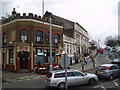
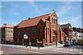
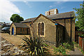
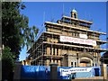
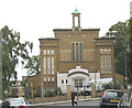


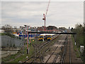
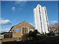
95 photos from this area
Area Information
Key information about the SE18 1NB including its size, population, and administrative classification.
- Area Type
- Postcode
- Area Size
- 2670 m²
- Population
- 2038
- Population Density
- 16927 people/km²
House Prices in SE18 1NB
41
Properties
£176,591
Average Sold Price
£20,000
Lowest Price
£390,000
Highest Price
Showing 41 properties
| Address | Type | Beds | Baths | Last Sale Price | Last Sale Date | |
|---|---|---|---|---|---|---|
| 45A Brewery Road, Plumstead, SE18 1NB | Maisonette | 1 | 1 | £262,500 | Sep 2024 | |
| 63 Brewery Road, Plumstead, SE18 1NB | house | 3 | 3 | £390,000 | Mar 2017 | |
| 53 Brewery Road, Plumstead, SE18 1NB | Terraced | 3 | - | £269,000 | May 2014 | |
| 59 Brewery Road, Plumstead, SE18 1NB | house | 3 | - | £220,000 | Jan 2012 | |
| Bridge 86 Ltd, 43 Brewery Road, Plumstead, SE18 1NB | house | 6 | - | £180,000 | Aug 2006 | |
| 41 Brewery Road, Plumstead, SE18 1NB | house | 4 | 1 | £180,000 | May 2006 | |
| 39 Brewery Road, Plumstead, SE18 1NB | house | 1 | 3 | £206,000 | Jul 2004 | |
| 45 Brewery Road, Plumstead, SE18 1NB | Terraced | - | - | £70,000 | Feb 2001 | |
| 61 Brewery Road, Plumstead, SE18 1NB | Terraced | - | - | £105,000 | Jun 2000 | |
| 47 Brewery Road, Plumstead, SE18 1NB | Maisonette | 2 | 1 | £20,000 | Jan 1997 |
Page 1 of 5
Energy Efficiency in SE18 1NB
Amenities
Schools
| Rank | School | Type | Entry gender | Ages |
|---|
Explore more schools in this area
Go to Schools tabDemographics
Household Size
Family (3-5 people)
most common
Accommodation Type
Houses
most common
Tenure
38
majority
Ethnic Group
asian_total
most common
Religion
N/A
most common
Household Composition
N/A
most common
Age
47
median
Adults (30-64 years)
most common
Household Deprivation
N/A
with no deprivation
NS-SEC
21
in Lower managerial occupations
Explore more demographic insights in this area
Go to Demographics tabPlanning
Planning Constraints
- Flood RiskPremium
- Ramsar Wetland SitesPremium
- Area of Outstanding Natural BeautyPremium
- Protected Nature ReservePremium
- Protected WoodlandPremium