Area Overview for SE18 7PZ
Photos of SE18 7PZ
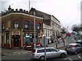
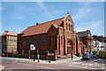
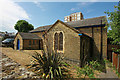
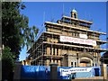
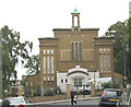


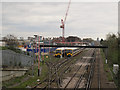
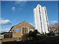
95 photos from this area
Area Information
Key information about the SE18 7PZ including its size, population, and administrative classification.
- Area Type
- Postcode
- Area Size
- 6280 m²
- Population
- 1684
- Population Density
- 13483 people/km²
House Prices in SE18 7PZ
45
Properties
£276,750
Average Sold Price
£92,000
Lowest Price
£588,000
Highest Price
Showing 45 properties
| Address | Type | Beds | Baths | Last Sale Price | Last Sale Date | |
|---|---|---|---|---|---|---|
| 175 Griffin Road, Plumstead, SE18 7PZ | Terraced | 3 | 2 | £530,000 | Mar 2024 | |
| 167 Griffin Road, Plumstead, SE18 7PZ | Terraced | 3 | 1 | £296,000 | Mar 2023 | |
| 181 Griffin Road, Plumstead, SE18 7PZ | house | 3 | 1 | £510,000 | Aug 2022 | |
| 179 Griffin Road, Plumstead, SE18 7PZ | house | - | - | £588,000 | May 2021 | |
| 169 Griffin Road, Plumstead, SE18 7PZ | Flat | 2 | 1 | £210,000 | Jun 2015 | |
| 163 Griffin Road, Plumstead, SE18 7PZ | house | - | - | £122,500 | Aug 2009 | |
| 185 Griffin Road, Plumstead, SE18 7PZ | house | - | - | £119,000 | Aug 2009 | |
| 143 Griffin Road, Plumstead, SE18 7PZ | Flat | - | - | £150,000 | Mar 2009 | |
| 165 Griffin Road, Plumstead, SE18 7PZ | house | - | - | £150,000 | Mar 2009 | |
| 139 Griffin Road, Plumstead, SE18 7PZ | house | - | - | £92,000 | Nov 2004 |
Page 1 of 5
Energy Efficiency in SE18 7PZ
Amenities
Schools
| Rank | School | Type | Entry gender | Ages |
|---|
Explore more schools in this area
Go to Schools tabDemographics
Household Size
Family (3-5 people)
most common
Accommodation Type
Houses
most common
Tenure
41
majority
Ethnic Group
White
most common
Religion
N/A
most common
Household Composition
N/A
most common
Age
47
median
Adults (30-64 years)
most common
Household Deprivation
N/A
with no deprivation
NS-SEC
26
in Lower managerial occupations
Explore more demographic insights in this area
Go to Demographics tabPlanning
Planning Constraints
- Flood RiskPremium
- Ramsar Wetland SitesPremium
- Area of Outstanding Natural BeautyPremium
- Protected Nature ReservePremium
- Protected WoodlandPremium