Area Overview for SE18 1NG
Photos of SE18 1NG
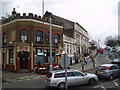
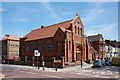
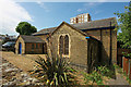
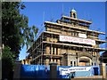


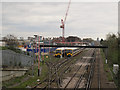
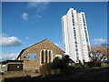
95 photos from this area
Area Information
Key information about the SE18 1NG including its size, population, and administrative classification.
- Area Type
- Postcode
- Area Size
- 7644 m²
- Population
- 1684
- Population Density
- 13483 people/km²
House Prices in SE18 1NG
76
Properties
£223,595
Average Sold Price
£51,000
Lowest Price
£515,000
Highest Price
Showing 76 properties
| Address | Type | Beds | Baths | Last Sale Price | Last Sale Date | |
|---|---|---|---|---|---|---|
| 82 Brewery Road, Plumstead, SE18 1NG | Terraced | 3 | 1 | £475,000 | Feb 2025 | |
| 114 Brewery Road, Plumstead, SE18 1NG | Terraced | 5 | 2 | £515,000 | Feb 2024 | |
| 96 Brewery Road, Plumstead, SE18 1NG | Terraced | 3 | 1 | £500,000 | Nov 2022 | |
| 78 Brewery Road, Plumstead, SE18 1NG | house | - | - | £410,000 | Nov 2020 | |
| 110 Brewery Road, Plumstead, SE18 1NG | Terraced | 3 | 1 | £386,000 | Nov 2015 | |
| 112 Brewery Road, Plumstead, SE18 1NG | house | - | - | £245,000 | Sep 2011 | |
| 134 Brewery Road, Plumstead, SE18 1NG | Semi-detached | 3 | 1 | £63,217 | Jul 2011 | |
| 124 Brewery Road, Plumstead, SE18 1NG | house | - | - | £195,000 | Feb 2009 | |
| 108 Brewery Road, Plumstead, SE18 1NG | Terraced | - | - | £190,000 | Feb 2006 | |
| 104 Brewery Road, Plumstead, SE18 1NG | Terraced | - | - | £204,000 | Aug 2003 |
Page 1 of 8
Energy Efficiency in SE18 1NG
Amenities
Schools
| Rank | School | Type | Entry gender | Ages |
|---|
Explore more schools in this area
Go to Schools tabDemographics
Household Size
Family (3-5 people)
most common
Accommodation Type
Houses
most common
Tenure
41
majority
Ethnic Group
White
most common
Religion
N/A
most common
Household Composition
N/A
most common
Age
47
median
Adults (30-64 years)
most common
Household Deprivation
N/A
with no deprivation
NS-SEC
26
in Lower managerial occupations
Explore more demographic insights in this area
Go to Demographics tabPlanning
Planning Constraints
- Flood RiskPremium
- Ramsar Wetland SitesPremium
- Area of Outstanding Natural BeautyPremium
- Protected Nature ReservePremium
- Protected WoodlandPremium