Area Overview for SE18 1LB
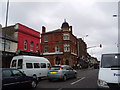
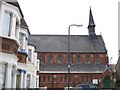
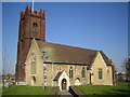
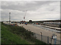
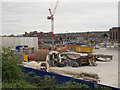
Photos of SE18 1LB
Area Information
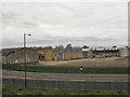
Living in SE18 1LB means residing in a specific residential cluster within Greater London with an area of just 1,734 square metres. This postcode accommodates 2,403 residents in a tightly defined space, creating a compact community atmosphere. The location sits within Plumstead, an area known for its diverse character and strong transport links across the borough. Daily life here involves a mix of close proximity to amenities and access to wider London networks. You will find yourself surrounded by a population where adults between 30 and 64 years old form the largest demographic group. While this is a small footprint compared to broader neighbourhoods, the concentration of homes suggests a high pace of urban living. The area does not sprawl, which often means neighbours are your neighbours, fostering a distinct local identity. Residents benefit from immediate access to rail stations and ferry crossings without needing extensive travel to reach these facilities. The low-rise nature of this postcode cluster contrasts with the larger industrial sites nearby, offering a quieter residential experience despite being adjacent toEmployment hubs. You are choosing a practical base in East London where space is at a premium but connectivity remains a priority for most households.
- Area Type
- Postcode
- Area Size
- 1734 m²
- Population
- 2403
- Population Density
- 13771 people/km²
The housing market in SE18 1LB is defined by a scarcity of owner-occupied homes and a prevalence of rental properties. With home ownership standing at only 24%, this postcode operates largely as a rental hub rather than a settlement for families buying their first home. This low ownership rate implies that if you are looking to purchase, your options will be extremely limited within these exact coordinates. Most residents living in flats here are likely tenants navigating the private rental market which dominates this specific cluster. The accommodation type is exclusively flats, which aligns with the population density figures for this small area. You cannot expect detached houses or semi-detached homes in this postcode; everything is urban-level living concentrated in high-rise or apartment blocks. This structure means that while you gain access to modern amenities and proximity to transport, you trade off the privacy and space associated with traditional houses. The 1,734 square metre size of the area further constrains land availability, reinforcing the nature of the building stock. Potential buyers viewing homes in this immediate vicinity should expect to be in a highly competitive rental market or face a severe shortage of purchase opportunities within the exact SE18 1LB boundary.
House Prices in SE18 1LB
Showing 61 properties
| Address | Type | Beds | Baths | Last Sale Price | Last Sale Date | |
|---|---|---|---|---|---|---|
| Strand Court, 33 Strandfield Close, Plumstead, SE18 1LB | Retirement | - | - | - | - | |
| Flat 4, Strand Court, 33 Strandfield Close, Plumstead, SE18 1LB | Retirement | - | - | - | - | |
| Flat 10, Strand Court, 33 Strandfield Close, Plumstead, SE18 1LB | Retirement | - | - | - | - | |
| Flat 9, Strand Court, 33 Strandfield Close, Plumstead, SE18 1LB | Retirement | - | - | - | - | |
| Flat 13, Strand Court, 33 Strandfield Close, Plumstead, SE18 1LB | Retirement | - | - | - | - | |
| Flat 22, Strand Court, 33 Strandfield Close, Plumstead, SE18 1LB | Retirement | - | - | - | - | |
| Flat 12, Strand Court, 33 Strandfield Close, Plumstead, SE18 1LB | Retirement | - | - | - | - | |
| Flat 23, Strand Court, 33 Strandfield Close, Plumstead, SE18 1LB | Retirement | - | - | - | - | |
| Flat 27, Strand Court, 33 Strandfield Close, Plumstead, SE18 1LB | Retirement | - | - | - | - | |
| Flat 54, Strand Court, 33 Strandfield Close, Plumstead, SE18 1LB | Retirement | - | - | - | - |
Energy Efficiency in SE18 1LB
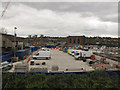
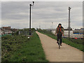
Daily life in SE18 1LB is supported by a dense array of amenities located within practical walking distance. Retail choices include Iceland Plumstead, Tesco Plumstead, and Co-op Links, ensuring you have access to groceries and daily essentials without needing a car. These five retail outlets cater to your weekly shopping needs and impulse purchases alike. For leisure, you have five rail stations and five ferry terminals nearby, turning your commute into part of the local experience at Plumstead Station or Woolwich Arsenal Pier. The presence of London City Airport also offers a convenient escape for those who travel frequently. You can enjoy the proximity to diverse dining options often found near these major transport hubs. While parks are not explicitly named in the immediate data, the urban setting of SE18 1LB integrates green spaces into its 1,734 square metres. The combination of five ferry options and five metro stations creates a lively waterfront atmosphere, particularly around Barrier Gardens Pier. Residents of SE18 1LB benefit from a lifestyle where public transport is the norm, reducing the need for private vehicle ownership. You spend your week navigating this interconnected network of shops and stations, finding a balance between the bustle of London and the convenience of local services like Co-op Links.
Amenities
Schools
Families living in SE18 1LB have access to two specific primary schools nearby, both catering to younger children. Bannockburn Primary School serves as a key educational provider for the area, offering education to residents in its neighbourhood. St Patrick's Catholic Primary School also stands nearby, holding a good rating from Ofsted, which indicates a standard of education deemed satisfactory by the government inspectorate. These institutions are the only ones listed for immediate attendance by children in this postcode. The school provision focuses entirely on primary education within the immediate vicinity of SE18 1LB. There are no secondary schools or special needs colleges listed in the immediate data for this specific cluster. This suggests that students may require further travel to reach junior or high schools as they progress beyond the primary stage. For parents assessing schools near SE18 1LB, the presence of two primary options with one rated good provides a solid foundation. However, the lack of other data means you cannot comment on the quality of secondary education directly from the local area statistics. You must consider the distance to these named schools when planning for young children's commute to Bannockburn Primary School or St Patrick's.
| Rank | School | Type | Entry gender | Ages |
|---|
Explore more schools in this area
Go to Schools tabDemographics
The community profile of SE18 1LB reflects a mature and established demographic landscape. The median age stands at 47 years, indicating that families with young children are less dominant than in suburban fringes, while empty nesters and professionals in their middle years form the core resident group. Over 99% of the population falls into the adult bracket spanning 30 to 64 years old, suggesting a stable, working-age population rather than a transient student crowd. This age distribution often correlates with well-maintained properties and long-term residents who have deep roots in Plumstead. Home ownership sits at a relatively low level of 24%, meaning the vast majority of the 2,403 people living here reside in rental accommodation. This statistic clearly points to a private rented sector dominating the local housing stock. Consequently, you are likely to encounter a high turnover of tenants rather than long-term owner-occupiers, which can impact the stability of the immediate street scene. The predominant ethnic group is Asian, adding a significant layer of cultural diversity to the neighbourhood character. Accommodation consists primarily of flats, fitting the high population density of 1,385,923 people per square kilometre across the postcode zone. This configuration supports a vibrant, shared-living environment typical of inner city London living.
Household Size
Accommodation Type
Tenure
Ethnic Group
Religion
Household Composition
Age
Household Deprivation
NS-SEC
Explore more demographic insights in this area
Go to Demographics tabPlanning
Planning Constraints
- Flood RiskPremium
- Ramsar Wetland SitesPremium
- Area of Outstanding Natural BeautyPremium
- Protected Nature ReservePremium
- Protected WoodlandPremium