Area Overview for SE18 1HE
Photos of SE18 1HE
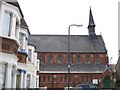
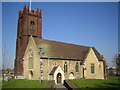
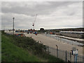
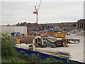
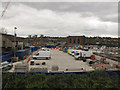
100 photos from this area
Area Information
Key information about the SE18 1HE including its size, population, and administrative classification.
- Area Type
- Postcode
- Area Size
- 8535 m²
- Population
- 2403
- Population Density
- 13771 people/km²
House Prices in SE18 1HE
74
Properties
£129,650
Average Sold Price
£28,500
Lowest Price
£390,000
Highest Price
Showing 74 properties
| Address | Type | Beds | Baths | Last Sale Price | Last Sale Date | |
|---|---|---|---|---|---|---|
| 177 Plumstead High Street, Plumstead, SE18 1HE | house | - | - | £390,000 | Jun 2015 | |
| 189 Plumstead High Street, Plumstead, SE18 1HE | house | - | - | £215,000 | Jul 2006 | |
| 179 Plumstead High Street, Plumstead, SE18 1HE | house | - | - | £175,000 | May 2003 | |
| 207 Plumstead High Street, Plumstead, SE18 1HE | Terraced | 4 | 1 | £156,000 | Aug 2002 | |
| 169 Plumstead High Street, Plumstead, SE18 1HE | Terraced | - | - | £60,000 | Nov 1999 | |
| 209 Plumstead High Street, Plumstead, SE18 1HE | Retail | 2 | 1 | £37,100 | Feb 1998 | |
| 205 Plumstead High Street, Plumstead, SE18 1HE | Terraced | 4 | 1 | £69,000 | Nov 1997 | |
| 217A Plumstead High Street, Plumstead, SE18 1HE | house | - | - | £36,250 | Jun 1996 | |
| 183 Plumstead High Street, Plumstead, SE18 1HE | Flat | - | - | £28,500 | Dec 1995 | |
| 167A Plumstead High Street, Plumstead, SE18 1HE | Maisonette | 1 | 1 | - | - |
Page 1 of 8
Energy Efficiency in SE18 1HE
Amenities
Schools
| Rank | School | Type | Entry gender | Ages |
|---|
Explore more schools in this area
Go to Schools tabDemographics
Household Size
One person
most common
Accommodation Type
Flats
most common
Tenure
24
majority
Ethnic Group
asian_total
most common
Religion
N/A
most common
Household Composition
N/A
most common
Age
47
median
Adults (30-64 years)
most common
Household Deprivation
N/A
with no deprivation
NS-SEC
15
in Lower managerial occupations
Explore more demographic insights in this area
Go to Demographics tabPlanning
Planning Constraints
- Flood RiskPremium
- Ramsar Wetland SitesPremium
- Area of Outstanding Natural BeautyPremium
- Protected Nature ReservePremium
- Protected WoodlandPremium