Area Overview for SE18 1ES
Photos of SE18 1ES
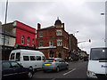
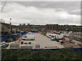
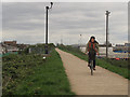
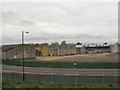
100 photos from this area
Area Information
Key information about the SE18 1ES including its size, population, and administrative classification.
- Area Type
- Postcode
- Area Size
- 5940 m²
- Population
- 2403
- Population Density
- 13771 people/km²
House Prices in SE18 1ES
24
Properties
£230,550
Average Sold Price
£75,000
Lowest Price
£397,000
Highest Price
Showing 24 properties
| Address | Type | Beds | Baths | Last Sale Price | Last Sale Date | |
|---|---|---|---|---|---|---|
| 40 Bannockburn Road, Plumstead, SE18 1ES | house | 3 | 1 | £395,000 | Apr 2023 | |
| 16 Bannockburn Road, Plumstead, SE18 1ES | Terraced | 3 | 1 | £397,000 | May 2022 | |
| 12 Bannockburn Road, Plumstead, SE18 1ES | house | - | - | £390,000 | Jan 2021 | |
| 14 Bannockburn Road, Plumstead, SE18 1ES | Terraced | - | - | £240,000 | Oct 2013 | |
| 34 Bannockburn Road, Plumstead, SE18 1ES | Terraced | 3 | 1 | £250,000 | Feb 2008 | |
| 36 Bannockburn Road, Plumstead, SE18 1ES | Flat | - | - | £120,000 | Oct 2007 | |
| 28 Bannockburn Road, Plumstead, SE18 1ES | Terraced | 3 | 1 | £174,995 | Mar 2007 | |
| 10 Bannockburn Road, Plumstead, SE18 1ES | Terraced | - | - | £165,000 | Dec 2002 | |
| 8 Bannockburn Road, Plumstead, SE18 1ES | Terraced | - | - | £98,500 | Nov 2000 | |
| 18 Bannockburn Road, Plumstead, SE18 1ES | house | 1 | 1 | £75,000 | Nov 1998 |
Page 1 of 3
Energy Efficiency in SE18 1ES
Amenities
Schools
| Rank | School | Type | Entry gender | Ages |
|---|
Explore more schools in this area
Go to Schools tabDemographics
Household Size
One person
most common
Accommodation Type
Flats
most common
Tenure
24
majority
Ethnic Group
asian_total
most common
Religion
N/A
most common
Household Composition
N/A
most common
Age
47
median
Adults (30-64 years)
most common
Household Deprivation
N/A
with no deprivation
NS-SEC
15
in Lower managerial occupations
Explore more demographic insights in this area
Go to Demographics tabPlanning
Planning Constraints
- Flood RiskPremium
- Ramsar Wetland SitesPremium
- Area of Outstanding Natural BeautyPremium
- Protected Nature ReservePremium
- Protected WoodlandPremium