Area Overview for SE15 2DS
Photos of SE15 2DS
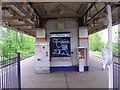
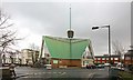
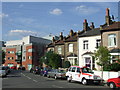
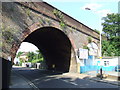
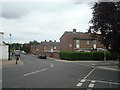
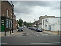
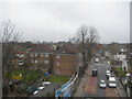
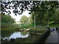
100 photos from this area
Area Information
Key information about the SE15 2DS including its size, population, and administrative classification.
- Area Type
- Postcode
- Area Size
- 8850 m²
- Population
- 1861
- Population Density
- 12292 people/km²
House Prices in SE15 2DS
59
Properties
£584,119
Average Sold Price
£94,500
Lowest Price
£1,211,500
Highest Price
Showing 59 properties
| Address | Type | Beds | Baths | Last Sale Price | Last Sale Date | |
|---|---|---|---|---|---|---|
| 8B Ansdell Road, London, SE15 2DS | house | 4 | 3 | £1,211,500 | Apr 2024 | |
| 64 Ansdell Road, London, SE15 2DS | Retail | 3 | 1 | £860,000 | Oct 2022 | |
| 68A Ansdell Road, London, SE15 2DS | Flat | 1 | 1 | £460,000 | Oct 2022 | |
| 82 Ansdell Road, London, SE15 2DS | Terraced | 2 | 1 | £560,000 | Jan 2022 | |
| 18 Ansdell Road, London, SE15 2DS | Terraced | 3 | 1 | £890,000 | Jun 2021 | |
| 2B Ansdell Road, London, SE15 2DS | house | 4 | - | £888,000 | May 2021 | |
| 8A Ansdell Road, London, SE15 2DS | house | 4 | 3 | £880,000 | Aug 2020 | |
| 22 Ansdell Road, London, SE15 2DS | house | - | - | £675,000 | Nov 2019 | |
| 2 Ansdell Road, London, SE15 2DS | Terraced | 5 | 3 | £1,175,000 | Jul 2017 | |
| 12 Ansdell Road, London, SE15 2DS | Terraced | 4 | 2 | £530,000 | Nov 2016 |
Page 1 of 6
Energy Efficiency in SE15 2DS
Amenities
Schools
| Rank | School | Type | Entry gender | Ages |
|---|
Explore more schools in this area
Go to Schools tabDemographics
Household Size
Family (3-5 people)
most common
Accommodation Type
Houses
most common
Tenure
44
majority
Ethnic Group
White
most common
Religion
N/A
most common
Household Composition
N/A
most common
Age
47
median
Adults (30-64 years)
most common
Household Deprivation
N/A
with no deprivation
NS-SEC
42
in Lower managerial occupations
Explore more demographic insights in this area
Go to Demographics tabPlanning
Planning Constraints
- Flood RiskPremium
- Ramsar Wetland SitesPremium
- Area of Outstanding Natural BeautyPremium
- Protected Nature ReservePremium
- Protected WoodlandPremium