Area Overview for SE15 2DY
Photos of SE15 2DY
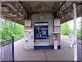
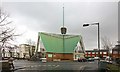
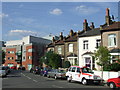
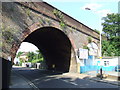
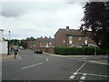
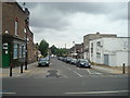
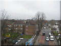
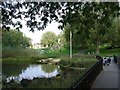
100 photos from this area
Area Information
Key information about the SE15 2DY including its size, population, and administrative classification.
- Area Type
- Postcode
- Area Size
- 9590 m²
- Population
- 1949
- Population Density
- 12003 people/km²
House Prices in SE15 2DY
54
Properties
£436,917
Average Sold Price
£70,000
Lowest Price
£950,000
Highest Price
Showing 54 properties
| Address | Type | Beds | Baths | Last Sale Price | Last Sale Date | |
|---|---|---|---|---|---|---|
| 48 Evelina Road, London, SE15 2DY | house | 3 | 1 | £675,600 | Aug 2025 | |
| 40B Evelina Road, London, SE15 2DY | Flat | - | - | £265,000 | Jan 2025 | |
| 53 Evelina Road, London, SE15 2DY | Terraced | 3 | 1 | £950,000 | Mar 2024 | |
| 42 Evelina Road, London, SE15 2DY | Terraced | 4 | 1 | £868,000 | Aug 2022 | |
| 38 Evelina Road, London, SE15 2DY | Detached | 3 | 2 | £680,000 | Jun 2021 | |
| 55 Evelina Road, London, SE15 2DY | house | - | - | £900,000 | Sep 2019 | |
| 70 Evelina Road, London, SE15 2DY | Flat | 2 | 1 | £270,000 | Dec 2014 | |
| 50 Evelina Road, London, SE15 2DY | Terraced | 1 | 1 | £249,900 | Aug 2005 | |
| 54 Evelina Road, London, SE15 2DY | Terraced | 4 | 2 | £125,000 | Jul 2000 | |
| 65 Evelina Road, London, SE15 2DY | house | 3 | 1 | £109,000 | Jan 2000 |
Page 1 of 6
Energy Efficiency in SE15 2DY
Amenities
Schools
| Rank | School | Type | Entry gender | Ages |
|---|
Explore more schools in this area
Go to Schools tabDemographics
Household Size
One person
most common
Accommodation Type
Flats
most common
Tenure
37
majority
Ethnic Group
White
most common
Religion
N/A
most common
Household Composition
N/A
most common
Age
47
median
Adults (30-64 years)
most common
Household Deprivation
N/A
with no deprivation
NS-SEC
41
in Lower managerial occupations
Explore more demographic insights in this area
Go to Demographics tabPlanning
Planning Constraints
- Flood RiskPremium
- Ramsar Wetland SitesPremium
- Area of Outstanding Natural BeautyPremium
- Protected Nature ReservePremium
- Protected WoodlandPremium