Area Overview for SE12 8AJ
Photos of SE12 8AJ
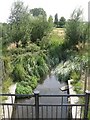
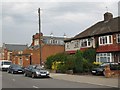
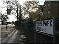
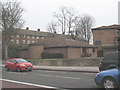
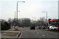
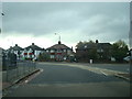

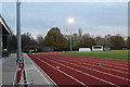
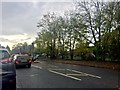
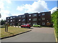
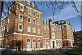
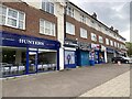
89 photos from this area
Area Information
Key information about the SE12 8AJ including its size, population, and administrative classification.
- Area Type
- Postcode
- Area Size
- 3.1 hectares
- Population
- 1736
- Population Density
- 9127 people/km²
House Prices in SE12 8AJ
74
Properties
£731,400
Average Sold Price
£285,000
Lowest Price
£1,400,000
Highest Price
Showing 74 properties
| Address | Type | Beds | Baths | Last Sale Price | Last Sale Date | |
|---|---|---|---|---|---|---|
| 12 Cambridge Drive, London, SE12 8AJ | Semi-detached | 6 | 2 | £1,178,500 | Sep 2025 | |
| 64 Cambridge Drive, London, SE12 8AJ | house | 3 | 3 | £900,000 | Mar 2024 | |
| 72 Cambridge Drive, London, SE12 8AJ | Bungalow | 2 | 1 | £500,000 | Oct 2022 | |
| 52 Cambridge Drive, London, SE12 8AJ | house | - | - | £885,000 | Feb 2021 | |
| 8 Cambridge Drive, London, SE12 8AJ | house | - | - | £1,400,000 | Dec 2020 | |
| 14 Cambridge Drive, London, SE12 8AJ | house | - | - | £950,000 | Apr 2019 | |
| 2A Cambridge Drive, London, SE12 8AJ | Flat | - | - | £525,000 | Oct 2017 | |
| 48 Cambridge Drive, London, SE12 8AJ | house | - | - | £830,000 | May 2017 | |
| 56 Cambridge Drive, London, SE12 8AJ | house | - | - | £795,000 | Nov 2015 | |
| 66 Cambridge Drive, London, SE12 8AJ | house | - | - | £715,000 | Apr 2015 |
Page 1 of 8
Energy Efficiency in SE12 8AJ
Amenities
Schools
| Rank | School | Type | Entry gender | Ages |
|---|
Explore more schools in this area
Go to Schools tabDemographics
Household Size
One person
most common
Accommodation Type
Flats
most common
Tenure
28
majority
Ethnic Group
White
most common
Religion
N/A
most common
Household Composition
N/A
most common
Age
47
median
Adults (30-64 years)
most common
Household Deprivation
N/A
with no deprivation
NS-SEC
32
in Lower managerial occupations
Explore more demographic insights in this area
Go to Demographics tabPlanning
Planning Constraints
- Flood RiskPremium
- Ramsar Wetland SitesPremium
- Area of Outstanding Natural BeautyPremium
- Protected Nature ReservePremium
- Protected WoodlandPremium