Area Overview for SE12 8UE
Photos of SE12 8UE


Area Information
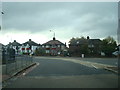
Living in SE12 8UE offers a distinct experience within a very compact residential cluster. This specific postcode covers just 2.4 hectares, creating an intensely dense environment where space is premium. You will find 1654 residents living in this small footprint, resulting in a population density of 68399 people per square kilometre. Such high density is typical of urban London clusters, meaning your street lounge or local park is rarely far away. The area functions as a tight-knit residential pocket rather than a sprawling neighbourhood. Daily life here is defined by proximity. You wake up, get to work, and return to your doorstep with minimal travel time because the physical boundaries are so defined. This concentration of population means noise and activity are immediate considerations. However, the small scale also allows for efficient access to essential services without long commutes across the postcode district. The community feels immediate and accessible. When you walk down the street, you are likely only steps from greenery or a shop in adjacent streets. This postcode acts as a functional node within the broader Lee Valley and Greenwich area. It is a place where urban convenience meets a concentrated living environment, suitable for those who value short distances over low density. You are part of a defined group of neighbours in a setting where everyone is within cycling distance of their daily needs.
- Area Type
- Postcode
- Area Size
- 2.4 hectares
- Population
- 1654
- Population Density
- 3806 people/km²
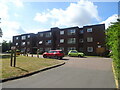
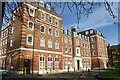
The property market in SE12 8UE is characterised by its accommodation type and ownership structure. Fifty-six per cent of homes are owner-occupied, indicating that the area is primarily an estate rather than a rental enclave. This statistic means many residents have invested in their properties and seek to maintain their homes' value. As this specific postcode covers only 2.4 hectares, the housing stock is limited and defined. Flats form the predominant form of accommodation alongside traditional houses. This mix appears in a small geographical area, ensuring that you can find varied property types within a very short radius. You do not need to travel far to see both period homes and modern apartments. The high population density of 68399 people per square kilometre drives demand for space, influencing property values and pricing. Buyers seeking flats should look specifically within this cluster, while families might find semi-detached or terraced properties in the immediate vicinity. The 56% ownership figure suggests a market where sellers know their home's worth from experience. This stability benefits the local market. The small area size restricts inventory, meaning available homes in SE12 8UE may move quickly. Prospective buyers must act decisively if they wish to purchase. The combination of flats and a high ownership rate creates a environment where both investors and owner-occupiers coexist. This dynamic keeps the market active.
House Prices in SE12 8UE
Showing 72 properties
| Address | Type | Beds | Baths | Last Sale Price | Last Sale Date | |
|---|---|---|---|---|---|---|
| 60 Eltham Road, Eltham, SE12 8UE | Terraced | 2 | 1 | £400,000 | Mar 2024 | |
| 56 Eltham Road, Eltham, SE12 8UE | house | 4 | 1 | £575,000 | Oct 2022 | |
| 72 Eltham Road, Eltham, SE12 8UE | house | - | - | £310,000 | Feb 2020 | |
| 70 Eltham Road, Eltham, SE12 8UE | Terraced | 2 | 1 | £224,000 | Nov 2013 | |
| 58 Eltham Road, Eltham, SE12 8UE | Terraced | 2 | - | £213,500 | Sep 2011 | |
| 68 Eltham Road, Eltham, SE12 8UE | house | 2 | - | £201,000 | Sep 2010 | |
| 74 Eltham Road, Eltham, SE12 8UE | house | 3 | 1 | £215,000 | May 2010 | |
| 84C Eltham Road, Eltham, SE12 8UE | Flat | 2 | 1 | £180,000 | May 2006 | |
| 64 Eltham Road, Eltham, SE12 8UE | Terraced | - | - | £160,000 | Sep 2003 | |
| 66 Eltham Road, Eltham, SE12 8UE | Terraced | - | - | £127,500 | May 2001 |
Energy Efficiency in SE12 8UE
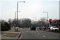
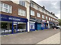
Your lifestyle in SE12 8UE is supported by a wide array of transport links and retail venues within practical reach. You have five rail stations nearby, including Lee, Kidbrooke, and Hither Green, offering swift connections across London. Similarly, five metro stations serve the area, featuring stops such as Elverson Road, Deptford Bridge, and Cutty Sark for Maritime Greenwich. These transport nodes allow you to miss the train station crowd and choose the line that suits your schedule. Beyond trains, five ferry ports provide unique river travel to Greenwich Pier, Masthouse Terrace Pier, and Royal Wharf Pier. You can take a boat trip for leisure or commute. London City Airport sits within easy reach of SE12 8UE, granting you direct flights to continental Europe. For your daily shopping, five retail locations are conveniently situated. Sainsburys Lee, Co-op Burnt, and Tesco Clifton offer everything from fresh groceries to household necessities. You can complete a weekly shop without travelling far. This density of options means you do not need a car for most errands. The combination of rail, metro, ferry, and airport creates a layered transport network. Your day might start with coffee, travel to work via train, and end with a ferry ride back. The variety ensures you can match your transport method to your mood and destination.
Amenities
Schools
Families living in SE12 8UE have access to specific educational institutions within practical reach. Riverston School operates as an independent school nearby, offering an alternative curriculum to the local state system. You should verify the specific Ofsted rating for Riverston School independently, as this data source does not provide grading details. This independent option appeals to parents seeking a boarding or selective education model. Additionally, Abbey Manor College serves the community as an educational establishment. Its classification as a college suggests it may offer further education or adult learning alongside secondary education. The presence of these two named schools indicates a choice for residents between independent and other state-provided education. For young children, the school cluster highlights the availability of post-primary options. The independence of Riverston School means it follows a tailored academic path, while Abbey Manor College serves a broader demographic potentially including older students. Living in SE12 8UE places your children near these educational hubs. You must check current registration numbers and inspection reports directly with each institution. This school mix ensures that parents can choose based on their educational philosophies. The proximity of these schools to the postcode means drop-off and collection occur within the Lee Valley area.
| Rank | School | Type | Entry gender | Ages |
|---|
Explore more schools in this area
Go to Schools tabDemographics
The community in SE12 8UE reflects a mature demographic profile. The median age is 47 years, indicating that the neighbourhood draws significantly on adults between 30 and 64 years old. Households here tend to be established rather than temporary. Fifty-six per cent of homes are owner-occupied, showing a strong tradition of home ownership in this specific postcode. The remaining properties are predominantly flats, which suggests a mix of terraced houses and apartment blocks catering to families and small households alike. White residents form the predominant ethnic group in this immediate vicinity. The age range of 30 to 64 years implies a stable population with likely established careers and families. This demographic composition supports local businesses that rely on regular patrons with discretionary income. Home ownership figures suggest residents value stability in their address. The lack of a specified deprivation index in the data means you cannot assess economic pressure directly, but the high home ownership rate often correlates with financial security. The population density of 68399 people per square kilometre creates a backdrop of daily interaction. You will encounter neighbours who have likely lived in the area for decades. This stability fosters a sense of continuity. The age profile means you will see children playing in shared external spaces and teenagers studying nearby. The community is not geared towards retirement holidays but towards long-term residency. This demographic reality shapes the local culture.
Household Size
Accommodation Type
Tenure
Ethnic Group
Religion
Household Composition
Age
Household Deprivation
NS-SEC
Explore more demographic insights in this area
Go to Demographics tabPlanning
Planning Constraints
- Flood RiskPremium
- Ramsar Wetland SitesPremium
- Area of Outstanding Natural BeautyPremium
- Protected Nature ReservePremium
- Protected WoodlandPremium