Area Overview for SE12 8AD
Photos of SE12 8AD

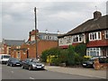
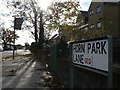

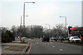
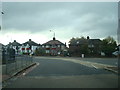


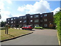
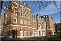
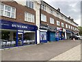
89 photos from this area
Area Information
Key information about the SE12 8AD including its size, population, and administrative classification.
- Area Type
- Postcode
- Area Size
- 5421 m²
- Population
- 1751
- Population Density
- 7952 people/km²
House Prices in SE12 8AD
12
Properties
£589,500
Average Sold Price
£112,000
Lowest Price
£1,448,500
Highest Price
Showing 12 properties
| Address | Type | Beds | Baths | Last Sale Price | Last Sale Date | |
|---|---|---|---|---|---|---|
| 22 Upwood Road, London, SE12 8AD | house | - | - | £1,448,500 | Nov 2023 | |
| 20 Upwood Road, London, SE12 8AD | Detached | 4 | 3 | £680,000 | Feb 2015 | |
| 18 Upwood Road, London, SE12 8AD | Detached | 4 | 2 | £718,000 | Feb 2014 | |
| 38 Upwood Road, London, SE12 8AD | house | - | - | £460,000 | Aug 2013 | |
| 34 Upwood Road, London, SE12 8AD | house | - | - | £353,000 | Aug 2009 | |
| 30 Upwood Road, London, SE12 8AD | Terraced | - | - | £355,000 | Sep 2001 | |
| 36 Upwood Road, London, SE12 8AD | Semi-detached | - | - | £112,000 | Jul 1995 | |
| 38A Upwood Road, London, SE12 8AD | Detached | 4 | 2 | - | - | |
| 32 Upwood Road, London, SE12 8AD | Terraced | - | - | - | - | |
| 24 Upwood Road, London, SE12 8AD | house | 3 | 2 | - | - |
Page 1 of 2
Energy Efficiency in SE12 8AD
Amenities
Schools
| Rank | School | Type | Entry gender | Ages |
|---|
Explore more schools in this area
Go to Schools tabDemographics
Household Size
Family (3-5 people)
most common
Accommodation Type
Flats
most common
Tenure
55
majority
Ethnic Group
White
most common
Religion
N/A
most common
Household Composition
N/A
most common
Age
47
median
Adults (30-64 years)
most common
Household Deprivation
N/A
with no deprivation
NS-SEC
46
in Lower managerial occupations
Explore more demographic insights in this area
Go to Demographics tabPlanning
Planning Constraints
- Flood RiskPremium
- Ramsar Wetland SitesPremium
- Area of Outstanding Natural BeautyPremium
- Protected Nature ReservePremium
- Protected WoodlandPremium