Area Overview for SE12 0UQ
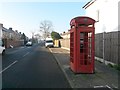
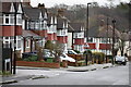
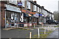
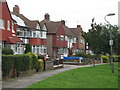
Photos of SE12 0UQ


Area Information
Living in SE12 0UQ offers a compact residential experience defined by its specific boundaries. This postcode covers a small residential cluster, measuring just over 8200 square metres. Within this confined space, 1625 people call the location home. The area functions as an intimate neighbourhood rather than a sprawling suburb, creating a close-knit environment where daily life unfolds. Residents enjoy a distinct sense of place within the broader London postcode system. The density here is significant, with approximately 198000 people per square kilometre. This high density contributes to a lively atmosphere despite the limited physical footprint. You will find yourself part of a tightly defined community where the immediate surroundings shape your daily routine. The area sits in England, integrating seamlessly with the local infrastructure surrounding it. Understanding the scale is essential for buying property here. The small footprint means noise and activity are shared closely among neighbours. You purchase not just a house, but a slice of this specific 8215 square metre lifestyle.
- Area Type
- Postcode
- Area Size
- 8215 m²
- Population
- 1625
- Population Density
- 5527 people/km²
The property market in SE12 0UQ is characterised by a distinct lack of buildings to let. You will find that 83% of accommodations in this postcode are owner-occupied. The remaining private homes in SE12 0UQ are Houses, which dominate the local stock. This 83% ownership rate suggests that sellers outnumber buyers, or at least that existing residents are less likely to move quickly. When you look at homes in SE12 0UQ, you are looking at a market where residents usually stay put until they sell. This contrasts with areas where many parents live in rented flats for a few years before moving on. The accommodation type is exclusively Houses, meaning large multi-storey blocks or high-density flats are not found within this specific cluster. You are buying a standalone structure, likely surrounded by other similar properties. The high ownership percentage often reflects long-term investment in the area. For a buyer, this environment feels secure and consistent. Prices in SE12 0UQ likely reflect the cost of acquiring a share of this stable housing stock.
House Prices in SE12 0UQ
Showing 31 properties
| Address | Type | Beds | Baths | Last Sale Price | Last Sale Date | |
|---|---|---|---|---|---|---|
| 6 Heather Road, London, SE12 0UQ | Terraced | 3 | 1 | £550,000 | May 2025 | |
| 56 Heather Road, London, SE12 0UQ | Detached | 4 | 3 | £450,000 | Mar 2025 | |
| 40 Heather Road, London, SE12 0UQ | Semi-detached | 4 | 2 | £775,000 | Jun 2024 | |
| 50 Heather Road, London, SE12 0UQ | Semi-detached | 3 | 1 | £495,000 | Feb 2021 | |
| 48 Heather Road, London, SE12 0UQ | Semi-detached | 3 | 1 | £375,000 | Oct 2019 | |
| 12 Heather Road, London, SE12 0UQ | Terraced | 2 | 1 | £472,350 | Sep 2019 | |
| 32 Heather Road, London, SE12 0UQ | Terraced | 3 | 1 | £460,000 | Aug 2018 | |
| 18 Heather Road, London, SE12 0UQ | Terraced | 2 | 1 | £460,000 | Aug 2018 | |
| 38 Heather Road, London, SE12 0UQ | Semi-detached | 4 | - | £675,000 | Feb 2018 | |
| 46A Heather Road, London, SE12 0UQ | Maisonette | - | - | £312,500 | Jul 2016 |
Energy Efficiency in SE12 0UQ
Your daily life in SE12 0UQ is supported by a selection of amenities within practical reach. For your weekly shop, Budgens Catford, Sainsburys Lewisham Grove, and Tesco Grove are all available nearby. These retailers provide the essentials you need without lengthy journeys. If you choose to travel by train, Grove Park Station, Lee, and Hither Green serve as key rail hubs close to the area. Metro commuters can utilise Elverson Road, Deptford Bridge, and Cutty Sark for Maritime Greenwich. Ferry enthusiasts have access to Greenwich Pier, Masthouse Terrace Pier, and Barrier Gardens Pier. A single London City Airport is located within reasonable distance for short trips. The presence of these facilities means you can meet most needs locally. You enjoy convenience when visiting supermarkets or catching public transport. The variety of modes of transport gives you flexibility in your daily commute. Living in SE12 0UQ grants you easy access to both retail and travel networks. These amenities form the backbone of your neighbourhood routine.
Amenities
Schools
| Rank | School | Type | Entry gender | Ages |
|---|
Explore more schools in this area
Go to Schools tabDemographics
The community in SE12 0UQ reflects a mature and established population profile. The median age stands at 47, indicating a significant presence of older residents. Most commonly, households consist of adults aged between 30 and 64 years. This age range suggests the area attracts families and established professionals rather than young singles or retirees. Home ownership is exceptionally high, with 83% of residents owning their properties outright. This statistic points to a stable, long-term community rather than a transient rental market. The predominant ethnic group is White, aligning with traditional demographics found in many parts of south-east London. The local housing stock consists primarily of Houses, rather than flats or blocks of flats. Every claim about the population mirrors the specific figures provided for this postcode. With over four in five residents owning homes, you buy into a settled neighbourhood. The low proportion of renters often correlates with better property maintenance and community cohesion. Buying a home here means joining a demographic that has put down roots.
Household Size
Accommodation Type
Tenure
Ethnic Group
Religion
Household Composition
Age
Household Deprivation
NS-SEC
Explore more demographic insights in this area
Go to Demographics tabPlanning
Planning Constraints
- Flood RiskPremium
- Ramsar Wetland SitesPremium
- Area of Outstanding Natural BeautyPremium
- Protected Nature ReservePremium
- Protected WoodlandPremium