Area Overview for SE12 0QE
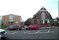
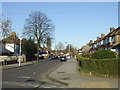
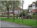
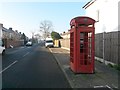
Photos of SE12 0QE


Area Information
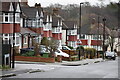
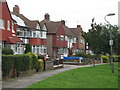
Living in SE12 0QE offers a distinct experience within a small residential cluster that covers 8452 m². This specific postcode serves approximately 1645 residents, creating an environment defined by its compact footprint. You will find yourself part of a community where space is concentrated yet distinct. The area sits comfortably within greater London, providing easy access to nearby transport hubs without the overwhelming scale of some central districts. Daily life here revolves around the practicalities of close-knit housing and proximity to established amenities. The character of SE12 0QE is shaped by its density and location. Residents benefit from being surrounded by key transport links, including station names like Grove Park and Lee which sit within practical reach. You can step outside and find chosen retailers such as Tesco Grove or Co-op Burnt nearby, making daily errands convenient. The area does not extend far, meaning your neighbourhood is entirely accessible on foot or by short vehicle journeys. This concentration means you interact with a tight group of neighbours who know each other. It is a place where the boundary between private home and public space is narrow, yet the layout supports a standard suburban existence. You live in an environment where the local geography supports a quiet, managed lifestyle rather than a sprawling one.
- Area Type
- Postcode
- Area Size
- 8452 m²
- Population
- 1645
- Population Density
- 5838 people/km²
The property market in SE12 0QE is firmly rooted in home ownership rather than the rental sector. With 72% of households owning their homes, the area has matured into a market where resale value and long-term tenure are primary concerns. This percentage indicates that the majority of stock consists of principal residences rather than investment buy-to-let properties. The accommodation type is listed as Houses, meaning you will primarily encounter single-family homes rather than flats or apartment blocks. This structure supports a family-centric market where buyers prioritise space and garden access. You are looking at a small residential cluster of 8452 m², which implies a finite number of homes available. The stock is static, defined by the established architecture of houses rather than new-build developments. For a prospective buyer, this means competition is likely focused on existing properties that have stood the test of time. The high ownership rate suggests that flipping properties frequently is not the norm. Instead, trades are often simple transfers between owner-occupiers. If you consider homes in SE12 0QE, you move into a market driven by stability. The lack of rental accommodation data for this specific code reinforces the idea that tenants are a minority presence here. You are buying into a community where neighbours often have lived in their houses for years.
House Prices in SE12 0QE
Showing 34 properties
| Address | Type | Beds | Baths | Last Sale Price | Last Sale Date | |
|---|---|---|---|---|---|---|
| 198 Burnt Ash Hill, London, SE12 0QE | Semi-detached | 4 | 1 | £640,000 | Aug 2025 | |
| 226 Burnt Ash Hill, London, SE12 0QE | Terraced | 3 | 1 | £450,000 | Dec 2022 | |
| 190 Burnt Ash Hill, London, SE12 0QE | house | - | - | £556,000 | Dec 2021 | |
| 214 Burnt Ash Hill, London, SE12 0QE | house | 2 | - | £375,000 | Dec 2020 | |
| 216 Burnt Ash Hill, London, SE12 0QE | Terraced | 3 | 1 | £376,000 | Nov 2020 | |
| 206 Burnt Ash Hill, London, SE12 0QE | house | - | - | £400,000 | Feb 2019 | |
| 224 Burnt Ash Hill, London, SE12 0QE | Terraced | 3 | 1 | £325,000 | Apr 2018 | |
| 204 Burnt Ash Hill, London, SE12 0QE | house | - | - | £545,000 | May 2016 | |
| 184 Burnt Ash Hill, London, SE12 0QE | house | - | - | £415,000 | Jun 2015 | |
| 200 Burnt Ash Hill, London, SE12 0QE | Semi-detached | 4 | 2 | £385,000 | May 2014 |
Energy Efficiency in SE12 0QE
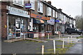
Living in SE12 0QE places you within striking distance of a wide variety of amenities. Your daily shopping needs are met by five retail locations, including Tesco Grove, Sainsburys Lewisham Grove, and Co-op Burnt. These venues are situated just outside your property boundaries. For larger supermarkets, you can walk to Sainsburys or rely on the Co-op for weekly necessities. Dining options and fresh groceries are therefore never far away. Transport choices define your leisure and work life. You can catch a train from Grove Park Station or Lee station, both counted among the five rail stops serving the area. If you prefer the DLR, five metro stations provide an alternative, covering spots like Cutty Sark for Maritime Greenwich. For water-based travel, five ferry locations are accessible, including Greenwich Pier and Barrier Gardens Pier. You might take a short hop across the river for a change of pace. London City Airport is a notable feature within reach, offering global connections without the hassle of long tube journeys. This concentration of five rail, five metro, and five ferry points ensures you can choose how you get there. The retail and transport mix supports a life where convenience is built into the fabric of the neighbourhood. You can travel or shop without planning days in advance.
Amenities
Schools
| Rank | School | Type | Entry gender | Ages |
|---|
Explore more schools in this area
Go to Schools tabDemographics
The community in SE12 0QE is characterised by a mature population dynamic. Data shows the median age is 47, confirming that adults between 30 and 64 years represent the most common age range. You are likely to see a street full of established families and professionals rather than transient youth or elderly retirees. This age profile suggests a stable neighbourhood where residents have put down roots. Home ownership stands at 72%, indicating that three out of every four properties are owned outright by their occupants. This high rate suggests long-term stability within the cluster. The accommodation type is recorded as Houses, which aligns with the ownership data and the demographic stability. You can expect a landscape dominated by detached or semi-detached structures rather than high-rise blocks or purpose-built estates. The predominant ethnic group is White, reflecting the broader London demographics while maintaining a specific local character. There is no indication of significant deprivation in the immediate data provided for this specific postcode. Instead, the area presents a clear picture of a middle-aged, owner-occupied housing stock. The population density reaches 194617 people per km², a figure that reflects the intensity of life within this small residential zone. Every resident lives in close proximity to hundreds of others within the immediate square kilometre.
Household Size
Accommodation Type
Tenure
Ethnic Group
Religion
Household Composition
Age
Household Deprivation
NS-SEC
Explore more demographic insights in this area
Go to Demographics tabPlanning
Planning Constraints
- Flood RiskPremium
- Ramsar Wetland SitesPremium
- Area of Outstanding Natural BeautyPremium
- Protected Nature ReservePremium
- Protected WoodlandPremium