Area Overview for SE12 0QD
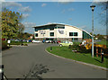
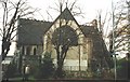
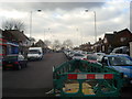
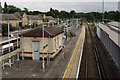
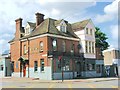
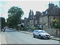
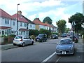
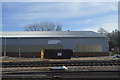
Photos of SE12 0QD

Area Information
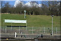
SE12 0QD is a compact residential cluster in south-east London that encompasses only 1.5 hectares of land. This small footprint houses 1625 people, resulting in a high population density of 108923 people per square kilometre. You will find that living in this postcode involves close proximity to neighbours and efficient use of space. The area functions as a defined residential zone rather than a sprawling district. Its character is shaped by significant population density within a very limited geographical boundary. Daily life here is typical of an urban residential pocket where services and housing are concentrated. The combination of compact size and substantial population creates a tight-knit community environment. Prospective buyers should consider this intense concentration of residents when imagining their future home. The postcode serves as a specific entry point into the broader SE12 network of addresses. Every house in this zone exists within close quarters to its counterparts. You gain immediate access to local resources while sharing a significant population with your immediate vicinity. This density defines the practical reality of daily life in SE12 0QD.
- Area Type
- Postcode
- Area Size
- 1.5 hectares
- Population
- 1625
- Population Density
- 5527 people/km²
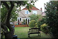
The property market in SE12 0QD is characterised by substantial owner-occupation and traditional housing types. You are entering an area where 83 percent of residents own their homes, which strongly influences the local market dynamics. This high ownership footprint means you are primarily engaging with sellers rather than landlords. Houses constitute the standard accommodation type, so you will not encounter a prevalence of purpose-built rental blocks or high-rise developments. The housing stock consists mainly of standalone properties rather than urban flats. This predominance of houses suggests a market geared towards those seeking more space or garden areas. When viewing homes in SE12 0QD, the listings will largely reflect this established character. Buyers looking for flats may find fewer options compared to properties with land and garden boundaries. The 83 percent ownership statistic indicates a quiet, stable market where current owners have roots in the community. Investment buyers looking for rental yields might find less opportunity than those seeking family homes. Understanding this owner-led market structure helps you frame your expectations correctly. The housing mix prioritises permanent residence over transient living arrangements.
House Prices in SE12 0QD
Showing 39 properties
| Address | Type | Beds | Baths | Last Sale Price | Last Sale Date | |
|---|---|---|---|---|---|---|
| 238 Burnt Ash Hill, London, SE12 0QD | Terraced | 2 | 1 | £376,500 | Aug 2024 | |
| 278 Burnt Ash Hill, London, SE12 0QD | Retail | 3 | 1 | £555,000 | May 2022 | |
| 248 Burnt Ash Hill, London, SE12 0QD | Semi-detached | 4 | 2 | £500,000 | Feb 2022 | |
| 292 Burnt Ash Hill, London, SE12 0QD | house | - | - | £455,000 | Dec 2020 | |
| 294 Burnt Ash Hill, London, SE12 0QD | Semi-detached | 4 | - | £450,000 | Jan 2020 | |
| 256 Burnt Ash Hill, London, SE12 0QD | Semi-detached | 4 | 2 | £530,000 | Mar 2017 | |
| 254 Burnt Ash Hill, London, SE12 0QD | Semi-detached | 4 | - | £427,000 | Jul 2015 | |
| 234 Burnt Ash Hill, London, SE12 0QD | Terraced | 2 | 1 | £330,000 | Jun 2014 | |
| 230A Burnt Ash Hill, London, SE12 0QD | Flat | - | - | £260,000 | Feb 2014 | |
| 290 Burnt Ash Hill, London, SE12 0QD | house | - | - | £310,000 | Dec 2012 |
Energy Efficiency in SE12 0QD
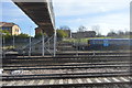
Living in SE12 0QD places you within practical reach of specific retail and transport venues that serve daily needs. Local retail options include Tesco Grove, Sainsburys Lewisham Grove, and Budgens Catford. These five supermarkets provide you with fresh groceries and household essentials without requiring a long journey. Public transport access is extensive, with five nearby railway stations including Grove Park Station, Lee, and Mottingham Station. You can easily commute using the train line to connect with wider London destinations. Tube services are also accessible through stations such as Elverson Road, Deptford Bridge, and Cutty Sark for Maritime Greenwich. Five ferry terminals serve the area, including Greenwich Pier, Masthouse Terrace Pier, and Barrier Gardens Pier for water-based travel. London City Airport is located just one terminal away, offering direct flights nearby. These five transport hubs ensure you have multiple routes to choose from based on your destination. The presence of these five retail, rail, and metro nodes creates a convenient lifestyle where most errands can be completed locally. You avoid long commutes to the city centre for basic shopping or transit connections. This concentration of services enhances the practicality of living in SE12 0QD.
Amenities
Schools
| Rank | School | Type | Entry gender | Ages |
|---|
Explore more schools in this area
Go to Schools tabDemographics
The community in SE12 0QD is defined by a mature demographic profile with a median age of 47 years. The most common age range for residents consists of adults between 30 and 64 years old. This age distribution suggests a population made up largely of established households rather than young singles or retirees. Home ownership is a dominant feature of living here, with 83 percent of residents owning their property outright or with a mortgage. This high ownership rate indicates long-term commitment to the area and financial stability among the local population. Houses form the primary accommodation type across the postcode, meaning you will predominantly find detached, semi-detached, or detached homes rather than high-density flats. The predominant ethnic group in the area is White, reflecting the broader cultural makeup of the neighbourhood. You can expect a community where stability and property ownership define the social fabric. The resident profile points towards families or dual-income households seeking established neighbourhoods. An 83 percent ownership rate significantly differs from typical high-rent London enclaves. These demographic facts shape the economic and social interactions of those living in SE12 0QD.
Household Size
Accommodation Type
Tenure
Ethnic Group
Religion
Household Composition
Age
Household Deprivation
NS-SEC
Explore more demographic insights in this area
Go to Demographics tabPlanning
Planning Constraints
- Flood RiskPremium
- Ramsar Wetland SitesPremium
- Area of Outstanding Natural BeautyPremium
- Protected Nature ReservePremium
- Protected WoodlandPremium