Area Overview for SE12 0SL
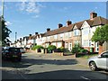
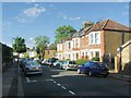
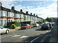
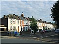
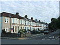
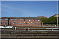
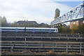
Photos of SE12 0SL

Area Information
SE12 0SL represents a tightly defined residential pocket within the wider South East London postcode district. This specific postcode cluster covers an area of just 5830 square metres, housing a population of 1644 residents. Despite its small footprint, the density stands at 281991 people per square kilometre, creating a concentrated living environment distinct from the sprawling suburbs often associated with the region. Living in SE12 0SL means navigating a micro-community where residents interact with immediate neighbours due to the compact layout. The area functions as a residential core rather than a mixed-use commercial hub, prioritising domestic space over commercial activity. You enter a zone where the primary characteristic is its intensive residential focus within a small geographical boundary. This density ensures that local services and neighbours are in close proximity, shaping a daily routine defined by proximity rather than travel. The area size limits vast open spaces within the immediate boundary, meaning your experience of living here revolves around the specific cluster of homes found within these 5830 square metres. Understanding the scale is essential for grasping the community feel, as the population of over one thousand six hundred people is compressed into a very small land mass.
- Area Type
- Postcode
- Area Size
- 5830 m²
- Population
- 1644
- Population Density
- 8266 people/km²
The housing stock in SE12 0SL is characterised predominantly by houses, distinguishing it from areas where flats or terraced properties dominate the skyline. With 50 per cent of the population in the area owning their homes, this postcode presents itself as a balanced market with significant owner-occupier representation. This figure implies that purchasing homes in SE12 0SL often involves securing a property with an established owner base rather than navigating a purely transient rental sector. The nature of the homes suggests traditional family living arrangements are common, supported by the house-based accommodation type. Yuvendale way and the surrounding streets in the BE12 0SL postcode cluster typically feature properties suited to this home ownership demographic. When considering buying a home in this specific area, you are entering a market where half of the residents have made the capital investment in their property. This level of ownership often contributes to price stability and a focus on property maintenance over rapid turnover. The limited area size of 5830 square metres means available stock is finite, potentially driving competition for suitable houses within this specific postcode.
House Prices in SE12 0SL
Showing 54 properties
| Address | Type | Beds | Baths | Last Sale Price | Last Sale Date | |
|---|---|---|---|---|---|---|
| 84 Stoneycroft Close, London, SE12 0SL | Flat | - | - | £292,500 | Aug 2024 | |
| 96 Stoneycroft Close, London, SE12 0SL | Flat | - | - | £275,000 | Oct 2022 | |
| 54 Stoneycroft Close, London, SE12 0SL | Flat | - | - | £320,000 | Jul 2021 | |
| 102 Stoneycroft Close, London, SE12 0SL | Flat | - | - | £225,000 | Jun 2021 | |
| 10 Stoneycroft Close, London, SE12 0SL | Flat | - | - | £295,000 | Apr 2021 | |
| 108 Stoneycroft Close, London, SE12 0SL | Flat | 2 | 1 | £289,800 | May 2019 | |
| 12 Stoneycroft Close, London, SE12 0SL | Maisonette | 2 | 1 | £280,000 | Jan 2017 | |
| 50 Stoneycroft Close, London, SE12 0SL | Flat | - | - | £161,000 | Apr 2012 | |
| 92 Stoneycroft Close, London, SE12 0SL | Flat | - | - | £113,000 | Jul 2007 | |
| 28 Stoneycroft Close, London, SE12 0SL | Flat | - | - | £136,500 | Apr 2007 |
Energy Efficiency in SE12 0SL
Residents of SE12 0SL benefit from a range of amenities located within practical reach, spanning retail, rail, and maritime connections. You have access to five retail outlets including the Co-op Burnt, Sainsburys Lee, and Tesco Hither Green, ensuring all daily shopping needs are met nearby. Transport links are equally extensive, with five rail stations available, notably Lee, Hither Green, and Grove Park Station. Additionally, five metro options serve the area, such as Elverson Road, Deptford Bridge, and Cutty Sark for Maritime Greenwich. Ferry services connect you to Greenwich Pier, Masthouse Terrace Pier, and Royal Wharf Pier, offering waterborne transport directly from your vicinity. London City Airport is also one kilometre away, providing air travel convenience. This dense network of transport and retail options means you rarely need to travel far for essential services or leisure. The presence of Co-op and Sainsburys ensures fresh food is close by, while multiple stations offer versatile commuting choices. Living here grants you flexibility whether you prefer taking the train to Greenwich, cruising on a ferry, or simply visiting the local Tesco. The proximity of these five specific venues and stations creates a lifestyle defined by convenience and connectedness to the wider city network.
Amenities
Schools
| Rank | School | Type | Entry gender | Ages |
|---|
Explore more schools in this area
Go to Schools tabDemographics
The community profile of SE12 0SL reflects a settled adult population with a median age of 47 years. Adults between the ages of 30 and 64 years make up the most common age range in this postcode, indicating a household structure likely dominated by established families or professionals. Home ownership sits at exactly 50 per cent of the total population, suggesting an equal split between owners and tenants within this specific area. Houses constitute the main form of accommodation, distinguishing it from urban zones dominated by high-rise flats. The predominant ethnic group is White, reflecting the demographic makeup typical of many residential clusters in South East London. Living in SE12 0SL therefore involves joining a community where the majority of residents are middle-aged homeowners or renters residing in detached or semi-detached houses. This age profile often correlates with a preference for stability and established local networks rather than transient populations. With half of the residents owning their homes, financial investment in the property is common, which can influence the pace of development and community engagement. The demographic stability suggests a neighbourhood where long-term residents form the backbone of the social fabric.
Household Size
Accommodation Type
Tenure
Ethnic Group
Religion
Household Composition
Age
Household Deprivation
NS-SEC
Explore more demographic insights in this area
Go to Demographics tabPlanning
Planning Constraints
- Flood RiskPremium
- Ramsar Wetland SitesPremium
- Area of Outstanding Natural BeautyPremium
- Protected Nature ReservePremium
- Protected WoodlandPremium