Area Overview for SE12 0HS
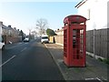
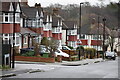
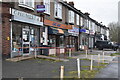
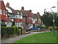
Photos of SE12 0HS


Area Information
Living in SE12 0HS offers a specific residential experience within a compact footprint of just 6,005 square metres. This postcode represents a tightly defined cluster where 1,644 residents call home, creating a neighbourhood with distinct boundaries. While the total area is small, the density reaches 273,778 people per square kilometre, placing you in close proximity to your neighbours and local facilities. The character of the area is defined by its urban context rather than sprawling green space. You are surrounded by the amenities of South East London, meaning daily errands, commutes, and social activities are rarely far away. This concentration of people within such a limited geographical scope suggests a community where local dynamics move quickly. Prospective buyers face a unique situation here because the land size is minimal compared to typical suburban plots. The high population density indicates a vibrant, busy environment where convenience is prioritised over isolation. Residents of SE12 0HS typically value their immediate access to transport links and shops over having large gardens or distant views. The area functions as a functional part of the wider London network, delivering essential services efficiently to a concentrated population. Whether you are considering this postcode for investment or personal residence, the reality is clear: you are choosing a spot where everything is reachable within a short walk or quick transit stop.
- Area Type
- Postcode
- Area Size
- 6005 m²
- Population
- 1644
- Population Density
- 8266 people/km²
The property market in SE12 0HS is characterised by a mix of housing tenure types, with 50% of residents owning their homes. This figure suggests that the area is equally divided between owner-occupiers and private renters, creating a dynamic environment for both long-term buyers and landlords. The predominant accommodation type in this postcode is houses, which generally offer more space and traditional architectural features compared to purpose-built flats. While flats exist in many London postcodes, the specific data for SE12 0HS highlights houses as the primary housing form. For a buyer looking at this small 6,005 square metre area, the market feels intimate and highly localised. The high population density means that competition for specific home types could be sharp if desirable properties come onto the market. Because half of the community owns their homes, stability is a key feature; owners are likely focused on maintenance and improvement rather than short-term flipping. This stability can be advantageous for investors seeking steady rental returns, as the local economy supports a diverse range of residents. Conversations with estate agents in the surrounding Lee or Hither Green areas will confirm that buyers here value the house style and the established nature of the street networks found in this postcode.
House Prices in SE12 0HS
Showing 6 properties
| Address | Type | Beds | Baths | Last Sale Price | Last Sale Date | |
|---|---|---|---|---|---|---|
| Flat 2, Rowan Court, Burnt Ash Hill, London, SE12 0HS | Flat | 2 | 1 | - | - | |
| Flat 3, Rowan Court, Burnt Ash Hill, London, SE12 0HS | Flat | - | - | - | - | |
| Flat 5, Rowan Court, Burnt Ash Hill, London, SE12 0HS | Flat | - | - | - | - | |
| Flat 1, Rowan Court, Burnt Ash Hill, London, SE12 0HS | Flat | - | - | - | - | |
| Flat 6, Rowan Court, Burnt Ash Hill, London, SE12 0HS | Flat | - | - | - | - | |
| Flat 4, Rowan Court, Burnt Ash Hill, London, SE12 0HS | Flat | 2 | 1 | - | - |
Energy Efficiency in SE12 0HS
Your lifestyle in SE12 0HS revolves around immediate access to essential services and leisure options. Within practical walking distance, five major retailers operate, including Co-op Burnt, Sainsburys Lee, and Tesco Hither. These venues provide everything from everyday groceries to household essentials without requiring a long car journey. For those who enjoy water-based leisure, four ferry terminals are nearby, featuring Greenwich Pier, Masthouse Terrace Pier, and Royal Wharf Pier. Accessible routes lead to iconic landmarks such as Cutty Sark for Maritime Greenwich, which serves as a major cultural and tourist attraction. Transport options further enhance your daily routine with five railway and metro stations available, including Lee, Hither Green, Grove Park Station, Elverson Road, and Deptford Bridge. You can shop for groceries at Sainsburys Lee or visit Co-op Burnt for fresh produce. A short trip takes you to the bustling waterfronts around Greenwich Pier or the historic settings of Cutty Sark. The presence of London City Airport nearby also adds a layer of connectivity for international visitors or frequent flyers. This concentration of amenities within a small area means that daily needs are met efficiently. You do not need to travel far to find quality shopping, reliable food sources, or exciting leisure outlets. Living in SE12 0HS places you at the heart of a well-served, convenient residential zone.
Amenities
Schools
| Rank | School | Type | Entry gender | Ages |
|---|
Explore more schools in this area
Go to Schools tabDemographics
The community in SE12 0HS reflects a mature demographic profile, with a median age of 47 years. Most commonly, the population consists of adults aged between 30 and 64 years, suggesting a neighbourhood dominated by established households rather than young families or students. Home ownership stands at exactly 50%, meaning half of the residents own their properties while the other half likely rent from private landlords or housing associations. This split indicates a balanced market where both investment professionals and owner-occupiers have stakes in the local property base. Accommodation in this postcode primarily consists of houses, which may include terraced or semi-detached properties typical of this part of London. Although no specific breakdown of ethnic diversity is provided in the current records, the predominant ethnic group is recorded as White. With a population of 1,644, the social fabric is relatively homogenous compared to larger London boroughs. The age profile implies a stable community where residents are likely settled, working in the city or local commercial sectors, and looking to maintain their homes rather than move frequently. This steady demographic base supports consistent local demand for services and preserves the character of the housing stock.
Household Size
Accommodation Type
Tenure
Ethnic Group
Religion
Household Composition
Age
Household Deprivation
NS-SEC
Explore more demographic insights in this area
Go to Demographics tabPlanning
Planning Constraints
- Flood RiskPremium
- Ramsar Wetland SitesPremium
- Area of Outstanding Natural BeautyPremium
- Protected Nature ReservePremium
- Protected WoodlandPremium