Area Overview for SE11 4SZ
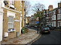
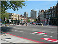
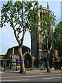
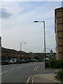
Photos of SE11 4SZ
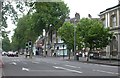
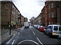
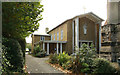
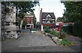


Area Information
The postcode SE11 4SZ covers a very small residential cluster measuring just 7,774 square metres. Despite its limited footprint, it contains a population of 1,541 residents, resulting in an exceptionally high population density of 198,230 people per square kilometre. Living in SE11 4SZ means residing in a tightly packed urban environment where neighbours are rarely far away. This specific location reflects the broader density characterised by high-rise living and compact street layouts typical of South London. The area functions as part of a larger metropolitan fabric, blending residential spaces with significant institutional buildings in its immediate vicinity. Prospective buyers looking at homes in SE11 4SZ should anticipate a neighbourhood defined by its intensity rather than spaciousness. Daily life here is dominated by the immediate presence of schools and commercial zones, creating an atmosphere of constant activity. The sheer number of people per square metre dictates a pace of life that is fast and direct, mirroring the surrounding transport hubs and employment centres that define the wider SE11 district.
- Area Type
- Postcode
- Area Size
- 7774 m²
- Population
- 1541
- Population Density
- 12600 people/km²
The housing stock in SE11 4SZ is characterised almost exclusively by flat living. Accommodation types are dominated by apartments, reflecting the necessity of vertical construction in such a densely populated zone. Only 23% of residents own their homes, confirming that the area operates primarily as a rental destination for investors and professionals alike. For anyone searching for homes in SE11 4SZ, the market focus is on leasehold properties rather than freehold houses. This concentration of flats aligns with the local demand generated by nearby tube stations and business districts. Buyers looking to purchase should expect to enter a competitive market where pricing is driven by proximity to transit links and the quality of the specific development. The low ownership rate implies that property turnover may be frequent, influenced by investment strategies rather than neighbourhood loyalty. Residents and prospective owners alike find themselves in a market where rental demand heavily influences property values and availability.
House Prices in SE11 4SZ
Showing 58 properties
| Address | Type | Beds | Baths | Last Sale Price | Last Sale Date | |
|---|---|---|---|---|---|---|
| Albert Reece House, 63 Elliotts Row, London, SE11 4SZ | house | - | - | £515,000 | Mar 2024 | |
| 68 Elliotts Row, London, SE11 4SZ | house | - | - | £1,040,000 | Nov 2020 | |
| 64 Elliotts Row, London, SE11 4SZ | house | 2 | - | £552,500 | Feb 2012 | |
| 51 Elliotts Row, London, SE11 4SZ | Terraced | 4 | 2 | £380,000 | Nov 2002 | |
| 62 Elliotts Row, London, SE11 4SZ | Terraced | 4 | 1 | £292,000 | Apr 2001 | |
| 52 Elliotts Row, London, SE11 4SZ | Terraced | 4 | 2 | £259,950 | Jun 1998 | |
| 32A Elliotts Row, London, SE11 4SZ | Flat | 2 | 1 | - | - | |
| 32C Elliotts Row, London, SE11 4SZ | Flat | 2 | 1 | - | - | |
| 33 Elliotts Row, London, SE11 4SZ | house | 2 | 1 | - | - | |
| 32B Elliotts Row, London, SE11 4SZ | Flat | 3 | 1 | - | - |
Energy Efficiency in SE11 4SZ
Residents of SE11 4SZ enjoy immediate access to a dense network of amenities and retail outlets. For shopping, you can reach Sainsburys Elephant & Castle, Sainsburys Elephant and, and Tesco Kennington, providing comprehensive supermarket options within short distances. Transport diversity is a key lifestyle feature, offering five Rail stations and five Metro stations close at hand. Travelers can easily access Green Line Coach Station, Victoria Coach Station, and London Victoria Coach Station Arrivals for longer journeys. Water transport via Lambeth Pier, Millbank Pier, and London Eye Waterloo Pier allows for scenic river crossings. The area supports a busy commercial life with five notable retail destinations and an equal number of rail entry points. This concentration of services ensures that daily errands, work commutes, and leisure trips require minimal planning. The proximity to these major venues defines the convenience of living in this specific postcode cluster.
Amenities
Schools
Families in SE11 4SZ have London South Bank University in their immediate vicinity. This institution is listed as a nearby school within the area's educational profile. It functions primarily as a higher education provider rather than a primary or secondary school for young children. The data lists one institution, which suggests that families with school-age children look beyond this immediate immediate cluster for their children's primary and secondary needs. Living in SE11 4SZ places you within walking distance of a major university campus, which offers opportunities for adult education and student life integration. The presence of a higher education facility indicates an area that caters to older students and professionals alongside families. While London South Bank University is a significant landmark, the lack of other school data means residents often rely on the wider Thornhill and Kennington zones for primary and secondary schooling options.
| Rank | School | Type | Entry gender | Ages |
|---|
Explore more schools in this area
Go to Schools tabDemographics
The community in SE11 4SZ is defined by a mature demographic profile. The median age for residents is 47 years, with the most common age range falling between 30 and 64 years. This indicates a neighbourhood populated largely by adults in their working years and beyond. Home ownership stands at 23%, a figure that suggests this is predominantly a rental market rather than an area of owner-occupiers. The majority of accommodation consists of flats, fitting the profile of a high-density urban zone. The predominant ethnic group is White, though the high density allows for a complex mix of households common in central London locations. With fewer than a quarter of residents owning their homes, the area attracts long-term tenants seeking convenient access to transport and amenities. This rental-heavy status shapes the local character, often resulting in more transient household compositions compared to suburbs with higher ownership rates.
Household Size
Accommodation Type
Tenure
Ethnic Group
Religion
Household Composition
Age
Household Deprivation
NS-SEC
Explore more demographic insights in this area
Go to Demographics tabPlanning
Planning Constraints
- Flood RiskPremium
- Ramsar Wetland SitesPremium
- Area of Outstanding Natural BeautyPremium
- Protected Nature ReservePremium
- Protected WoodlandPremium