Area Overview for SE11 4SU
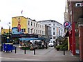
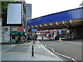
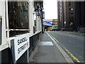
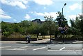
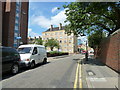
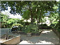
Photos of SE11 4SU
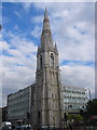
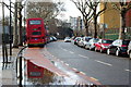


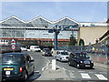
Area Information
Living in SE11 4SU means residing in a specific postcode area covering a small residential cluster within England. This tiny pocket of property spans just 5358 square metres, a footprint that belies a significant population of 2370 people. You are part of a high-density environment where over 442,000 people live per square kilometre, creating a distinctly urban experience. Daily life here demands an appreciation for proximity to major transport nodes rather than quiet suburban space. The area functions as a concentrated hub where residents navigate close-quarter living with the convenience of central London infrastructure. Your immediate surroundings define your routine because physical space is limited by design. The sheer number of people packed into such a small area creates a dynamic, fast-paced atmosphere characteristic of this postcode. You will interact with a community where 29 per cent of people own their homes, yet the structure of the neighbourhood is fundamentally different from outer London districts. Homes in SE11 4SU reflect a modern, compact living style suited to professional households. Despite the high population density, the cluster remains a defined entity within the broader SE11 postcode sector, offering a self-contained lifestyle where every service is within practical reach.
- Area Type
- Postcode
- Area Size
- 5358 m²
- Population
- 2370
- Population Density
- 10728 people/km²
The property market in SE11 4SU is characterised by a strong rental sector where tenancies dominate ownership. Only 29 per cent of households in this postcode area own their homes, meaning that 71 per cent of residents live in rented accommodation. This statistic defines the local housing stock as a high-volume rental zone rather than a traditional owner-occupied street. The overwhelming majority of accommodation comprises flats, reflecting the 5358 square metre constraint of the territory and its location within a dense urban cluster. You can expect a landscape dominated by block living rather than detached or semi-detached houses. This accommodation type suits the demographic profile of adults aged 30 to 64, many of whom prioritise location and convenience over private garden space. The low ownership rate suggests high demand for investment-grade rentals, a trend common in such high-density clusters. For buyers, viewing homes in SE11 4SU often involves navigating flats managed by large agencies or private landlords. The market operates on supply and demand dynamics related to transport links and proximity to work, rather than land scarcity alone. Understanding this market structure helps you decide whether to buy a flat for immediate letting or if a different postcode in SE11 offers better long-term capital growth potential.
House Prices in SE11 4SU
Showing 40 properties
| Address | Type | Beds | Baths | Last Sale Price | Last Sale Date | |
|---|---|---|---|---|---|---|
| 57 Hayles Street, London, SE11 4SU | Terraced | 4 | 2 | £1,275,000 | May 2024 | |
| 35 Hayles Street, London, SE11 4SU | Detached | 2 | 2 | £920,000 | Jun 2023 | |
| 31 Hayles Street, London, SE11 4SU | Terraced | 2 | 1 | £1,050,000 | Jun 2023 | |
| 1A Hayles Street, London, SE11 4SU | Flat | 2 | 1 | £600,000 | Sep 2016 | |
| 3 Hayles Street, London, SE11 4SU | Terraced | 6 | - | £1,025,000 | Mar 2016 | |
| 41 Hayles Street, London, SE11 4SU | house | 4 | 2 | £585,000 | Jun 2013 | |
| 33 Hayles Street, London, SE11 4SU | house | - | - | £355,000 | Jul 2009 | |
| 25 Hayles Street, London, SE11 4SU | Terraced | - | - | £475,000 | Sep 2003 | |
| 11 Hayles Street, London, SE11 4SU | house | 6 | 2 | £105,000 | Mar 2000 | |
| 21 Hayles Street, London, SE11 4SU | Terraced | 4 | 3 | £227,000 | Mar 1998 |
Energy Efficiency in SE11 4SU
Your lifestyle in SE11 4SU revolves around exceptional convenience offered by nearby amenities within practical reach. Retail is hard to beat in the area, with major supermarkets including Sainsburys Elephant & Castle, Sainsburys Elephant and, and Tesco Borough all within short walking distance. The proximity to Coach Station, Green Line Coach Station, Victoria Coach Station, and London Victoria Coach Station Arrivals highlights your connection to intercity travel without leaving the immediate vicinity. Public transport links are comprehensive, defining a lifestyle where work or leisure rarely requires a long commute. You have access to Elephant & Castle Railway Station, London Waterloo Railway Station, and London Bridge Station, alongside Kennington Station, Borough Station, and Southwark Station. These rail and metro options allow you to reach central business districts quickly. Ferry services via Lambeth Pier, London Eye Waterloo Pier, and Millbank Pier further expand your daily mobility. The abundance of bus routes, roads, and coach stations means you rarely feel trapped in a limited district.
Amenities
Schools
Charlotte Sharman Primary School stands as the key educational facility nearest to SE11 4SU. It operates as a primary school and holds a Good Ofsted rating, confirming its standard of education. Data shows few other primary options in the immediate vicinity, so this school serves the core local family population within this small residential cluster. Beyond primary education, the area relies on nearby facilities like the London College of Printing & Distributive Trades. This institution is classified as other, not primary or secondary, meaning it does not offer standard schooling for children. Families living in this area have access to Charlotte Sharman Primary School, a rated Good institution, for young children. However, the lack of secondary schools listed in the immediate data suggests that older children likely travel to schools located further away in SE1 or similar postcodes. The school mix indicates a primary focus on early education within the cluster, with secondary education requiring wider transport links. For parents living in flats in SE11 4SU, commuting to Charlotte Sharman Primary School is straightforward, but secondary schooling requires planning. You might need to consider transport routes to secondary schools not immediately adjacent to this specific postcode. The presence of Charlotte Sharman Primary School provides a solid foundation for early years education close to your home.
| Rank | School | Type | Entry gender | Ages |
|---|
Explore more schools in this area
Go to Schools tabDemographics
The community in SE11 4SU is defined by a mature adult demographic with a median age of 47 years. Most common age groups fall between 30 and 64 years, indicating a resident base focused on stability rather than transient young professional housing. Home ownership stands at 29 per cent, a figure that signals a predominantly rental market where tenancy changes may occur more frequently than in owner-dominated suburbs. The vast majority of accommodation consists of flats, aligning with the high-density urban fabric and the need for flexible, space-efficient living solutions. Demographic data shows that the predominant ethnic group in this area is White, forming the core of the local population profile. This homogeneity contrasts with the high population density, suggesting a tight-knit, established residents' group rather than a rapidly shifting transient crowd. The low home ownership rate of 29 per cent implies that many households may prioritise investment properties or rented flats over purchasing their first property. For families considering schools near SE11 4SU, the age profile suggests a community with many school-leavers or grandparents, though the flat-based accommodation type may attract younger professionals moving up the property ladder. The age range and ownership statistics offer a clear picture of a mature, rental-led neighbourhood rather than a family estate.
Household Size
Accommodation Type
Tenure
Ethnic Group
Religion
Household Composition
Age
Household Deprivation
NS-SEC
Explore more demographic insights in this area
Go to Demographics tabPlanning
Planning Constraints
- Flood RiskPremium
- Ramsar Wetland SitesPremium
- Area of Outstanding Natural BeautyPremium
- Protected Nature ReservePremium
- Protected WoodlandPremium