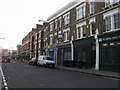
Area Overview for SE11 4TG
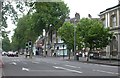
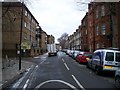
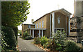
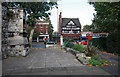
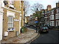
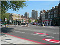
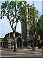
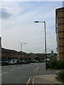
Photos of SE11 4TG


Area Information
Living in SE11 4TG means residing within a specific postcode area covering a small residential cluster of just 4003 m². This compact footprint houses a population of 2370 people, resulting in an exceptionally high population density of 592058 people per square kilometre. You should expect a neighbourhood where space is at a premium and daily life revolves around close proximity to local services. The area functions as a tight-knit pocket of residential accommodation rather than a sprawling district. Your day-to-day experience will be defined by the sheer concentration of residents within this limited zone. You are surrounded by fellow locals, yet the physical boundaries of this specific cluster keep everything accessible. The environment is purely urban and residential, offering little room for expansive parks or wide-open spaces within the immediate footprint of the postcode. For a homebuyer, the appeal lies in the convenience of being embedded in the heart of a dense community where every step brings you closer to shops or transit nodes. This small scale ensures that nothing is far from reach, but it also means you are never truly outside the busy rhythm of the area.
- Area Type
- Postcode
- Area Size
- 4003 m²
- Population
- 2370
- Population Density
- 10728 people/km²
The property market in SE11 4TG is characterised by a heavy lean towards rental accommodation rather than ownership. Only 29% of residences are owner-occupied, which means you will see a significantly larger proportion of landlords and tenants than homeowners. This skew suggests that buying a home immediately within this 4003 m² cluster may involve navigating a landlord-centric landscape. Instead, most residents live in flats, which fits the high-density modelling required for such a small postcode area. When looking at homes in SE11 4TG, you are likely considering flats designed to accommodate the 2370 residents living here. The high population density of 592058 people per square kilometre indicates that land value is intense and space is commodified. For a buyer, this area represents a niche where the primary stock comprises multi-occupancy units ideal for the age profile of the local population. The market dynamics favour those who can secure a long-term tenancy or have the means to purchase in a sector where ownership is less common. If your goal is broad homeownership, you might find more varied options by expanding your search beyond this specific tight cluster to the immediate wider borough.
House Prices in SE11 4TG
Showing 38 properties
| Address | Type | Beds | Baths | Last Sale Price | Last Sale Date | |
|---|---|---|---|---|---|---|
| 193 Brook Drive, London, SE11 4TG | Terraced | 4 | 2 | £900,000 | Nov 2021 | |
| 167 Brook Drive, London, SE11 4TG | house | - | - | £827,000 | Aug 2021 | |
| 173 Brook Drive, London, SE11 4TG | house | 4 | - | £400,000 | Dec 2003 | |
| 163 Brook Drive, London, SE11 4TG | house | 5 | 1 | £415,000 | Oct 2003 | |
| 179 Brook Drive, London, SE11 4TG | Terraced | 5 | 2 | £335,000 | Sep 2001 | |
| 171 Brook Drive, London, SE11 4TG | house | - | - | £268,000 | Apr 2000 | |
| 153 Brook Drive, London, SE11 4TG | Terraced | 4 | 2 | £230,000 | Feb 2000 | |
| Flat 1, 151 Brook Drive, London, SE11 4TG | Flat | 2 | 2 | - | - | |
| First Floor And Second Floor Flat, 191 Brook Drive, London, SE11 4TG | Terraced | 4 | 2 | - | - | |
| Flat 1, 189 Brook Drive, London, SE11 4TG | Flat | 2 | - | - | - |
Energy Efficiency in SE11 4TG
Your lifestyle in SE11 4TG centres around immediate access to major transport hubs and retail chains. Within practical reach, you have five retail options, including Sainsburys Elephant & Castle, Sainsburys Elephant and, and Tesco Kennington. These supermarkets form the backbone of your weekly grocery shopping routine. Transport connectivity is even stronger, with rail stations like Elephant & Castle Railway Station, London Waterloo Railway Station, and Vauxhall Railway Station all nearby. You also have five metro stations close by, such as Kennington Station, Borough Station, and Southwark Station, granting you swift access to the rest of the capital. Your travel options extend to three bus services, including links to the Green Line Coach Station and Victoria Coach Station. Furthermore, five ferry terminals like Lambeth Pier and London Eye Waterloo Pier offer unique river-bus connections. This density of amenities means your daily errands and commutes require minimal travel time. The character of SE11 4TG is one of hyper-convenience, where food, work, and leisure nodes are all clustered closely around your doorstep.
Amenities
Schools
Families considering schools near SE11 4TG have one primary educational option clearly listed within their vicinity: Charlotte Sharman Primary School. This primary institution holds a 'good' Ofsted rating, indicating a standard of education that parents can rely on. Beyond primary education, you are also close to the London College of Printing & Distributive Trades. This facility serves as an other type of school, likely offering vocational training or secondary specialisation that complements the primary education provided locally. The mix of institutions available to you is limited but functional. With Charlotte Sharman Primary School holding its rating, you have a secure foundation for younger children. The presence of the college suggests you are positioned well for residents who require both elementary and specialised training options. However, the selection is narrow, reflecting the small residential cluster nature of SE11 4TG. You must weigh the certainty of the primary school's rating against the fact that the college does not display a specific Ofsted grade in the current data. For families needing a round of primary education, this local pairing provides a complete picture, though the breadth of choice for secondary or sixth form options extends beyond this specific list.
| Rank | School | Type | Entry gender | Ages |
|---|
Explore more schools in this area
Go to Schools tabDemographics
The community in SE11 4TG is dominated by adults aged between 30 and 64 years. The median age for residents is 47, indicating a mature demographic where middle-aged families and working professionals are the norm. You will find that 29% of households own their homes outright, suggesting that a significant portion of the population rents these properties. This ratio points towards a market where long-term renting is common, alongside a minority of owner-occupiers who have settled into this postcode. The most common type of accommodation found here consists of flats. This structural reality aligns with the high density you encounter, as apartments allow for more efficient use of the limited land. While the predominant ethnic group is White, the specific breakdown of diversity is not detailed in the available records; however, the age profile remains clear. With over half the population in the working and pre-retirement ages, the area attracts those in the stability phase of their lives. You should view the community as a collection of established adults seeking practical housing solutions rather than a hub for young families or students. The residential nature is singular, focusing on flat living within a highly populated square kilometre.
Household Size
Accommodation Type
Tenure
Ethnic Group
Religion
Household Composition
Age
Household Deprivation
NS-SEC
Explore more demographic insights in this area
Go to Demographics tabPlanning
Planning Constraints
- Flood RiskPremium
- Ramsar Wetland SitesPremium
- Area of Outstanding Natural BeautyPremium
- Protected Nature ReservePremium
- Protected WoodlandPremium