Area Overview for SE10 8FS
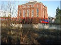
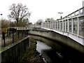
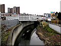
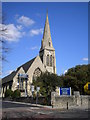
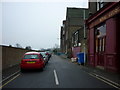
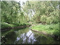
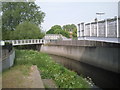
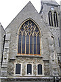
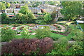
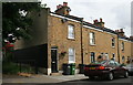
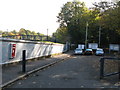
Photos of SE10 8FS

Area Information
SE10 8FS is a small residential cluster covering just 1,890 square metres within England. You will find a tightly knit community of 2,629 residents living in this compact postcode area. The location is defined by its density and immediate access to wider transport networks rather than vast open spaces. Daily life here revolves around proximity to key commercial and transit hubs, making it a practical choice for those prioritising connectivity. The area sits firmly within Greenwich and Deptford, blending residential calm with urban convenience. It is a place where you can walk to shops and stations, then enjoy the relative peace of a focused neighbourhood. The population density creates a sense of familiarity, yet the specific postcode covers a distinct housing cluster that functions independently from broader streets. Residents value the short distances to amenities. This setup suits people who do not wish to travel far for their weekly essentials or daily commute. Living in SE10 8FS means embracing a location that values efficiency. The area absorbs the energy of nearby transport links while maintaining a residential identity. You can expect a environment where neighbours and services are within practical reach. This postcode represents a slice of south-east London that balances urban access with a concentrated, local atmosphere.
- Area Type
- Postcode
- Area Size
- 1890 m²
- Population
- 2629
- Population Density
- 13764 people/km²
The property market in SE10 8FS is characterised by a significant rental component alongside substantial home ownership. With 45 per cent of households owning their homes, the area retains strong roots in owner-occupancy. Yet, a high proportion of renter-occupied homes suggests active letting activity within this specific postcode. Flats remain the primary accommodation type. This dominance of multi-level units shapes the value and availability of houses for sale. You will mostly find apartment blocks or converted buildings rather than detached family homes in this small footprint. The mix means prices often reflect the convenience of managed blocks and shared amenities. For buyers looking at SE10 8FS, the market offers a specific niche. The area functions as a dense hub where investment in flats is common. Tenants often choose this location for its proximity to transport hubs like Greenwich Station and Deptford Bridge. Homeowners enjoy the benefits of low-rise living in a high-access zone. The 45 per cent ownership rate indicates a healthy buyer presence despite the prevalence of rented flats. This balance suggests a stable market where property values are influenced by both long-term owners and the steady demand from renters seeking nearby access to London City Airport and the DLR. The specific housing stock limits options for those seeking large family houses, focusing the market instead on efficient urban living spaces.
House Prices in SE10 8FS
Showing 17 properties
| Address | Type | Beds | Baths | Last Sale Price | Last Sale Date | |
|---|---|---|---|---|---|---|
| 46 Catherine Grove, Greenwich, SE10 8FS | Flat | 3 | 1 | £450,000 | May 2023 | |
| 52 Catherine Grove, Greenwich, SE10 8FS | Flat | 4 | 3 | £730,000 | Apr 2020 | |
| 48 Catherine Grove, Greenwich, SE10 8FS | Flat | - | - | £535,000 | Dec 2013 | |
| Apartment 7, 44 Catherine Grove, Greenwich, SE10 8FS | Flat | 2 | 2 | - | - | |
| Flat 2, 50 Catherine Grove, Greenwich, SE10 8FS | Flat | 3 | 2 | - | - | |
| Toolworks House, 44 Catherine Grove, Greenwich, SE10 8FS | Semi-detached | 3 | 3 | - | - | |
| Flat 1, 50 Catherine Grove, Greenwich, SE10 8FS | Maisonette | 3 | 2 | - | - | |
| Flat 2, 21A Blackheath Road, Greenwich, SE10 8FS | Flat | - | - | - | - | |
| Flat 1, 21A Blackheath Road, Greenwich, SE10 8FS | Flat | - | - | - | - | |
| Apartment 2, 44 Catherine Grove, Greenwich, SE10 8FS | Flat | - | - | - | - |
Energy Efficiency in SE10 8FS
Living in SE10 8FS provides immediate access to extensive amenities. Retail options include Tesco Deptford, Co-op London, and another Tesco Deptford location. These supermarkets form the backbone of your weekly shop, offering everything from groceries to household basics within practical reach. Five retail outlets are located nearby, ensuring you rarely need to travel far for daily essentials. Public transport links are equally dense. You can reach five metro stations, including Deptford Bridge, Elverson Road, and Cutty Sark DLR Station. Rail access includes Greenwich Station, St Johns, and Deptford, connecting you across south-east London. Five ferry terminals, such as Greenwich Pier and Masthouse Terrace Pier, link you directly to Greenwich and Surrey Quays. London City Airport sits just one station away, offering quick access to the City of London. Three major coach stations, including Victoria Coach Station, provide links to the rest of the country. This network allows you to shop at Tesco, dine in Greenwich, and travel to the airport without taking a car. The area serves as a transit hub where travel is simple and frequent. You can catch a ferry to pour through to Greenwich or board a DLR train to cross London. The abundance of transport options gives you freedom of movement. Whether you want to visit a park in Greenwich or pick up a necessity at the local Co-op, the infrastructure is designed for convenience. The presence of multiple station names highlights the volume of connections available to residents. This lifestyle suits those who value speed and variety over distance.
Amenities
Schools
Families living in SE10 8FS have several educational options nearby. The most prominent independent school is Mayflower Independent School. This private institution offers alternative education for those seeking that specific curriculum and environment. The presence of an independent school indicates a diversity of educational choices beyond the standard state system. While primary and state secondary schools are not listed in the immediate data, the existence of Mayflower provides a high-standard option for local families. You can expect a mix of education types to serve the community. The independent sector in SE10 8FS offers flexibility for parents wishing to choose specific teaching methods or fee structures. For most residents, schooling relies on nearby state schools just outside the immediate residential cluster. The availability of an independent school suggests the area caters to a range of family needs. You do not need to travel far for private education if that is your preference. The educational landscape supports both traditional and selective learning paths. This variety ensures that residents can find a school that matches their specific requirements without leaving the broader neighbourhood. Families should check catchment areas for state schools separately, as they often extend beyond the small boundaries of this postcode.
| Rank | School | Type | Entry gender | Ages |
|---|
Explore more schools in this area
Go to Schools tabDemographics
The community in SE10 8FS reflects a mature demographic with a median age of 47 years. The majority of residents fall into the 30 to 64 age range, indicating a settlement built for adults with established careers and families. Home ownership stands at 45 per cent, meaning just under half of the households own their properties outright or via a mortgage. The remaining households typically rent, contributing to a stable tenure mix. Flats dominate the accommodation type in this area. You will find that most homes are multi-level units designed for efficient urban living. This layout is common in smaller postcode clusters where land is limited. The resident population is predominantly White, reflecting the broader ethnic composition of the surrounding boroughs. The average age of 47 suggests a neighbourhood favouring stability over transient living. Families and professionals seeking a settled environment will find this profile aligns with their needs. The high concentration of working-age adults supports local retail and services that require consistent footfall. Older residents likely enjoy a slower pace in this specific cluster. Understanding this demographic helps you see why the housing stock leans towards flats and why the community feels settled rather than driven by student housing or young professionals.
Household Size
Accommodation Type
Tenure
Ethnic Group
Religion
Household Composition
Age
Household Deprivation
NS-SEC
Explore more demographic insights in this area
Go to Demographics tabPlanning
Planning Constraints
- Flood RiskPremium
- Ramsar Wetland SitesPremium
- Area of Outstanding Natural BeautyPremium
- Protected Nature ReservePremium
- Protected WoodlandPremium