Area Overview for SE10 8PE
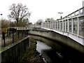
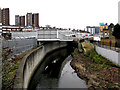
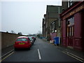
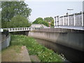
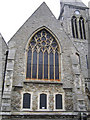
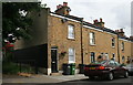
Photos of SE10 8PE


Area Information
SE10 8PE is a specific postcode area covering a small residential cluster in southeast London. It occupies just one hectare of land while supporting a population of 2,629 people. This high density defines the character of the neighbourhood, where residents live in close proximity to one another within a compact footprint. You will find homes in SE10 8PE situated in what is effectively a tight-knit urban environment rather than a sprawling suburb. The location places you at the heart of Deptford, a district with a long history of maritime and industrial significance. Living here means you are immediately connected to major transport hubs and commercial zones without needing to travel far. The immediate surroundings offer a mix of traditional residential streets and the infrastructure that supports a bustling local economy. You receive quick access to Deptford Bridge and the nearby DLR station, allowing you to reach central London efficiently. Daily life revolves around this concentrated community where the boundaries between home and public space are minimal.
- Area Type
- Postcode
- Area Size
- 1.0 hectares
- Population
- 2629
- Population Density
- 13764 people/km²
The housing stock in SE10 8PE is heavily weighted towards flats, which is unsurprising given the constraints of a single-hectare area. This accommodation type dominates the market, offering higher density living suited to urban environments. Forty-five per cent of residents own their freehold or leasehold, while the remaining households rent their properties. You will encounter a mix of tenures, but the nature of the built environment means individual houses are rare in this specific postcode. This mix of ownership and rental options creates a dynamic local market where price levels can fluctuate based on building age and service charges. Buyers looking at homes in SE10 8PE must consider that many properties are part of larger residential blocks. The high density implies shared amenities and local facilities are always within walking distance. While the area does not feature large detached estates, the flat-based housing provides a convenient solution for city workers. The limited land size means you are purchasing part of a larger urban fabric rather than an isolated plot.
House Prices in SE10 8PE
Showing 54 properties
| Address | Type | Beds | Baths | Last Sale Price | Last Sale Date | |
|---|---|---|---|---|---|---|
| 35A Blackheath Road, Greenwich, SE10 8PE | Flat | - | - | £240,000 | Jul 2025 | |
| 43A Blackheath Road, Greenwich, SE10 8PE | Flat | - | - | £265,000 | Jun 2024 | |
| 15 Blackheath Road, Greenwich, SE10 8PE | Flat | 3 | 2 | £635,000 | Oct 2022 | |
| 29 Blackheath Road, Greenwich, SE10 8PE | Flat | - | - | £510,000 | Jun 2021 | |
| 43B Blackheath Road, Greenwich, SE10 8PE | Flat | 1 | - | £301,500 | Jan 2018 | |
| 27A Blackheath Road, Greenwich, SE10 8PE | Flat | - | - | £412,000 | Jan 2017 | |
| 33 Blackheath Road, Greenwich, SE10 8PE | house | - | - | £975,000 | Mar 2016 | |
| 41 Blackheath Road, Greenwich, SE10 8PE | house | 4 | - | £1,150,000 | Jun 2015 | |
| Mews House, 35B Blackheath Road, Greenwich, SE10 8PE | Semi-detached | 3 | 2 | £850,000 | Jun 2015 | |
| 43C Blackheath Road, Greenwich, SE10 8PE | Flat | - | - | £207,000 | Dec 2012 |
Energy Efficiency in SE10 8PE
Your lifestyle in SE10 8PE benefits from a dense network of transport and retail options, all within practical walking or short transit distance. Retail convenience is high, with five nearby supermarkets including Tesco Deptford and Co-op London ensuring you can grab essentials without driving. You have immediate access to five metro stations such as Deptford Bridge and Elverson Road, making tube travel straightforward for daily commutes. Rail connections via St Johns and Greenwich Station provide additional flexibility for journeys outside the DLR network. Travel options extend to five ferry terminals, including Greenwich Pier and Masthouse Terrace Pier, offering scenic routes to South London and beyond. You are also close to London City Airport, the only airport listed nearby, which is useful for frequent travellers. Three major bus stations, including Victoria Coach Station, sit nearby for long-distance travel needs. This combination of retail, rail, metro, bus, ferry, and air links creates a neighbourhood where almost any destination is reachable quickly.
Amenities
Schools
Education provision for families in SE10 8PE centres around a specific nearby independent option. Mayflower Independent School stands as the primary educational institution referenced for this locality. You have direct access to this independent school, which offers an alternative to the state sector for children living in the area. The presence of a private school indicates that parents in SE10 8PE place a high value on educational choice and likely have the financial means to support such schooling. While you should note that this data highlights only one independent school, the proximity allows students to avoid long commutes. Families considering this location will find the Mayflower Independent School to be a key asset when evaluating the catchment benefits of the address. The school environment provides structured learning outside of the standard state curriculum options. Residents benefit from this established institution without needing to travel further into Greenwich or Southeast London for private schooling.
| Rank | School | Type | Entry gender | Ages |
|---|
Explore more schools in this area
Go to Schools tabDemographics
The community in SE10 8PE displays a mature demographic profile distinct from many other London postcodes. The median age of residents is 47 years, which places the area firmly within the adult demographic range spanning thirty to sixty-four years. This age distribution suggests a population composed largely of established professionals, families, and empty-nesters who have chosen to settle down or remain in the location long term. You will find that property purchases here are often driven by stability and long-term planning rather than short-term investment flips. Forty-five per cent of households own their homes, indicating a mixed market where rental properties coexist with owner-occupied dwellings. Flats constitute the predominant accommodation type, reflecting the limited land area available for development. You should expect a diverse ethnic mix, with the White ethnic group being the most common demographic. The high population density of over 260,000 people per square kilometre means you share your local space with thousands of others in a very small geographic zone.
Household Size
Accommodation Type
Tenure
Ethnic Group
Religion
Household Composition
Age
Household Deprivation
NS-SEC
Explore more demographic insights in this area
Go to Demographics tabPlanning
Planning Constraints
- Flood RiskPremium
- Ramsar Wetland SitesPremium
- Area of Outstanding Natural BeautyPremium
- Protected Nature ReservePremium
- Protected WoodlandPremium