Area Overview for SE10 8BS
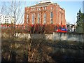
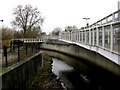
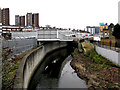
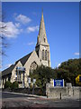
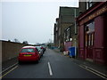
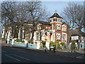
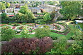
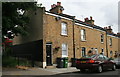
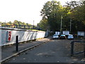
Photos of SE10 8BS
Area Information
SE10 8BS is a small residential cluster in South East London covering just 7,566 square metres. The area serves a population of approximately 2,629 people, creating a population density of 347,483 people per square kilometre. This high density means that homes in SE10 8BS are situated in close proximity to one another, resulting in a compact living environment. The postcode functions as a specific cluster rather than a vast neighbourhood, which influences how residents experience their daily surroundings. Your daily commute or evening walk will likely involve navigating through a concentrated community where space is at a premium. The character of this location is defined by its tight-knit layout, which supports a high degree of interconnection between nearby homes and street-level amenities. Living in SE10 8BS offers a distinct experience of urban density, where the immediate environment is closely integrated with the broader transport links found just outside the small zone.
- Area Type
- Postcode
- Area Size
- 7566 m²
- Population
- 2629
- Population Density
- 13764 people/km²
Your search for homes in SE10 8BS should focus primarily on flats given that this accommodation type is the main form of housing in the area. The elevated home ownership rate of 45% indicates a significant portion of the stock is privately held, yet the prevalence of flats suggests a market heavily influenced by investors and buy-to-let landlords. This dynamic often means that inventory consists of units that change owners or tenants with relative frequency. Buyers looking for space may find limited options within the small 7,566 square metre footprint of the postcode itself. The proximity of this dense cluster to wider transport hubs in Deptford and Greenwich influences property values and rental demand. When viewing properties in SE10 8BS, you will notice that the internal layout of these flats is the primary selling point due to external space limitations. Understanding this market mix is essential for anyone considering purchasing or renting in this specific location.
House Prices in SE10 8BS
Showing 20 properties
| Address | Type | Beds | Baths | Last Sale Price | Last Sale Date | |
|---|---|---|---|---|---|---|
| 6 Catherine Grove, Greenwich, SE10 8BS | Maisonette | 2 | 1 | £560,200 | Nov 2024 | |
| 2 Catherine Grove, Greenwich, SE10 8BS | Terraced | 2 | 1 | £1,000,000 | Jul 2024 | |
| 14 Catherine Grove, Greenwich, SE10 8BS | Terraced | 3 | 1 | £1,036,798 | Jul 2022 | |
| 7A Catherine Grove, Greenwich, SE10 8BS | Flat | - | - | £360,000 | Feb 2022 | |
| 11 Catherine Grove, Greenwich, SE10 8BS | Terraced | 3 | 2 | £1,125,000 | Apr 2021 | |
| 9 Catherine Grove, Greenwich, SE10 8BS | Maisonette | 2 | - | £540,000 | Dec 2020 | |
| 13 Catherine Grove, Greenwich, SE10 8BS | house | - | - | £695,000 | Aug 2020 | |
| 4 Catherine Grove, Greenwich, SE10 8BS | Terraced | 3 | 2 | £960,000 | Dec 2019 | |
| 31 Catherine Grove, Greenwich, SE10 8BS | house | 4 | - | £675,000 | Aug 2019 | |
| 1 Catherine Grove, Greenwich, SE10 8BS | Terraced | 4 | 3 | £1,075,000 | Jun 2019 |
Energy Efficiency in SE10 8BS
Your daily routine in SE10 8BS benefits from immediate access to multiple transport modes and retail options. TESCO Deptford and Co-op London are key retail destinations within practical reach, offering essential groceries and daily necessities. For commuting, you have five metro options, including Deptford Bridge and Cutty Sark DLR Station, alongside rail links to Greenwich and Deptford. Travel by water is also possible via Greenwich Pier and Greenland Surrey Quays Pier, providing a scenic alternative to road travel. London City Airport is situated nearby, which may be relevant for residents working in the finance sector or those with travel requirements. Bus connections, such as the Green Line Coach Station, further expand your mobility. This network of amenities means you can run your errands and commute without needing a car. The convenience of shops and stations directly accessible from homes in SE10 8BS defines a lifestyle built on public transport efficiency.
Amenities
Schools
Families living in SE10 8BS have access to Mayflower Independent School, which is located nearby. This independent institution holds a VAT-registered charitable status, though specific Ofsted ratings are not provided in current records. The presence of a private school indicates that families in the area have options beyond the state sector for their children's education. Because this is a short list of educational facilities, you may need to look further afield for comprehensive state secondary or primary schools if independent education is not your preference. The mix of school types available suggests a community with varied educational priorities. Living in SE10 8BS places your child within commuting distance of higher-tuition institutions, although commute times will vary depending on the specific road network used to reach Greenwich or Lewisham. Prospective parents should visit the school in person to assess suitability beyond the available notes.
| Rank | School | Type | Entry gender | Ages |
|---|
Explore more schools in this area
Go to Schools tabDemographics
The community within SE10 8BS reflects the broader profile of South London residents. The median age for residents is 47 years, and the most common age group consists of adults between 30 and 64 years old. This indicates an area populated largely by working-age individuals rather than retirees or young families. Approximately 45% of residents own their homes, meaning the remaining households are likely landlords renting out properties. Flats are the predominant form of accommodation, suggesting that vertical living solutions are preferred or mandated by the local planning constraints. The predominant ethnic group in the area is White, though the high-density nature of the postcode suggests a diverse mix of backgrounds common to London. You will find a neighbourighbourhood snapshot of a mature, working-age populace within these tightly packed flats. The demographic stability of SE10 8BS points to a settled community with established routines.
Household Size
Accommodation Type
Tenure
Ethnic Group
Religion
Household Composition
Age
Household Deprivation
NS-SEC
Explore more demographic insights in this area
Go to Demographics tabPlanning
Planning Constraints
- Flood RiskPremium
- Ramsar Wetland SitesPremium
- Area of Outstanding Natural BeautyPremium
- Protected Nature ReservePremium
- Protected WoodlandPremium