Area Overview for SE10 8LD
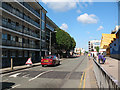
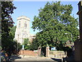
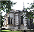
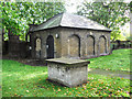
Photos of SE10 8LD


Area Information
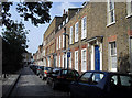
Living in SE10 8LD offers a distinct experience within a very small residential cluster measuring just 1,445 square metres. You will find this specific postcode area is home to a population of 1,399 residents. The density here is extremely high at 968,438 people per square kilometre, creating an environment where neighbours are always around. This postcode acts as a specific pocket within the wider SE10 ward, meaning daily life revolves around immediate proximity to transport hubs and shared local infrastructure. The character of this area is defined by its compact nature and its location in South East London. Although the total area is minimal, it provides direct access to larger towns and cities via its transport links. Residents here rely on the surrounding districts for broader amenities, as this postcode itself is a concentrated residential zone. Buying a home in SE10 8LD means entering a community where space is limited but connectivity is high. You will navigate a landscape designed for density, where the distinction between streets and local thoroughfares can feel blurred due to the sheer volume of people in such a small footprint.
- Area Type
- Postcode
- Area Size
- 1445 m²
- Population
- 1399
- Population Density
- 13962 people/km²
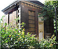
The property market in SE10 8LD is heavily characterised by rented accommodation, as evidence shows that only 37% of residents own their homes. You will find mostly flats rather than detached houses or semi-detached bungalows. This market structure suggests the area functions more as a rental hub or a location where tenants prefer lease agreements over mortgages. The prevalence of flats matches the area's small size of 1,445 square metres and its extreme population density. Buyers looking for a house in this specific postcode face different considerations than those seeking a suburban estate. The housing stock consists primarily of units suited to the high-density living style found here. With 1,399 people squeezed into such a small footprint, the available homes are designed for efficiency and maximised space usage. If you are considering purchasing, you are entering a sector where tenancy rights and rent control laws may play a larger role than property investment indices. The market is less about finding a detached family home and more about securing a flat in a rapidly filled residential block.
House Prices in SE10 8LD
Showing 16 properties
Energy Efficiency in SE10 8LD
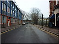
Your daily life in SE10 8LD relies heavily on the five Tesco stores and Co-op London outlets located within practical reach. Residents shop at Tesco Deptford to access groceries and household goods. Dining and leisure options are plentiful around Greenwich Station and the nearby ferry terminals. The five ferry services, including Greenwich Pier and Masthouse Terrace Pier, connect you directly across the river for leisure or commuting. You can take the bus from the area to the Green Line Coach Station if international travel is part of your needs. The immediate neighbourhood offers five metro stops, including Elverson Road, providing rapid access to central London. The character of the lifestyle is defined by these five rail connections to Deptford and St Johns. You can visit Greenwich Pier for Thames cruises or stop at London Victoria Coach Station via the bus network. The area functions as a highly connected transit point rather than a destination with sprawling parks or wide boulevards. Every convenience is accessible within a short walk or a single tube ride.
Amenities
Schools
| Rank | School | Type | Entry gender | Ages |
|---|
Explore more schools in this area
Go to Schools tabDemographics
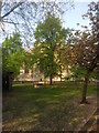
The community in SE10 8LD has a defined age profile where the median age is 47 years old. The most common age range comprises adults between 30 and 64 years. This suggests a neighbourhood populated primarily by families, long-term couples, or individuals in their middle and later working years rather than students or young professionals seeking entry-level rentals. House ownership stands at exactly 37%, which indicates a larger proportion of the population rents their homes compared to those who own them outright. Residents live in an area where flats are the predominant form of accommodation. This aligns with the high population density and small total area size, making multi-storey living the standard. The predominant ethnic group is White, reflecting the demographic makeup of this specific cluster within the borough. You are part of a community where the majority of residents are established adults. The high density means public spaces and corridors are shared extensively by these adult residents. This demographic mix creates a relatively stable environment where governance and noise levels often reflect the needs of working-age adults rather than transient populations.
Household Size
Accommodation Type
Tenure
Ethnic Group
Religion
Household Composition
Age
Household Deprivation
NS-SEC
Explore more demographic insights in this area
Go to Demographics tabPlanning
Planning Constraints
- Flood RiskPremium
- Ramsar Wetland SitesPremium
- Area of Outstanding Natural BeautyPremium
- Protected Nature ReservePremium
- Protected WoodlandPremium