Area Overview for SE10 8AD
Photos of SE10 8AD
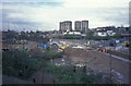
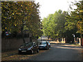
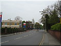
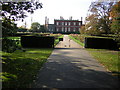

100 photos from this area
Area Information
Key information about the SE10 8AD including its size, population, and administrative classification.
- Area Type
- Postcode
- Area Size
- 4592 m²
- Population
- 1612
- Population Density
- 6272 people/km²
House Prices in SE10 8AD
21
Properties
£458,990
Average Sold Price
£17,369
Lowest Price
£679,800
Highest Price
Showing 21 properties
| Address | Type | Beds | Baths | Last Sale Price | Last Sale Date | |
|---|---|---|---|---|---|---|
| 78A Blackheath Hill, London, SE10 8AD | Land | - | - | £679,800 | Dec 2023 | |
| 78 Blackheath Hill, London, SE10 8AD | house | - | - | £679,800 | Dec 2023 | |
| 90 BLACKHEATH HILL, Greenwich, London, SE10 8AD | Flat | 3 | 1 | £17,369 | May 2022 | |
| Heathside Neurodisability Unit, Heathside Care Home, 80-82 Blackheath Hill, London, SE10 8AD | Flat | 2 | 2 | - | - | |
| 80A BLACKHEATH HILL, Greenwich, London, SE10 8AD | Flat | 2 | - | - | - | |
| Flat 3, 86 Blackheath Hill, London, SE10 8AD | Flat | - | - | - | - | |
| Flat 9, 86 Blackheath Hill, London, SE10 8AD | Flat | 2 | 1 | - | - | |
| Flat 10, 86 Blackheath Hill, London, SE10 8AD | Flat | - | - | - | - | |
| Flat 1, 86 Blackheath Hill, London, SE10 8AD | Flat | - | - | - | - | |
| Flat 7, 86 Blackheath Hill, London, SE10 8AD | Flat | - | - | - | - |
Page 1 of 3
Energy Efficiency in SE10 8AD
Amenities
Schools
| Rank | School | Type | Entry gender | Ages |
|---|
Explore more schools in this area
Go to Schools tabDemographics
Household Size
Two person
most common
Accommodation Type
Flats
most common
Tenure
35
majority
Ethnic Group
White
most common
Religion
N/A
most common
Household Composition
N/A
most common
Age
47
median
Adults (30-64 years)
most common
Household Deprivation
N/A
with no deprivation
NS-SEC
51
in Lower managerial occupations
Explore more demographic insights in this area
Go to Demographics tabPlanning
Planning Constraints
- Flood RiskPremium
- Ramsar Wetland SitesPremium
- Area of Outstanding Natural BeautyPremium
- Protected Nature ReservePremium
- Protected WoodlandPremium